canton of Saint-Just-Saint-Rambert (canton de Saint-Just-Saint-Rambert)

- canton of France
- Country:

- Capital: Saint-Just-Saint-Rambert
- Coordinates: 45° 32' 4" N, 4° 12' 39" E


- GPS tracks (wikiloc): [Link]
- Population: 43291
- Wikipedia en: wiki(en)
- Wikipedia: wiki(fr)
- Wikidata storage: Wikidata: Q1420293
- INSEE canton code: [4220]
Includes regions:

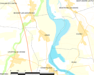
Unias
- commune in Loire, France
- Country:
- Postal Code: 42210
- Coordinates: 45° 36' 18" N, 4° 13' 39" E
- GPS tracks (wikiloc): [Link]
- Area: 5.37 sq km
- Population: 436


Saint-Just-Saint-Rambert
- commune in Loire, France
- Country:
- Postal Code: 42170
- Coordinates: 45° 29' 59" N, 4° 14' 29" E
- GPS tracks (wikiloc): [Link]
- AboveSeaLevel: 417 м m
- Area: 40.63 sq km
- Population: 14935
- Web site: [Link]


Saint-Romain-le-Puy
- commune in Loire, France
- Country:
- Postal Code: 42610
- Coordinates: 45° 33' 20" N, 4° 7' 23" E
- GPS tracks (wikiloc): [Link]
- Area: 21.14 sq km
- Population: 3882
- Web site: [Link]


Saint-Cyprien
- commune in Loire, France
- Country:
- Postal Code: 42160
- Coordinates: 45° 32' 17" N, 4° 14' 11" E
- GPS tracks (wikiloc): [Link]
- Area: 7.28 sq km
- Population: 2470
- Web site: [Link]


Sury-le-Comtal
- commune in Loire, France
- Country:
- Postal Code: 42450
- Coordinates: 45° 32' 15" N, 4° 10' 59" E
- GPS tracks (wikiloc): [Link]
- Area: 24.18 sq km
- Population: 6283


Chambles
- commune in Loire, France
- Country:
- Postal Code: 42170
- Coordinates: 45° 26' 31" N, 4° 14' 18" E
- GPS tracks (wikiloc): [Link]
- Area: 18.9 sq km
- Population: 981

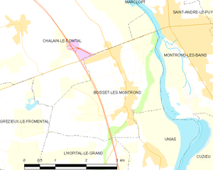
Boisset-lès-Montrond
- commune in Loire, France
- Country:
- Postal Code: 42210
- Coordinates: 45° 37' 16" N, 4° 12' 45" E
- GPS tracks (wikiloc): [Link]
- Area: 8.01 sq km
- Population: 1149