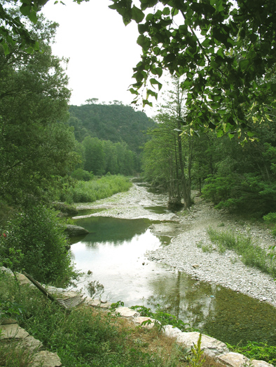
Saint-Sébastien-d'Aigrefeuille (Saint-Sébastien-d'Aigrefeuille)

- commune in Gard, France
- Country:

- Postal Code: 30140
- Coordinates: 44° 6' 25" N, 3° 59' 40" E


- GPS tracks (wikiloc): [Link]
- AboveSeaLevel: 125 м m
- Area: 15.82 sq km
- Population: 524
- Wikipedia en: wiki(en)
- Wikipedia: wiki(fr)
- Wikidata storage: Wikidata: Q267906
- Wikipedia Commons Category: [Link]
- Freebase ID: [/m/03c7xqj]
- GeoNames ID: Alt: [6616452]
- SIREN number: [213002983]
- BnF ID: [15254938c]
- PACTOLS thesaurus ID: [pcrtrr1dp4WLMS]
- INSEE municipality code: 30298
Shares border with regions:

Saint-Paul-la-Coste
- commune in Gard, France
- Country:
- Postal Code: 30480
- Coordinates: 44° 8' 59" N, 3° 58' 10" E
- GPS tracks (wikiloc): [Link]
- AboveSeaLevel: 650 м m
- Area: 18.95 sq km
- Population: 287


Mialet
- commune in Gard, France
- Country:
- Postal Code: 30140
- Coordinates: 44° 6' 39" N, 3° 56' 35" E
- GPS tracks (wikiloc): [Link]
- Area: 30.76 sq km
- Population: 612
- Web site: [Link]

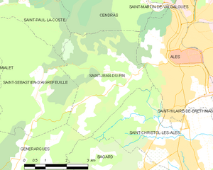
Saint-Jean-du-Pin
- commune in Gard, France
- Country:
- Postal Code: 30140
- Coordinates: 44° 7' 0" N, 4° 3' 2" E
- GPS tracks (wikiloc): [Link]
- AboveSeaLevel: 200 м m
- Area: 13.96 sq km
- Population: 1509
- Web site: [Link]


Générargues
- commune in Gard, France
- Country:
- Postal Code: 30140
- Coordinates: 44° 4' 55" N, 3° 59' 1" E
- GPS tracks (wikiloc): [Link]
- Area: 10.24 sq km
- Population: 709