
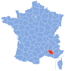
Gard (Gard)


- department located in southern France in the Occitanie region
- Country:

- Capital: Nîmes
- Coordinates: 44° 7' 41" N, 4° 4' 54" E


- GPS tracks (wikiloc): [Link]
- Area: 5853 sq km
- Population: 738189
- Web site: http://www.gard.gouv.fr/
- Wikipedia en: wiki(en)
- Wikipedia: wiki(fr)
- Wikidata storage: Wikidata: Q12515
- Wikipedia Commons Category: [Link]
- Wikipedia Commons Maps Category: [Link]
- Freebase ID: [/m/0mh48]
- GeoNames ID: Alt: [3016670]
- SIREN number: [223000019]
- BnF ID: [12176581q]
- VIAF ID: Alt: [159173798]
- OSM relation ID: [7461]
- GND ID: Alt: [4086671-3]
- archINFORM location ID: [2725]
- Library of Congress authority ID: Alt: [n50054371]
- MusicBrainz area ID: [ddd3d293-3074-48d7-a18c-367acea00877]
- SUDOC authorities ID: [030327563]
- Gran Enciclopèdia Catalana ID: [0029151]
- NUTS code: [FR812]
- BabelNet ID: [03797946n]
- INSEE department code: [30]
- Objectif Gard topic ID: [gard]
- ISO 3166-2 code: FR-30
Includes regions:


arrondissement of Alès
- arrondissement of France
- Country:
- Capital: Alès
- Coordinates: 44° 10' 0" N, 4° 5' 0" E
- GPS tracks (wikiloc): [Link]
- Area: 1322 sq km
- Population: 147609


arrondissement of Le Vigan
- arrondissement of France
- Country:
- Capital: Le Vigan
- Coordinates: 44° 0' 0" N, 3° 40' 0" E
- GPS tracks (wikiloc): [Link]
- Area: 1398 sq km
- Population: 39183


arrondissement of Nîmes
- arrondissement of France
- Country:
- Capital: Nîmes
- Coordinates: 43° 55' 0" N, 4° 25' 0" E
- GPS tracks (wikiloc): [Link]
- Area: 3133 sq km
- Population: 551397
Shares border with regions:


Hérault
- department of France
- Country:
- Capital: Montpellier
- Coordinates: 43° 36' 39" N, 3° 52' 38" E
- GPS tracks (wikiloc): [Link]
- Area: 6224 sq km
- Population: 1120190
- Web site: [Link]


Lozère
- French department
- Country:
- Capital: Mende
- Coordinates: 44° 20' 0" N, 3° 36' 0" E
- GPS tracks (wikiloc): [Link]
- Area: 5166.9 sq km
- Population: 76309
- Web site: [Link]
Vaucluse
- French department
 Hiking in Vaucluse
Vaucluse, located in the Provence-Alpes-Côte d'Azur region of southeastern France, offers a diverse range of hiking opportunities, combining stunning landscapes, historical sites, and charming villages. Here are some highlights for hiking in Vaucluse:...
- Country:
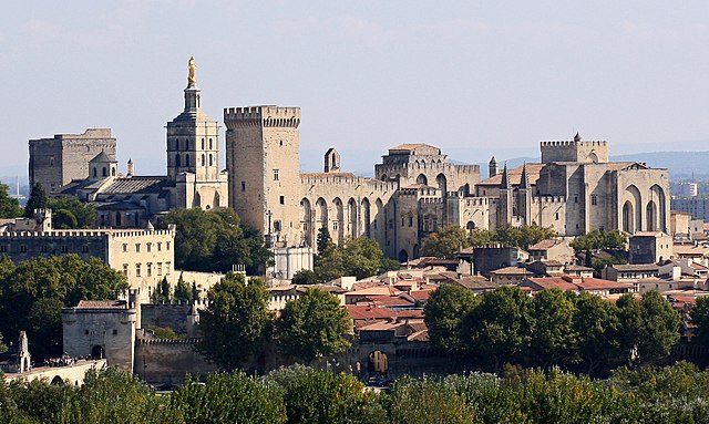
- Capital: Avignon
- Licence Plate Code: 84
- Coordinates: 44° 0' 0" N, 5° 10' 0" E
- GPS tracks (wikiloc): [Link]
- Area: 3567 sq km
- Population: 557548
- Web site: [Link]


Ardèche
- French department
Hiking in Ardèche
Hiking in the Ardèche region of France offers a remarkable experience for outdoor enthusiasts, with diverse landscapes ranging from dramatic gorges to tranquil forests. Here are some key aspects to consider when hiking in Ardèche:...
- Country:
- Capital: Privas
- Coordinates: 44° 40' 0" N, 4° 25' 0" E
- GPS tracks (wikiloc): [Link]
- Area: 5529 sq km
- Population: 324209
- Web site: [Link]


Aveyron
- French department
- Country:
- Capital: Rodez
- Coordinates: 44° 15' 0" N, 2° 42' 0" E
- GPS tracks (wikiloc): [Link]
- Area: 8735 sq km
- Population: 279169
- Web site: [Link]


Bouches-du-Rhône
- French department in Provence-Alpes-Côte d'Azur
Hiking in Bouches-du-Rhône
Bouches-du-Rhône, located in the Provence-Alpes-Côte d'Azur region of southern France, offers diverse hiking opportunities amid stunning landscapes, rich history, and vibrant culture. Here are some key highlights for hiking in this beautiful area:...
- Country:
- Capital: Marseille
- Coordinates: 43° 30' 0" N, 5° 5' 0" E
- GPS tracks (wikiloc): [Link]
- Area: 5087 sq km
- Population: 2016622
- Web site: [Link]