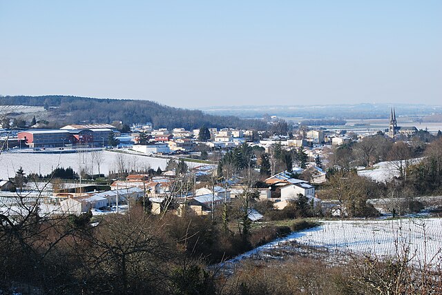
Saint-Sulpice-de-Faleyrens (Saint-Sulpice-de-Faleyrens)

- commune in Gironde, France
- Country:

- Postal Code: 33330
- Coordinates: 44° 52' 28" N, 0° 11' 25" E


- GPS tracks (wikiloc): [Link]
- Area: 18.17 sq km
- Population: 1410
- Web site: http://www.saintsulpicedefaleyrens.com
- Wikipedia en: wiki(en)
- Wikipedia: wiki(fr)
- Wikidata storage: Wikidata: Q1005035
- Wikipedia Commons Category: [Link]
- Freebase ID: [/m/0cstjz]
- GeoNames ID: Alt: [2976862]
- SIREN number: [213304801]
- BnF ID: [152565273]
- PACTOLS thesaurus ID: [pcrtpuU44fmkwn]
- Twitter username: Alt: [StSulpicedeF]
- INSEE municipality code: 33480
Shares border with regions:


Vignonet
- commune in Gironde, France
- Country:
- Postal Code: 33330
- Coordinates: 44° 50' 46" N, 0° 8' 47" E
- GPS tracks (wikiloc): [Link]
- Area: 4.15 sq km
- Population: 510
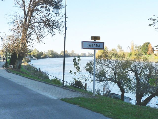

Cabara
- commune in Gironde, France
- Country:
- Postal Code: 33420
- Coordinates: 44° 49' 37" N, 0° 9' 36" E
- GPS tracks (wikiloc): [Link]
- Area: 3.42 sq km
- Population: 518
- Web site: [Link]
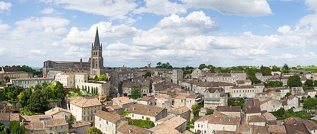

Saint-Émilion
- commune in Gironde, France
- Country:
- Postal Code: 33330
- Coordinates: 44° 53' 34" N, 0° 9' 21" E
- GPS tracks (wikiloc): [Link]
- AboveSeaLevel: 23 м m
- Area: 27.02 sq km
- Population: 1878
- Web site: [Link]


Grézillac
- commune in Gironde, France
- Country:
- Postal Code: 33420
- Coordinates: 44° 49' 4" N, 0° 13' 0" E
- GPS tracks (wikiloc): [Link]
- Area: 7.79 sq km
- Population: 694
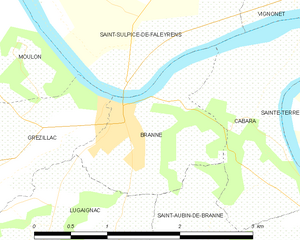
Branne
- commune in Gironde, France
- Country:
- Postal Code: 33420
- Coordinates: 44° 49' 49" N, 0° 11' 11" E
- GPS tracks (wikiloc): [Link]
- Area: 2.41 sq km
- Population: 1277
- Web site: [Link]


Moulon
- commune in Gironde, France
- Country:
- Postal Code: 33420
- Coordinates: 44° 50' 50" N, 0° 13' 14" E
- GPS tracks (wikiloc): [Link]
- AboveSeaLevel: 30 м m
- Area: 13.25 sq km
- Population: 994