Saint-Thurien (Saint-Thurien)

- commune in Finistère, France
- Country:

- Postal Code: 29380
- Coordinates: 47° 57' 33" N, 3° 37' 25" E


- GPS tracks (wikiloc): [Link]
- Area: 21.41 sq km
- Population: 1027
- Wikipedia en: wiki(en)
- Wikipedia: wiki(fr)
- Wikidata storage: Wikidata: Q225178
- Wikipedia Commons Category: [Link]
- Freebase ID: [/m/03gzly_]
- SIREN number: [212902696]
- BnF ID: [15254609z]
- INSEE municipality code: 29269
Shares border with regions:

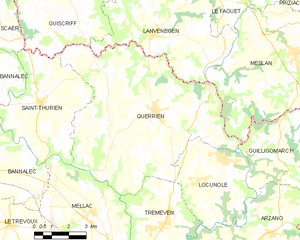
Querrien
- commune in Finistère, France
- Country:
- Postal Code: 29310
- Coordinates: 47° 57' 35" N, 3° 32' 13" E
- GPS tracks (wikiloc): [Link]
- Area: 54.01 sq km
- Population: 1743
- Web site: [Link]


Scaër
- commune in Finistère, France
- Country:
- Postal Code: 29390
- Coordinates: 48° 2' 0" N, 3° 42' 0" E
- GPS tracks (wikiloc): [Link]
- Area: 117.58 sq km
- Population: 5402
- Web site: [Link]

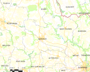
Bannalec
- commune in Finistère, France
- Country:
- Postal Code: 29380
- Coordinates: 47° 55' 57" N, 3° 41' 49" E
- GPS tracks (wikiloc): [Link]
- Area: 77.51 sq km
- Population: 5634
- Web site: [Link]


Mellac
- commune in Finistère, France
- Country:
- Postal Code: 29300
- Coordinates: 47° 54' 14" N, 3° 34' 41" E
- GPS tracks (wikiloc): [Link]
- Area: 26.38 sq km
- Population: 2970
- Web site: [Link]

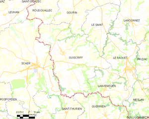
Guiscriff
- commune in Morbihan, France
- Country:
- Postal Code: 56560
- Coordinates: 48° 3' 0" N, 3° 38' 43" E
- GPS tracks (wikiloc): [Link]
- Area: 85.46 sq km
- Population: 2155