Saint-Vivien-de-Monségur (Saint-Vivien-de-Monségur)

- commune in Gironde, France
- Country:

- Postal Code: 33580
- Coordinates: 44° 36' 58" N, 0° 6' 25" E


- GPS tracks (wikiloc): [Link]
- Area: 15.83 sq km
- Population: 365
- Web site: http://www.saint-vivien-de-monsegur.com
- Wikipedia en: wiki(en)
- Wikipedia: wiki(fr)
- Wikidata storage: Wikidata: Q537527
- Wikipedia Commons Category: [Link]
- Freebase ID: [/m/03ns271]
- SIREN number: [213304918]
- BnF ID: [15256538r]
- INSEE municipality code: 33491
Shares border with regions:

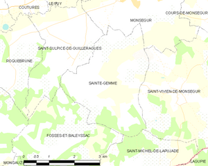
Sainte-Gemme
- commune in Gironde, France
- Country:
- Postal Code: 33580
- Coordinates: 44° 37' 13" N, 0° 4' 11" E
- GPS tracks (wikiloc): [Link]
- Area: 9.55 sq km
- Population: 202

Saint-Géraud
- commune in Lot-et-Garonne, France
- Country:
- Postal Code: 47120
- Coordinates: 44° 37' 18" N, 0° 9' 10" E
- GPS tracks (wikiloc): [Link]
- Area: 5.68 sq km
- Population: 90

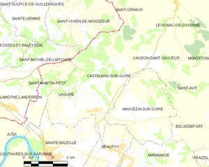
Castelnau-sur-Gupie
- commune in Lot-et-Garonne, France
- Country:
- Postal Code: 47180
- Coordinates: 44° 33' 35" N, 0° 7' 57" E
- GPS tracks (wikiloc): [Link]
- Area: 15.23 sq km
- Population: 871

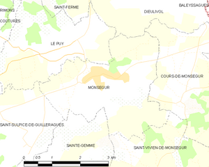
Monségur
- commune in Gironde, France
- Country:
- Postal Code: 33580
- Coordinates: 44° 39' 1" N, 0° 4' 51" E
- GPS tracks (wikiloc): [Link]
- Area: 9.91 sq km
- Population: 1500
- Web site: [Link]


Cours-de-Monségur
- commune in Gironde, France
- Country:
- Postal Code: 33580
- Coordinates: 44° 39' 4" N, 0° 7' 5" E
- GPS tracks (wikiloc): [Link]
- Area: 9.64 sq km
- Population: 282

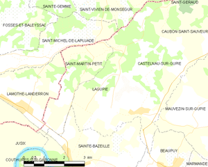
Lagupie
- commune in Lot-et-Garonne, France
- Country:
- Postal Code: 47180
- Coordinates: 44° 33' 23" N, 0° 6' 53" E
- GPS tracks (wikiloc): [Link]
- Area: 8.69 sq km
- Population: 761


Saint-Michel-de-Lapujade
- commune in Gironde, France
- Country:
- Postal Code: 33190
- Coordinates: 44° 34' 54" N, 0° 4' 14" E
- GPS tracks (wikiloc): [Link]
- AboveSeaLevel: 85 м m
- Area: 7.47 sq km
- Population: 225
- Web site: [Link]