Sainte-Colombe (Sainte-Colombe)

- commune in Manche, France
- Country:

- Postal Code: 50390
- Coordinates: 49° 25' 18" N, 1° 31' 20" E


- GPS tracks (wikiloc): [Link]
- Area: 4.99 sq km
- Population: 215
- Wikipedia en: wiki(en)
- Wikipedia: wiki(fr)
- Wikidata storage: Wikidata: Q1062250
- Wikipedia Commons Category: [Link]
- Freebase ID: [/m/03nxbnz]
- Freebase ID: [/m/03nxbnz]
- GeoNames ID: Alt: [6454222]
- GeoNames ID: Alt: [6454222]
- SIREN number: [215004573]
- SIREN number: [215004573]
- BnF ID: [152624319]
- BnF ID: [152624319]
- INSEE municipality code: 50457
- INSEE municipality code: 50457
Shares border with regions:

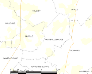
Hautteville-Bocage
- commune in Manche, France
- Country:
- Postal Code: 50390
- Coordinates: 49° 25' 33" N, 1° 27' 53" E
- GPS tracks (wikiloc): [Link]
- Area: 4.22 sq km
- Population: 149


Golleville
- commune in Manche, France
- Country:
- Postal Code: 50390
- Coordinates: 49° 26' 11" N, 1° 30' 58" E
- GPS tracks (wikiloc): [Link]
- Area: 6.46 sq km
- Population: 175


Rauville-la-Place
- commune in Manche, France
- Country:
- Postal Code: 50390
- Coordinates: 49° 23' 18" N, 1° 30' 17" E
- GPS tracks (wikiloc): [Link]
- Area: 11.88 sq km
- Population: 386


Néhou
- commune in Manche, France
- Country:
- Postal Code: 50390
- Coordinates: 49° 25' 12" N, 1° 32' 31" E
- GPS tracks (wikiloc): [Link]
- Area: 15.98 sq km
- Population: 611


Reigneville-Bocage
- commune in Manche, France
- Country:
- Postal Code: 50390
- Coordinates: 49° 24' 25" N, 1° 28' 30" E
- GPS tracks (wikiloc): [Link]
- Area: 2.27 sq km
- Population: 39

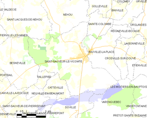
Saint-Sauveur-le-Vicomte
- commune in Manche, France
- Country:
- Postal Code: 50390
- Coordinates: 49° 23' 12" N, 1° 31' 56" E
- GPS tracks (wikiloc): [Link]
- Area: 34.27 sq km
- Population: 2199
- Web site: [Link]


Biniville
- commune in Manche, France
- Country:
- Postal Code: 50390
- Coordinates: 49° 25' 39" N, 1° 28' 38" E
- GPS tracks (wikiloc): [Link]
- Area: 2.98 sq km
- Population: 116