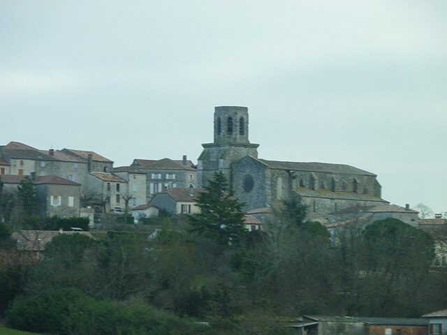
Sainte-Colombe-en-Bruilhois (Sainte-Colombe-en-Bruilhois)

- commune in Lot-et-Garonne, France
- Country:

- Postal Code: 47310
- Coordinates: 44° 10' 39" N, 0° 30' 57" E


- GPS tracks (wikiloc): [Link]
- Area: 21.15 sq km
- Population: 1659
- Web site: http://www.ville-saintecolombeenbruilhois.fr
- Wikipedia en: wiki(en)
- Wikipedia: wiki(fr)
- Wikidata storage: Wikidata: Q218830
- Wikipedia Commons Category: [Link]
- Freebase ID: [/m/03qm2nx]
- GeoNames ID: Alt: [6435054]
- SIREN number: [214702383]
- BnF ID: [15261319x]
- PACTOLS thesaurus ID: [pcrtGM8xYTFUUi]
- INSEE municipality code: 47238
Shares border with regions:

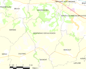
Montagnac-sur-Auvignon
- commune in Lot-et-Garonne, France
- Country:
- Postal Code: 47600
- Coordinates: 44° 9' 39" N, 0° 27' 35" E
- GPS tracks (wikiloc): [Link]
- Area: 22.69 sq km
- Population: 613

Laplume
- commune in Lot-et-Garonne, France
- Country:
- Postal Code: 47310
- Coordinates: 44° 6' 43" N, 0° 31' 52" E
- GPS tracks (wikiloc): [Link]
- Area: 32.64 sq km
- Population: 1462
- Web site: [Link]

Sérignac-sur-Garonne
- commune in Lot-et-Garonne, France
- Country:
- Postal Code: 47310
- Coordinates: 44° 12' 49" N, 0° 29' 6" E
- GPS tracks (wikiloc): [Link]
- Area: 8.91 sq km
- Population: 1150
- Web site: [Link]


Moncaut
- commune in Lot-et-Garonne, France
- Country:
- Postal Code: 47310
- Coordinates: 44° 8' 30" N, 0° 29' 57" E
- GPS tracks (wikiloc): [Link]
- Area: 15.76 sq km
- Population: 623


Roquefort
- commune in Lot-et-Garonne, France
- Country:
- Postal Code: 47310
- Coordinates: 44° 10' 27" N, 0° 33' 35" E
- GPS tracks (wikiloc): [Link]
- Area: 7.53 sq km
- Population: 1820
- Web site: [Link]
Colayrac-Saint-Cirq
- commune in Lot-et-Garonne, France
- Country:
- Postal Code: 47450
- Coordinates: 44° 13' 11" N, 0° 33' 10" E
- GPS tracks (wikiloc): [Link]
- Area: 21.36 sq km
- Population: 2989
- Web site: [Link]


Brax
- commune in Lot-et-Garonne, France
- Country:
- Postal Code: 47310
- Coordinates: 44° 12' 11" N, 0° 33' 6" E
- GPS tracks (wikiloc): [Link]
- Area: 8.8 sq km
- Population: 2060
- Web site: [Link]