
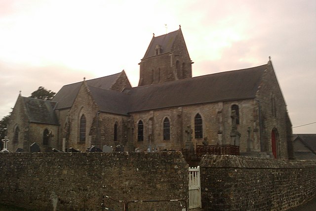
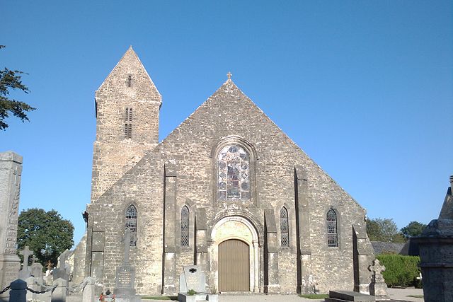
Sainte-Mère-Église (Sainte-Mère-Église)

- former commune in Manche, France
- Country:

- Postal Code: 50480
- Coordinates: 49° 24' 32" N, 1° 19' 4" E


- GPS tracks (wikiloc): [Link]
- AboveSeaLevel: 34 м m
- Area: 17.68 sq km
- Population: 1618
- Web site: http://www.saintemereeglise.fr
- Wikipedia en: wiki(en)
- Wikipedia: wiki(fr)
- Wikidata storage: Wikidata: Q273393
- Wikipedia Commons Gallery: [Link]
- Wikipedia Commons Category: [Link]
- Freebase ID: [/m/033_4n]
- Freebase ID: [/m/033_4n]
- GeoNames ID: Alt: [2980397]
- GeoNames ID: Alt: [2980397]
- BnF ID: [15262496w]
- BnF ID: [15262496w]
- VIAF ID: Alt: [134825932]
- VIAF ID: Alt: [134825932]
- Library of Congress authority ID: Alt: [n80117067]
- Library of Congress authority ID: Alt: [n80117067]
- Encyclopædia Britannica Online ID: [place/Sainte-Mere-Eglise]
- Encyclopædia Britannica Online ID: [place/Sainte-Mere-Eglise]
- INSEE municipality code: 50523
- INSEE municipality code: 50523
- US National Archives Identifier: 10037942
- US National Archives Identifier: 10037942
Shares border with regions:


Carquebut
- commune in Manche, France
- Country:
- Postal Code: 50480
- Coordinates: 49° 22' 21" N, 1° 19' 48" E
- GPS tracks (wikiloc): [Link]
- Area: 8.54 sq km
- Population: 335


Écoquenéauville
- former commune in Manche, France
- Country:
- Postal Code: 50480
- Coordinates: 49° 24' 7" N, 1° 17' 31" E
- GPS tracks (wikiloc): [Link]
- Area: 3.52 sq km
- Population: 79

Amfreville
- former commune in Manche, France
- Country:
- Postal Code: 50480
- Coordinates: 49° 24' 36" N, 1° 23' 34" E
- GPS tracks (wikiloc): [Link]
- Area: 10.1 sq km
- Population: 286


Beuzeville-au-Plain
- former commune in Manche, France
- Country:
- Postal Code: 50480
- Coordinates: 49° 25' 50" N, 1° 17' 10" E
- GPS tracks (wikiloc): [Link]
- Area: 2.04 sq km
- Population: 48
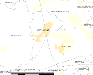
Chef-du-Pont
- former commune in Manche, France
- Country:
- Postal Code: 50480
- Coordinates: 49° 23' 4" N, 1° 20' 39" E
- GPS tracks (wikiloc): [Link]
- Area: 3.78 sq km
- Population: 679
- Web site: [Link]


Turqueville
- commune in Manche, France
- Country:
- Postal Code: 50480
- Coordinates: 49° 24' 18" N, 1° 16' 35" E
- GPS tracks (wikiloc): [Link]
- Area: 5.21 sq km
- Population: 157


Sébeville
- commune in Manche, France
- Country:
- Postal Code: 50480
- Coordinates: 49° 23' 15" N, 1° 17' 16" E
- GPS tracks (wikiloc): [Link]
- Area: 2.88 sq km
- Population: 29

Ravenoville
- commune in Manche, France
- Country:
- Postal Code: 50480
- Coordinates: 49° 27' 24" N, 1° 16' 14" E
- GPS tracks (wikiloc): [Link]
- Area: 11.65 sq km
- Population: 256


Neuville-au-Plain
- commune in Manche, France
- Country:
- Postal Code: 50480
- Coordinates: 49° 25' 39" N, 1° 19' 48" E
- GPS tracks (wikiloc): [Link]
- Area: 4.7 sq km
- Population: 91


Fresville
- commune in Manche, France
- Country:
- Postal Code: 50310
- Coordinates: 49° 26' 23" N, 1° 21' 22" E
- GPS tracks (wikiloc): [Link]
- Area: 13.94 sq km
- Population: 362
- Web site: [Link]


Picauville
- former commune in Manche, France
- Country:
- Postal Code: 50360
- Coordinates: 49° 22' 47" N, 1° 25' 3" E
- GPS tracks (wikiloc): [Link]
- Area: 19.1 sq km
- Population: 1928