Salagnon (Salagnon)

- commune in Isère, France
 Hiking in Salagnon
Salagnon is a beautiful area for hiking, with its picturesque landscapes and variety of trails. While specific trail information may vary, here are some general tips and insights for hiking in Salagnon:
-
Trails: Typically, trails in Salagnon cater to different skill levels, from easy walks suitable for families to more challenging routes for experienced hikers. Research local guides or maps to find suitable trails for your ability.
-
Scenery: The region is known for its stunning views, including rolling hills, lush forests, and potentially some bodies of water. Take the time to enjoy the natural beauty and consider bringing a camera to capture the scenery.
-
Wildlife: Depending on the season, you may encounter a variety of wildlife along the trails. Keep an eye out for birds, deer, and other local fauna, but remember to respect their space and avoid disturbing them.
-
Preparation: Always check the weather forecast before heading out. Dress in layers suitable for hiking, and make sure to wear sturdy footwear. Carry sufficient water, snacks, and a map or GPS device to ensure you stay on track.
-
Safety: Inform someone about your hiking plans and estimated return time. It's also wise to hike with a buddy, especially on less-trafficked trails.
-
Leave No Trace: Respect the environment by following Leave No Trace principles. Stay on marked trails, pack out what you bring in, and avoid picking plants or disturbing wildlife.
-
Local Regulations: Be mindful of any local regulations regarding hiking and camping in the area, including permits required for overnight stays or campfires.
If you're planning a hike in Salagnon, it may be helpful to connect with local hiking clubs or tour guides for additional information and guided experiences. Enjoy your hike!
- Country:

- Postal Code: 38890
- Coordinates: 45° 40' 1" N, 5° 21' 18" E


- GPS tracks (wikiloc): [Link]
- Area: 8.21 sq km
- Population: 1331
- Web site: http://www.salagnon38.fr
- Wikipedia en: wiki(en)
- Wikipedia: wiki(fr)
- Wikidata storage: Wikidata: Q1067740
- Wikipedia Commons Category: [Link]
- Freebase ID: [/m/03nvkxh]
- GeoNames ID: Alt: [6433405]
- SIREN number: [213804677]
- BnF ID: [15258273x]
- INSEE municipality code: 38467
Shares border with regions:


Sermérieu
- commune in Isère, France
Hiking in Sermérieu
Sermérieu is a small commune located in the Isère department of southeastern France. Nestled in a picturesque part of the Rhône-Alpes region, it offers several opportunities for hiking and enjoying the outdoors. Here are some things to know about hiking in and around Sermérieu:...
- Country:
- Postal Code: 38510
- Coordinates: 45° 40' 17" N, 5° 24' 35" E
- GPS tracks (wikiloc): [Link]
- Area: 17.14 sq km
- Population: 1640
- Web site: [Link]


Trept
- commune in Isère, France
Hiking in Trept
Trept is a scenic area located in the eastern part of Germany, particularly known for its beautiful landscapes and walking trails. While it may not be as famous as some other hiking destinations in Germany, there are still plenty of opportunities for outdoor enthusiasts to explore nature and enjoy some hiking....
- Country:
- Postal Code: 38460
- Coordinates: 45° 41' 12" N, 5° 19' 12" E
- GPS tracks (wikiloc): [Link]
- Area: 15.87 sq km
- Population: 2024
- Web site: [Link]
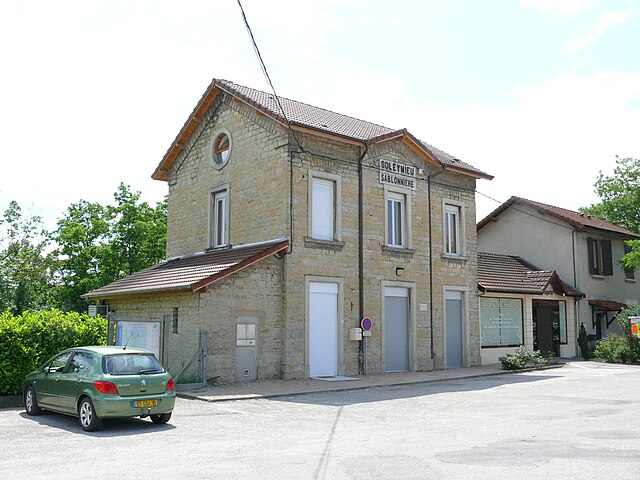

Soleymieu
- commune in Isère, France
Hiking in Soleymieu
Soleymieu, located in the Auvergne-Rhône-Alpes region of France, offers a delightful environment for hiking enthusiasts with its picturesque landscapes and varied terrains. Here are some key points to consider when planning a hike in Soleymieu:...
- Country:
- Postal Code: 38460
- Coordinates: 45° 42' 35" N, 5° 20' 59" E
- GPS tracks (wikiloc): [Link]
- Area: 13.36 sq km
- Population: 776


Saint-Chef
- commune in Isère, France
Hiking in Saint-Chef
Saint-Chef is a charming commune located in the Isère department of the Auvergne-Rhône-Alpes region in southeastern France. The area is known for its beautiful landscapes, rolling hills, and rich natural surroundings, making it an attractive destination for hikers of all levels....
- Country:
- Postal Code: 38890
- Coordinates: 45° 38' 2" N, 5° 21' 57" E
- GPS tracks (wikiloc): [Link]
- Area: 27.16 sq km
- Population: 3620
- Web site: [Link]