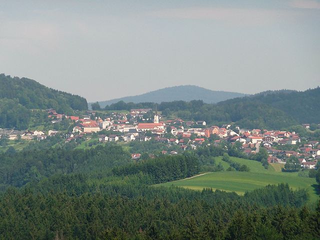
Saldenburg (Saldenburg)

- municipality of Germany
 Hiking in Saldenburg
Saldenburg, located in Bavaria, Germany, is a charming area that offers a variety of hiking opportunities amidst beautiful natural landscapes. Known for its picturesque countryside, forests, and hills, Saldenburg is an excellent destination for hikers of all levels.
Hiking Trails
-
Local Trails: The region features numerous marked hiking trails that can take you through lush forests, alongside streams, and up to elevated vantage points. The trails vary in difficulty, so you can find routes suitable for beginners as well as more experienced hikers.
-
The Bavarian Forest: Nearby, the Bavarian Forest National Park provides extensive hiking options, including longer, well-marked trails that can take you deep into the heart of the forest. These trails often lead to stunning viewpoints and allow for wildlife observation.
-
Cultural Trails: Some hiking paths in the area might include historical sites, allowing you to explore local culture and history while enjoying the natural beauty.
Recommendations
-
Preparation: Always check local maps and trail conditions before heading out. Having a good pair of hiking boots and appropriate clothing is essential, as weather in the area can change quickly.
-
Respect Nature: Follow the Leave No Trace principles to help preserve the natural beauty of the area. Stick to marked trails and avoid disturbing wildlife.
-
Stay Hydrated & Nourished: Bring sufficient water and snacks, especially if planning for longer hikes.
-
Weather Considerations: Check the local weather forecast before heading out, as the mountain climate can be unpredictable.
Additional Activities
In addition to hiking, Saldenburg and the surrounding region offer opportunities for biking, bird watching, and even winter sports in colder months.
Whether you’re looking for a peaceful walk in nature or a challenging hike, Saldenburg has plenty to offer. Enjoy your time exploring this beautiful Bavarian landscape!
- Country:

- Postal Code: 94163
- Local Dialing Code: 08504
- Licence Plate Code: FRG
- Coordinates: 48° 47' 0" N, 13° 21' 0" E


- GPS tracks (wikiloc): [Link]
- AboveSeaLevel: 532 м m
- Area: 28.04 sq km
- Population: 1982
- Web site: http://www.saldenburg.de
- Wikipedia en: wiki(en)
- Wikipedia: wiki(de)
- Wikidata storage: Wikidata: Q503437
- Wikipedia Commons Category: [Link]
- Freebase ID: [/m/02q36yl]
- GeoNames ID: Alt: [2842311]
- BnF ID: [13532751c]
- VIAF ID: Alt: [312847922]
- OSM relation ID: [958970]
- GND ID: Alt: [4312158-5]
- Library of Congress authority ID: Alt: [n96003633]
- Historical Gazetteer (GOV) ID: [SALUR1JN68QS]
- Bavarikon ID: [ODB_A00001475]
- German municipality key: 09272142
Shares border with regions:

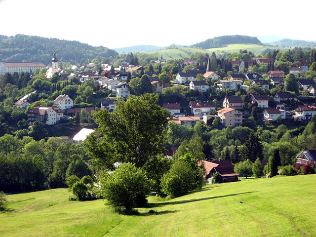
Schönberg
- municipality in the district of Freyung-Grafenau in Bavaria in Germany
Hiking in Schönberg
Schönberg, located in Lower Bavaria, is a picturesque area known for its stunning natural landscapes and hiking opportunities. Here are some key features of hiking in this region:...
- Country:
- Postal Code: 94513
- Local Dialing Code: 08554
- Licence Plate Code: FRG
- Coordinates: 48° 50' 0" N, 13° 20' 0" E
- GPS tracks (wikiloc): [Link]
- AboveSeaLevel: 563 м m
- Area: 32.75 sq km
- Population: 3663
- Web site: [Link]


Thurmansbang
- municipality of Germany
Hiking in Thurmansbang
Thurmansbang is a picturesque village located in Bavaria, Germany, surrounded by the beautiful landscape of the Bavarian Forest. It's an excellent destination for hiking enthusiasts, offering a variety of trails that cater to different skill levels and preferences....
- Country:
- Postal Code: 94169
- Local Dialing Code: 08504
- Licence Plate Code: FRG
- Coordinates: 48° 46' 0" N, 13° 19' 0" E
- GPS tracks (wikiloc): [Link]
- AboveSeaLevel: 494 м m
- Area: 32.93 sq km
- Population: 2159
- Web site: [Link]


Perlesreut
- municipality of Germany
Hiking in Perlesreut
Perlesreut is a charming village located in Bavaria, Germany, close to the border with the Czech Republic. It’s situated in a picturesque region that offers a range of hiking opportunities, making it a great destination for both novice and experienced hikers....
- Country:
- Postal Code: 94157
- Local Dialing Code: 08555
- Licence Plate Code: FRG
- Coordinates: 48° 47' 0" N, 13° 27' 0" E
- GPS tracks (wikiloc): [Link]
- AboveSeaLevel: 542 м m
- Area: 29.73 sq km
- Population: 2686
- Web site: [Link]

Grafenau
- municipality in Bavaria, Germany
Hiking in Grafenau
Grafenau, located in the Lower Bavarian region of Germany, is a delightful destination for hiking enthusiasts. It is surrounded by stunning natural landscapes, including the Bavarian Forest National Park, which provides a variety of trails suitable for all skill levels....
- Country:
- Postal Code: 94568; 94481
- Local Dialing Code: 08552
- Coordinates: 48° 51' 22" N, 13° 23' 49" E
- GPS tracks (wikiloc): [Link]
- AboveSeaLevel: 609 м m
- Area: 63.73 sq km
- Population: 8093
- Web site: [Link]


Tittling
- municipality of Germany
Hiking in Tittling
Tittling is a small town located in Germany, specifically in the Bavarian region. It's nestled near the border with Austria and is surrounded by scenic nature, making it ideal for hiking enthusiasts. Here are a few highlights about hiking in and around Tittling:...
- Country:
- Postal Code: 94104
- Local Dialing Code: 08504
- Licence Plate Code: PA
- Coordinates: 48° 43' 33" N, 13° 22' 55" E
- GPS tracks (wikiloc): [Link]
- AboveSeaLevel: 540 м m
- Area: 20.78 sq km
- Population: 3860
- Web site: [Link]