Salles-de-Villefagnan (Salles-de-Villefagnan)

- commune in Charente, France
- Country:

- Postal Code: 16700
- Coordinates: 45° 57' 32" N, 0° 9' 43" E


- GPS tracks (wikiloc): [Link]
- Area: 12.83 sq km
- Population: 334
- Wikipedia en: wiki(en)
- Wikipedia: wiki(fr)
- Wikidata storage: Wikidata: Q1437797
- Wikipedia Commons Category: [Link]
- Freebase ID: [/m/03mcdsp]
- GeoNames ID: Alt: [2976369]
- SIREN number: [211603618]
- BnF ID: [15248798f]
- INSEE municipality code: 16361
Shares border with regions:


Charmé
- commune in Charente, France
- Country:
- Postal Code: 16140
- Coordinates: 45° 57' 8" N, 0° 7' 2" E
- GPS tracks (wikiloc): [Link]
- Area: 11.42 sq km
- Population: 356


Juillé
- commune in Charente, France
- Country:
- Postal Code: 16230
- Coordinates: 45° 55' 48" N, 0° 8' 38" E
- GPS tracks (wikiloc): [Link]
- Area: 8.6 sq km
- Population: 193

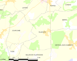
Villegats
- commune in Charente, France
- Country:
- Postal Code: 16700
- Coordinates: 45° 59' 29" N, 0° 11' 34" E
- GPS tracks (wikiloc): [Link]
- Area: 7.71 sq km
- Population: 219

Lonnes
- commune in Charente, France
- Country:
- Postal Code: 16230
- Coordinates: 45° 56' 21" N, 0° 9' 56" E
- GPS tracks (wikiloc): [Link]
- Area: 7.51 sq km
- Population: 174


Tuzie
- commune in Charente, France
- Country:
- Postal Code: 16700
- Coordinates: 45° 58' 32" N, 0° 9' 27" E
- GPS tracks (wikiloc): [Link]
- Area: 2.43 sq km
- Population: 182


Verteuil-sur-Charente
- commune in Charente, France
- Country:
- Postal Code: 16510
- Coordinates: 45° 58' 55" N, 0° 13' 47" E
- GPS tracks (wikiloc): [Link]
- Area: 14.24 sq km
- Population: 643
- Web site: [Link]