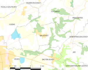
Salt-en-Donzy (Salt-en-Donzy)
- commune in Loire, France
- Country:

- Postal Code: 42110
- Coordinates: 45° 44' 15" N, 4° 17' 20" E


- GPS tracks (wikiloc): [Link]
- Area: 8.93 sq km
- Population: 543
- Wikipedia en: wiki(en)
- Wikipedia: wiki(fr)
- Wikidata storage: Wikidata: Q1106355
- Wikipedia Commons Category: [Link]
- Freebase ID: [/m/03nw98l]
- Freebase ID: [/m/03nw98l]
- GeoNames ID: Alt: [6434324]
- GeoNames ID: Alt: [6434324]
- SIREN number: [214202962]
- SIREN number: [214202962]
- BnF ID: [152598625]
- BnF ID: [152598625]
- PACTOLS thesaurus ID: [pcrtXo8EsaJdrY]
- PACTOLS thesaurus ID: [pcrtXo8EsaJdrY]
- Pleiades ID: [167910]
- Pleiades ID: [167910]
- INSEE municipality code: 42296
- INSEE municipality code: 42296
Shares border with regions:


Salvizinet
- commune in Loire, France
- Country:

- Postal Code: 42110
- Coordinates: 45° 45' 34" N, 4° 16' 29" E


- GPS tracks (wikiloc): [Link]
- Area: 10.84 sq km
- Population: 600
- Web site: [Link]
Saint-Barthélemy-Lestra
- commune in Loire, France
- Country:

- Postal Code: 42110
- Coordinates: 45° 43' 10" N, 4° 20' 24" E


- GPS tracks (wikiloc): [Link]
- Area: 11.06 sq km
- Population: 678

Jas
- commune in Loire, France
- Country:

- Postal Code: 42110
- Coordinates: 45° 44' 44" N, 4° 18' 37" E


- GPS tracks (wikiloc): [Link]
- Area: 6.22 sq km
- Population: 222
- Web site: [Link]


Feurs
- commune in Loire, France
- Country:

- Postal Code: 42110
- Coordinates: 45° 44' 27" N, 4° 13' 33" E


- GPS tracks (wikiloc): [Link]
- AboveSeaLevel: 366 м m
- Area: 24.39 sq km
- Population: 8056
- Web site: [Link]


Valeille
- commune in Loire, France
- Country:

- Postal Code: 42110
- Coordinates: 45° 42' 27" N, 4° 18' 25" E


- GPS tracks (wikiloc): [Link]
- AboveSeaLevel: 400 м m
- Area: 16.43 sq km
- Population: 717
