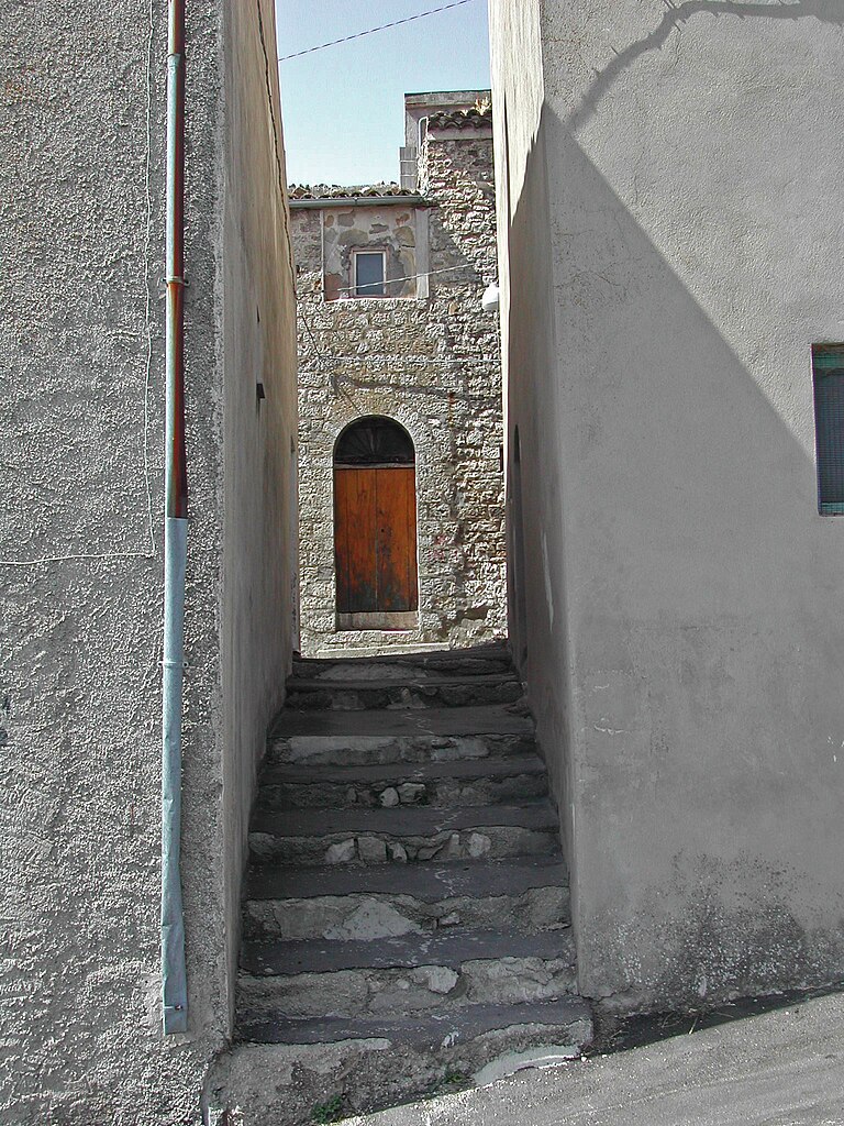
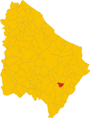
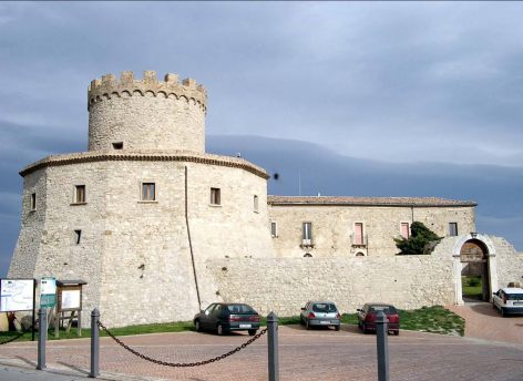
San Buono (San Buono)
.svg)
- Italian comune
 Hiking in San Buono
San Buono is a charming village located in the Abruzzo region of Italy, nestled within the foothills of the Apennine Mountains. This area is known for its lush landscapes, stunning views, and a variety of hiking opportunities suitable for different skill levels. Here are some highlights regarding hiking in and around San Buono:
Trails and Paths
-
Local Trails: There are numerous local trails that offer breathtaking views of the surrounding hills and countryside. Many of these paths are well-marked and can take you through fields, forests, and vineyards.
-
Majella National Park: Just a short drive from San Buono, this park offers a range of hiking routes, from easy strolls to more challenging treks. The park is home to diverse flora and fauna, striking rock formations, and ancient hermitages.
-
The Aventine Valley: This area features trails that follow the Aventine River, offering a mix of nature and historical sites. The trails often pass by quaint villages, old stone bridges, and beautiful landscapes.
Tips for Hiking in San Buono
-
Best Seasons: The best times for hiking in San Buono are in the spring (April to June) and fall (September to October), when the weather is mild and the scenery is particularly vibrant.
-
Preparation: Always wear appropriate hiking footwear and bring plenty of water and snacks. Some trails can be remote, so having a map or GPS is recommended.
-
Local Guidance: Consider hiring a local guide or joining a hiking group if you’re unfamiliar with the area. They can provide insights into the local culture, wildlife, and history.
-
Respect Nature: Follow the "Leave No Trace" principles to keep the beautiful environment pristine for future hikers.
Attractions Nearby
-
Vasto: A coastal town offering beautiful beaches and historical sites, great for a post-hike visit.
-
Castel di Sangro: Known for its historic architecture and proximity to Abruzzo’s highest peaks, perfect for extended hiking trips.
-
Gargano National Park: If you’re willing to drive a bit further, this national park offers stunning coastal hikes along the Adriatic Sea.
Conclusion
Hiking in San Buono allows you to immerse yourself in the natural beauty and cultural richness of the Abruzzo region. Whether you’re looking for a leisurely walk or a more challenging hike, this area provides a fantastic outdoor experience. Always check local trail conditions and regulations before heading out, and enjoy the adventure!
- Country:

- Postal Code: 66050
- Local Dialing Code: 0873
- Licence Plate Code: CH
- Coordinates: 41° 59' 0" N, 14° 34' 0" E


- GPS tracks (wikiloc): [Link]
- AboveSeaLevel: 470 м m
- Area: 25.27 sq km
- Population: 928
- Web site: http://www.comune.sanbuono.ch.it/
- Wikipedia en: wiki(en)
- Wikipedia: wiki(it)
- Wikidata storage: Wikidata: Q51283
- Wikipedia Commons Category: [Link]
- Freebase ID: [/m/0fg2wz]
- GeoNames ID: Alt: [6537493]
- VIAF ID: Alt: [240161026]
- OSM relation ID: [41675]
- TGN ID: [1046471]
- Digital Atlas of the Roman Empire ID: [36731]
- Trismegistos Geo ID: [32841]
- ISTAT ID: 069079
- Italian cadastre code: H784
Shares border with regions:


Carpineto Sinello
- Italian comune
Hiking in Carpineto Sinello
Carpineto Sinello, located in the Abruzzo region of Italy, is a charming destination for hiking enthusiasts, offering a mix of scenic views, rich natural landscapes, and cultural heritage. Here are some details about what you can expect when hiking in this area:...
- Country:
- Postal Code: 66030
- Local Dialing Code: 0872
- Licence Plate Code: CH
- Coordinates: 42° 1' 0" N, 14° 30' 0" E
- GPS tracks (wikiloc): [Link]
- AboveSeaLevel: 381 м m
- Area: 29.85 sq km
- Population: 574
- Web site: [Link]


Fresagrandinaria
- Italian comune
Hiking in Fresagrandinaria
Fresagrandinaria is a picturesque location in the Abruzzo region of Italy, surrounded by beautiful natural landscapes, dense forests, and striking mountain scenery. It is part of the larger area known for its outdoor recreational opportunities, particularly hiking....
- Country:
- Postal Code: 66050
- Local Dialing Code: 0873
- Licence Plate Code: CH
- Coordinates: 41° 59' 0" N, 14° 40' 0" E
- GPS tracks (wikiloc): [Link]
- AboveSeaLevel: 460 м m
- Area: 25.15 sq km
- Population: 946
- Web site: [Link]
Furci
- Italian comune
Hiking in Furci
Furci is a charming town located in Sicily, Italy. While it may not be as known for hiking as some larger national parks or mountain ranges, the surrounding areas do offer some opportunities for outdoor activities and exploration. Here are a few aspects to consider when hiking in and around Furci:...
- Country:
- Postal Code: 66050
- Local Dialing Code: 0873
- Licence Plate Code: CH
- Coordinates: 42° 0' 0" N, 14° 35' 0" E
- GPS tracks (wikiloc): [Link]
- AboveSeaLevel: 550 м m
- Area: 25.99 sq km
- Population: 926
- Web site: [Link]


Gissi
- Italian comune
Hiking in Gissi
Gissi is a charming town located in the Abruzzo region of Italy, known for its stunning landscapes and natural beauty. Hiking in and around Gissi can provide an opportunity to explore picturesque trails, beautiful countryside, and potentially some interesting historical sites....
- Country:
- Postal Code: 66052
- Local Dialing Code: 0873
- Licence Plate Code: CH
- Coordinates: 42° 1' 0" N, 14° 33' 0" E
- GPS tracks (wikiloc): [Link]
- AboveSeaLevel: 499 м m
- Area: 36.65 sq km
- Population: 2706
- Web site: [Link]
Liscia
- Italian comune
Hiking in Liscia
Liscia is a beautiful region in Sardinia, Italy, known for its stunning landscapes, rich history, and diverse flora and fauna, making it an excellent destination for hiking enthusiasts. Here's an overview of what you can expect when hiking in the area:...
- Country:
- Postal Code: 66050
- Local Dialing Code: 0873
- Licence Plate Code: CH
- Coordinates: 41° 57' 19" N, 14° 33' 19" E
- GPS tracks (wikiloc): [Link]
- AboveSeaLevel: 740 м m
- Area: 8.18 sq km
- Population: 700
- Web site: [Link]

Palmoli
- Italian comune
Hiking in Palmoli
Palmoli is a small town in the Abruzzo region of Italy, surrounded by beautiful natural landscapes and offering a variety of hiking opportunities. The area is characterized by rolling hills, lush valleys, and nearby mountain ranges, making it a great destination for both beginner and experienced hikers....
- Country:
- Postal Code: 66050
- Local Dialing Code: 0873
- Licence Plate Code: CH
- Coordinates: 41° 56' 22" N, 14° 34' 53" E
- GPS tracks (wikiloc): [Link]
- AboveSeaLevel: 711 м m
- Area: 32.78 sq km
- Population: 922
- Web site: [Link]