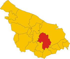
San Donaci (San Donaci)
.svg)
- Italian comune
 Hiking in San Donaci
San Donaci is a charming town located in the Apulia region of Italy, known for its rich history and beautiful landscapes. While it may not be as famous for hiking as some other regions in Italy, there are opportunities for outdoor activities and exploration in the surrounding areas.
Hiking Opportunities:
-
Countryside Trails: The areas surrounding San Donaci are characterized by picturesque countryside, olive groves, and vineyards. You can find various unmarked trails that are perfect for walking or hiking, allowing you to experience the local flora and fauna.
-
Cisternino and the Itria Valley: A short drive from San Donaci, the Itria Valley is known for its rolling hills and traditional trulli houses. There are numerous trails in this area, ranging from easy walks to more challenging hikes, making it suitable for hikers of all skill levels.
-
Nature Reserves: The nearby Torre Guaceto Nature Reserve offers stunning coastal views and diverse terrain, including sandy beaches and rocky cliffs. There are well-marked trails for hiking, which provide excellent opportunities for bird watching and seeing wildlife.
-
Alberobello: If you're willing to travel a bit further, Alberobello, famous for its trulli architecture, has trails that lead through the picturesque countryside. This area includes both cultural and natural attractions.
Tips for Hiking:
-
Best Time to Hike: Spring (April to June) and fall (September to October) are the best times for hiking in the region due to milder temperatures and beautiful scenery.
-
Preparation: Even though the hikes may not be very strenuous, it's important to bring water, snacks, and a good map or GPS device. Some trails may not be well-marked.
-
Local Guidance: Consider hiring a local guide or joining a hiking group if you're unfamiliar with the area. They can provide insights into the best trails and local history.
-
Respect Nature: As always, practice Leave No Trace principles, respect wildlife, and stay on marked trails to preserve the natural beauty of the area.
Overall, while San Donaci may not be a major hiking destination, it serves as a great starting point for exploring the scenic landscapes of Apulia. Enjoy your adventure!
- Country:

- Postal Code: 72025
- Local Dialing Code: 0831
- Licence Plate Code: BR
- Coordinates: 40° 27' 0" N, 17° 55' 0" E


- GPS tracks (wikiloc): [Link]
- AboveSeaLevel: 42 м m
- Area: 34.04 sq km
- Population: 6569
- Web site: http://www.comune.sandonaci.br.it/
- Wikipedia en: wiki(en)
- Wikipedia: wiki(it)
- Wikidata storage: Wikidata: Q51873
- Wikipedia Commons Category: [Link]
- Freebase ID: [/m/0f5l4r]
- GeoNames ID: Alt: [6537576]
- VIAF ID: Alt: [236155047]
- OSM relation ID: [33452]
- WOEID: [722466]
- UN/LOCODE: [ITSD2]
- ISTAT ID: 074013
- Italian cadastre code: H822
Shares border with regions:


Brindisi
- Italian comune
Hiking in Brindisi
Brindisi, located in the Apulia region of southern Italy, offers a variety of hiking opportunities that showcase its beautiful landscapes, coastal scenery, and historical sites. Here are some key hiking spots and experiences in and around Brindisi:...
- Country:
- Postal Code: 72100
- Local Dialing Code: 0831
- Licence Plate Code: BR
- Coordinates: 40° 38' 18" N, 17° 56' 45" E
- GPS tracks (wikiloc): [Link]
- AboveSeaLevel: 15 м m
- Area: 332.98 sq km
- Population: 88126
- Web site: [Link]
Cellino San Marco
- Italian comune
Hiking in Cellino San Marco
Cellino San Marco is a charming town located in the Apulia region of Italy. While it might not be widely known for its hiking routes compared to more mountainous areas, it does offer some beautiful landscapes and trails suitable for walking and light hiking....
- Country:
- Postal Code: 72020
- Local Dialing Code: 0831
- Licence Plate Code: BR
- Coordinates: 40° 28' 0" N, 17° 58' 0" E
- GPS tracks (wikiloc): [Link]
- AboveSeaLevel: 56 м m
- Area: 37.84 sq km
- Population: 6530
- Web site: [Link]

Mesagne
- Italian comune
Hiking in Mesagne
Mesagne, located in the Apulia region of Italy, is not typically known as a primary hiking destination like some of the larger national parks or mountainous areas, but it offers a unique opportunity for those interested in exploring the picturesque landscapes of the Salento region....
- Country:
- Postal Code: 72023
- Local Dialing Code: 0831
- Licence Plate Code: BR
- Coordinates: 40° 34' 0" N, 17° 48' 0" E
- GPS tracks (wikiloc): [Link]
- AboveSeaLevel: 72 м m
- Area: 124.05 sq km
- Population: 26836
- Web site: [Link]
San Pancrazio Salentino
- Italian comune
Hiking in San Pancrazio Salentino
San Pancrazio Salentino, located in the Puglia region of Italy, offers a unique landscape for hiking enthusiasts. The area is characterized by its charming countryside, olive groves, and a mix of rolling hills and flatlands. While it may not be as well-known for hiking as some other Italian regions, there are several trails and routes you can explore....
- Country:
- Postal Code: 72026
- Local Dialing Code: 0831
- Licence Plate Code: BR
- Coordinates: 40° 25' 0" N, 17° 50' 0" E
- GPS tracks (wikiloc): [Link]
- AboveSeaLevel: 62 м m
- Area: 56.68 sq km
- Population: 9882
- Web site: [Link]


Guagnano
- Italian comune
Hiking in Guagnano
Guagnano, a small town in the Apulia region of southern Italy, is surrounded by picturesque landscapes that offer a variety of outdoor activities, including hiking. While Guagnano itself may not be as well known as some other hiking destinations in Italy, its proximity to natural and historical sites provides opportunities for enjoyable hikes....
- Country:
- Postal Code: 73010
- Local Dialing Code: 0832
- Licence Plate Code: LE
- Coordinates: 40° 24' 0" N, 17° 57' 0" E
- GPS tracks (wikiloc): [Link]
- AboveSeaLevel: 44 м m
- Area: 38.03 sq km
- Population: 5681
- Web site: [Link]