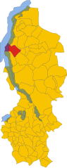
San Siro (San Siro)
.svg)
- Italian comune
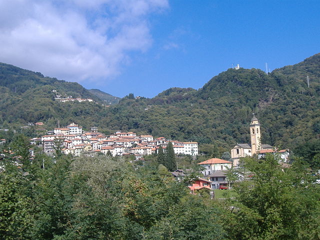
 Hiking in San Siro
San Siro, located in the province of Como in Northern Italy, is a beautiful area known for its stunning natural landscapes and picturesque hiking trails. It's situated along the western shore of Lake Como, and the combination of mountains and the lake provides hikers with breathtaking views and diverse terrain. Here are some highlights for hiking in San Siro:
Hiking Trails
-
Sentiero del Viandante
- This historic path stretches along the eastern shore of Lake Como and offers various segments. Some parts can be accessed from San Siro, providing panoramic views of the lake and surrounding mountains.
-
Monte Grona
- A more challenging hike that leads to the summit of Monte Grona. The trail takes you through woodlands, meadows, and rocky paths, culminating in stunning views of Lake Como, the Alps, and nearby towns.
-
Sentiero dei Fiori
- A scenic trail known for its rich flora and fauna. This trail is perfect for nature lovers and offers a relatively easy hike suitable for families.
Tips for Hiking in San Siro
- Footwear: Good hiking boots are essential, as trails can vary from easy walks to rocky paths.
- Weather: Be aware of the local weather conditions; storms can roll in quickly, especially in the mountains. It’s best to check forecasts before heading out.
- Hydration: Carry enough water, as there may not always be refill points along the trails.
- Maps and Guides: Having a physical map or a reliable navigation app can be advantageous, especially since some trails may not be well-marked.
- Local Advice: Don’t hesitate to ask locals or at visitor centers for trail conditions and recommendations.
Best Times to Hike
The best time to go hiking around San Siro is during spring (April to June) and early autumn (September to October) when the weather is typically mild, the flora is vibrant, and there are fewer crowds. Summer can be hot, while winter may bring snow to higher elevations.
Other Activities
Besides hiking, you might also consider:
- Lake Activities: Boat rentals, swimming, and fishing on Lake Como.
- Cultural Visits: Explore charming villages and historical sites in the vicinity, like Bellagio and Varenna.
Conclusion
Hiking in San Siro offers a wonderful blend of natural beauty, cultural heritage, and outdoor adventure. Whether you're an experienced hiker or just starting out, the trails around this part of Lake Como have something to offer everyone. Remember to prioritize safety, respect nature, and enjoy the stunning scenery!
- Country:

- Postal Code: 22010
- Local Dialing Code: 0344
- Licence Plate Code: CO
- Coordinates: 46° 3' 53" N, 9° 16' 0" E


- GPS tracks (wikiloc): [Link]
- AboveSeaLevel: 220 м m
- Area: 18.79 sq km
- Population: 1744
- Web site: http://www.comune.sansiro.co.it
- Wikipedia en: wiki(en)
- Wikipedia: wiki(it)
- Wikidata storage: Wikidata: Q47650
- Wikipedia Commons Category: [Link]
- Freebase ID: [/m/0gj2d1]
- GeoNames ID: Alt: [6542502]
- OSM relation ID: [70527]
- Quora topic ID: [San-Siro-1]
- ISTAT ID: 013248
- Italian cadastre code: I162
Shares border with regions:

Perledo
- Italian comune
Hiking in Perledo
Perledo is a charming village located in the province of Lecco, in the Lombardy region of Italy, perched above the eastern shore of Lake Como. It offers stunning views of the lake and the surrounding mountains, making it an attractive destination for hikers. Here are some key points to consider when hiking in and around Perledo:...
- Country:
- Postal Code: 23828
- Local Dialing Code: 0341
- Licence Plate Code: LC
- Coordinates: 46° 1' 0" N, 9° 18' 0" E
- GPS tracks (wikiloc): [Link]
- AboveSeaLevel: 395 м m
- Area: 13.68 sq km
- Population: 916
- Web site: [Link]


Dervio
- Italian comune
Hiking in Dervio
Dervio, located on the eastern shore of Lake Como in Italy's Lombardy region, is a beautiful destination for hikers and outdoor enthusiasts. The area is known for its stunning landscapes, charming village atmosphere, and a variety of hiking trails that cater to different skill levels....
- Country:
- Postal Code: 23824
- Local Dialing Code: 0341
- Licence Plate Code: LC
- Coordinates: 46° 4' 35" N, 9° 18' 24" E
- GPS tracks (wikiloc): [Link]
- AboveSeaLevel: 220 м m
- Area: 11.7 sq km
- Population: 2669
- Web site: [Link]


Bellano
- Italian comune
Hiking in Bellano
Bellano is a charming village located on the eastern shore of Lake Como in Italy, known for its beautiful landscapes and hiking opportunities. Here are some highlights about hiking in Bellano:...
- Country:
- Postal Code: 23822
- Local Dialing Code: 0341
- Licence Plate Code: LC
- Coordinates: 46° 2' 36" N, 9° 18' 22" E
- GPS tracks (wikiloc): [Link]
- AboveSeaLevel: 202 м m
- Area: 10.23 sq km
- Population: 3203
- Web site: [Link]
Cremia
- Italian comune
Hiking in Cremia
Cremia is a charming village located on the western shores of Lake Como in Italy, and it offers a variety of hiking opportunities in a beautiful natural setting. Below are some highlights and recommended trails for hiking in and around Cremia:...
- Country:
- Postal Code: 22010
- Local Dialing Code: 0344
- Licence Plate Code: CO
- Coordinates: 46° 5' 14" N, 9° 16' 17" E
- GPS tracks (wikiloc): [Link]
- AboveSeaLevel: 330 м m
- Area: 10.14 sq km
- Population: 675
- Web site: [Link]

Plesio
- Italian comune
Hiking in Plesio
Plesio is a charming village located in the Lombardy region of Italy, near Lake Como. It is a part of the Valtellina Valley and offers stunning views of the surrounding mountains and the lake itself. Hiking in this area can be an incredible experience, as it is blessed with natural beauty and a variety of trails suited for different skill levels....
- Country:
- Postal Code: 22010
- Local Dialing Code: 0344
- Licence Plate Code: CO
- Coordinates: 46° 2' 58" N, 9° 13' 32" E
- GPS tracks (wikiloc): [Link]
- AboveSeaLevel: 595 м m
- Area: 16.9 sq km
- Population: 840
- Web site: [Link]


Menaggio
- Italian comune
Hiking in Menaggio
Menaggio, located on the western shore of Lake Como in Italy, is a fantastic destination for hiking enthusiasts. The area offers stunning views, diverse trails, and a beautiful natural landscape that attracts visitors year-round. Here are some things to know about hiking in Menaggio:...
- Country:
- Postal Code: 22017
- Local Dialing Code: 0344
- Licence Plate Code: CO
- Coordinates: 46° 1' 0" N, 9° 14' 0" E
- GPS tracks (wikiloc): [Link]
- AboveSeaLevel: 202 м m
- Area: 11.77 sq km
- Population: 3107
- Web site: [Link]