Sandillon (Sandillon)

- commune in Loiret, France
- Country:

- Postal Code: 45640
- Coordinates: 47° 50' 43" N, 2° 1' 57" E


- GPS tracks (wikiloc): [Link]
- Area: 41.31 sq km
- Population: 3908
- Web site: http://www.sandillon.fr
- Wikipedia en: wiki(en)
- Wikipedia: wiki(fr)
- Wikidata storage: Wikidata: Q1108198
- Wikipedia Commons Category: [Link]
- Freebase ID: [/m/03nwhmn]
- Freebase ID: [/m/03nwhmn]
- GeoNames ID: Alt: [2976224]
- GeoNames ID: Alt: [2976224]
- SIREN number: [214503005]
- SIREN number: [214503005]
- BnF ID: [15260692k]
- BnF ID: [15260692k]
- PACTOLS thesaurus ID: [pcrtJfpIlEqfS1]
- PACTOLS thesaurus ID: [pcrtJfpIlEqfS1]
- WOEID: [620907]
- WOEID: [620907]
- INSEE municipality code: 45300
- INSEE municipality code: 45300
Shares border with regions:
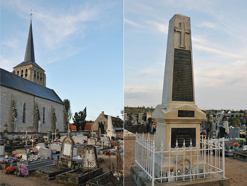

Darvoy
- commune in Loiret, France
- Country:
- Postal Code: 45150
- Coordinates: 47° 51' 26" N, 2° 5' 57" E
- GPS tracks (wikiloc): [Link]
- Area: 8.58 sq km
- Population: 1880
- Web site: [Link]


Bou
- commune in Loiret, France
- Country:
- Postal Code: 45430
- Coordinates: 47° 52' 24" N, 2° 2' 51" E
- GPS tracks (wikiloc): [Link]
- Area: 6.29 sq km
- Population: 918
- Web site: [Link]

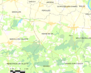
Vienne-en-Val
- commune in Loiret, France
- Country:
- Postal Code: 45510
- Coordinates: 47° 48' 3" N, 2° 8' 10" E
- GPS tracks (wikiloc): [Link]
- Area: 35.94 sq km
- Population: 1944
- Web site: [Link]


Férolles
- commune in Loiret, France
- Country:
- Postal Code: 45150
- Coordinates: 47° 50' 6" N, 2° 6' 31" E
- GPS tracks (wikiloc): [Link]
- Area: 17.05 sq km
- Population: 1176
- Web site: [Link]


Saint-Cyr-en-Val
- commune in Loiret, France
- Country:
- Postal Code: 45590
- Coordinates: 47° 49' 48" N, 1° 58' 10" E
- GPS tracks (wikiloc): [Link]
- Area: 44.23 sq km
- Population: 3273
- Web site: [Link]


Marcilly-en-Villette
- commune in Loiret, France
- Country:
- Postal Code: 45240
- Coordinates: 47° 45' 51" N, 2° 1' 19" E
- GPS tracks (wikiloc): [Link]
- Area: 62.66 sq km
- Population: 2056
- Web site: [Link]
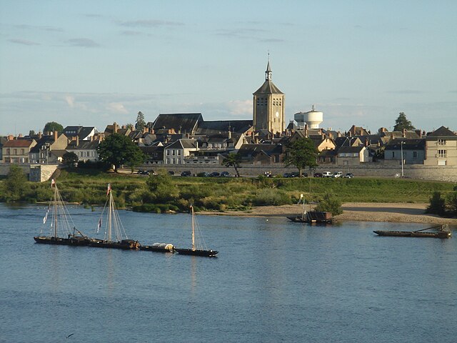

Jargeau
- commune in Loiret, France
- Country:
- Postal Code: 45150
- Coordinates: 47° 51' 53" N, 2° 7' 30" E
- GPS tracks (wikiloc): [Link]
- AboveSeaLevel: 100 м m
- Area: 14.66 sq km
- Population: 4550
- Web site: [Link]


Chécy
- commune in Loiret, France
- Country:
- Postal Code: 45430
- Coordinates: 47° 53' 37" N, 2° 1' 37" E
- GPS tracks (wikiloc): [Link]
- Area: 15.47 sq km
- Population: 8791
- Web site: [Link]


Saint-Denis-en-Val
- commune in Loiret, France
- Country:
- Postal Code: 45560
- Coordinates: 47° 52' 38" N, 1° 57' 36" E
- GPS tracks (wikiloc): [Link]
- Area: 17.11 sq km
- Population: 7497
- Web site: [Link]