
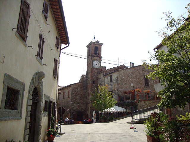
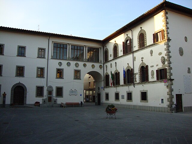
Sansepolcro (Sansepolcro)
.svg)
- Italian comune
 Hiking in Sansepolcro
Sansepolcro, located in the Toscano-Emiliano Apennines of Italy, is known not only for its rich history and art but also for its beautiful natural landscapes and hiking opportunities. Here are some highlights for hiking in and around Sansepolcro:
Trails and Routes
-
Historic Vineyards and Olive Groves: Many trails meander through picturesque vineyards and olive groves that are typical of the Tuscany region. The scenery is stunning, especially during harvest seasons.
-
The Alpe della Luna: This area offers several trails with varying difficulty levels. Hikes here reward you with panoramic views of the Tiber Valley and the surrounding hills. You may also encounter diverse flora and fauna.
-
Pieve di San Giovanni Battista: This historic church is surrounded by trails that allow you to explore the tranquil countryside. The routes often lead to small chapels and scenic viewpoints.
-
Monte Rognoso: For a bit more challenge, you can hike up Monte Rognoso. The trail is steeper but offers breathtaking vistas from the summit, making the effort worthwhile.
Tips for Hiking in Sansepolcro
- Best Time to Hike: The best months for hiking are typically late spring (May-June) and early autumn (September-October) when the weather is mild.
- Local Guide: Consider hiring a local guide for the best hiking experience. They can provide insights into the natural surroundings and historical context, making your hike more enriching.
- Preparation: Wear appropriate footwear and bring water, snacks, and sun protection, especially during warmer days.
- Respect Nature: Always stick to marked trails to protect local wildlife and plants, and remember to carry out all trash.
Additional Activities
- Cultural Exploration: After hiking, take some time to explore Sansepolcro’s historical sites, such as the Museo Civico or the birthplace of painter Piero della Francesca.
- Local Cuisine: Enjoy traditional Tuscan cuisine in local restaurants, celebrating the region's flavors after a day of hiking.
Sansepolcro is a fantastic base for hiking enthusiasts looking to explore the beauty of Tuscany's nature and cultural sites. Enjoy your adventure!
- Country:

- Postal Code: 52037
- Local Dialing Code: 0575
- Licence Plate Code: AR
- Coordinates: 43° 34' 32" N, 12° 8' 38" E


- GPS tracks (wikiloc): [Link]
- AboveSeaLevel: 330 м m
- Area: 91 sq km
- Population: 15876
- Web site: http://www.comune.sansepolcro.ar.it/
- Wikipedia en: wiki(en)
- Wikipedia: wiki(it)
- Wikidata storage: Wikidata: Q52098
- Wikipedia Commons Category: [Link]
- Freebase ID: [/m/0b6z1m]
- GeoNames ID: Alt: [6541100]
- VIAF ID: Alt: [264085244]
- OSM relation ID: [42495]
- archINFORM location ID: [6456]
- Quora topic ID: [Sansepolcro]
- UN/LOCODE: [ITSSC]
- Gran Enciclopèdia Catalana ID: [0058838]
- ISTAT ID: 051034
- Italian cadastre code: I155
Shares border with regions:


Borgo Pace
- Italian comune
Hiking in Borgo Pace
Borgo Pace, located in the Marche region of Italy, offers a stunning array of hiking opportunities set against a backdrop of rolling hills, lush forests, and picturesque landscapes. Here are some highlights and tips for hiking in this beautiful area:...
- Country:
- Postal Code: 61040
- Local Dialing Code: 0722
- Licence Plate Code: PU
- Coordinates: 43° 39' 28" N, 12° 17' 39" E
- GPS tracks (wikiloc): [Link]
- AboveSeaLevel: 469 м m
- Area: 56.22 sq km
- Population: 613
- Web site: [Link]
Citerna
- Italian comune
Hiking in Citerna
Citerna is a charming hilltop village located in the Umbria region of Italy, near the border with Tuscany. Known for its stunning landscapes, historical architecture, and tranquil atmosphere, it makes for a great hiking destination. Here are some key points regarding hiking in and around Citerna:...
- Country:
- Postal Code: 06010
- Local Dialing Code: 075
- Licence Plate Code: PG
- Coordinates: 43° 30' 0" N, 12° 7' 0" E
- GPS tracks (wikiloc): [Link]
- AboveSeaLevel: 480 м m
- Area: 23.53 sq km
- Population: 3463
- Web site: [Link]


Città di Castello
- Italian comune
Hiking in Città di Castello
Città di Castello, located in the Umbria region of Italy, is surrounded by stunning landscapes, making it a great destination for hiking enthusiasts. Here are some key points about hiking in and around Città di Castello:...
- Country:
- Postal Code: 06018; 06010; 06012
- Local Dialing Code: 075
- Licence Plate Code: PG
- Coordinates: 43° 27' 27" N, 12° 14' 25" E
- GPS tracks (wikiloc): [Link]
- AboveSeaLevel: 288 м m
- Area: 387.32 sq km
- Population: 39632
- Web site: [Link]


San Giustino
- Italian comune
Hiking in San Giustino
San Giustino, located in the province of Perugia in the Umbria region of Italy, is not only a quaint town with charming architecture, but it also serves as a gateway to various hiking opportunities in the surrounding landscape. Here are some highlights and tips for hiking in and around San Giustino:...
- Country:
- Postal Code: 06016
- Local Dialing Code: 075
- Licence Plate Code: PG
- Coordinates: 43° 33' 0" N, 12° 11' 0" E
- GPS tracks (wikiloc): [Link]
- AboveSeaLevel: 336 м m
- Area: 79.98 sq km
- Population: 11213
- Web site: [Link]


Anghiari
- Italian comune
Hiking in Anghiari
Anghiari is a charming medieval town located in the Tuscany region of Italy, known for its stunning landscapes, rich history, and well-preserved architecture. Hiking in and around Anghiari offers a variety of trails that showcase the beautiful countryside, rolling hills, and picturesque views unique to this part of Tuscany....
- Country:
- Postal Code: 52031
- Local Dialing Code: 0575
- Licence Plate Code: AR
- Coordinates: 43° 32' 30" N, 12° 3' 18" E
- GPS tracks (wikiloc): [Link]
- AboveSeaLevel: 429 м m
- Area: 130.92 sq km
- Population: 5536
- Web site: [Link]


Badia Tedalda
- Italian comune
Hiking in Badia Tedalda
Badia Tedalda is a beautiful destination located in the province of Arezzo in Tuscany, Italy. Nestled in the Valtiberina valley, this area is known for its stunning landscapes, rich history, and natural beauty, making it an excellent spot for hiking enthusiasts....
- Country:
- Postal Code: 53032
- Local Dialing Code: 0575
- Licence Plate Code: AR
- Coordinates: 43° 42' 29" N, 12° 11' 14" E
- GPS tracks (wikiloc): [Link]
- AboveSeaLevel: 700 м m
- Area: 119.03 sq km
- Population: 1075
- Web site: [Link]

Pieve Santo Stefano
- Italian comune
Hiking in Pieve Santo Stefano
Pieve Santo Stefano, located in Tuscany, Italy, is an enchanting destination for hikers. Nestled in the Casentino region, it offers a diverse range of trails that cater to various skill levels, all while showcasing stunning landscapes, rich history, and cultural heritage....
- Country:
- Postal Code: 52036
- Local Dialing Code: 0575
- Licence Plate Code: AR
- Coordinates: 43° 40' 21" N, 12° 2' 32" E
- GPS tracks (wikiloc): [Link]
- AboveSeaLevel: 431 м m
- Area: 156.1 sq km
- Population: 3117
- Web site: [Link]