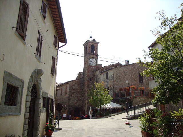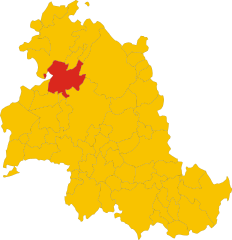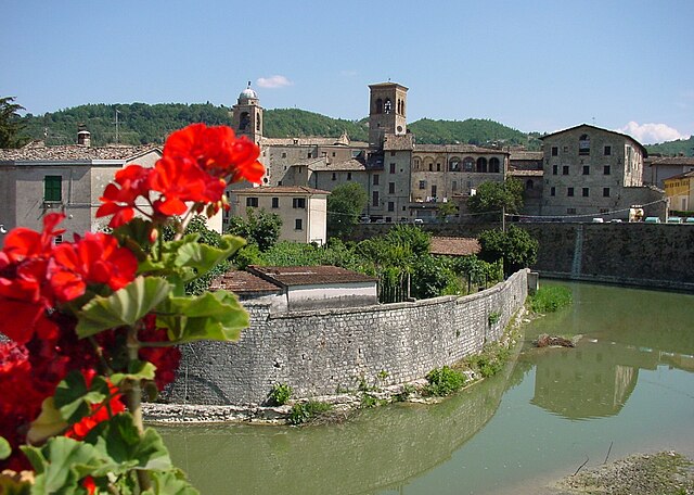
Città di Castello (Città di Castello)
- Italian comune
Città di Castello, located in the Umbria region of Italy, is surrounded by stunning landscapes, making it a great destination for hiking enthusiasts. Here are some key points about hiking in and around Città di Castello:
Trails and Terrain
- Scenic Routes: The area features a variety of trails that pass through beautiful countryside, including vineyards, olive groves, and picturesque hills.
- Difficulty Levels: There are trails suitable for all levels, from easy walks for beginners to more challenging hikes for experienced trekkers.
- Natural Parks: Nearby parks such as the Parco del Tevere and the Alto Tevere provide well-marked trails and opportunities to enjoy local flora and fauna.
Popular Hiking Areas
- Monte Rinaldo: This mountain offers well-defined trails with stunning views of the surrounding landscape and is a great spot for a day hike.
- The Tiber River Path: Follow the Tiber River through beautiful landscapes. This trail can be less strenuous and allows for leisurely walks along the water.
- Castrocaro: Hike up to this medieval castle site offering panoramic views and a glimpse into the region's history.
Points of Interest
- Historic Sites: Many trails will take you past historical landmarks and churches, providing a cultural aspect to your hike.
- Local Flora and Fauna: Keep an eye out for the diverse wildlife and plant species native to the region.
Tips for Hikers
- Prepare for Weather: The weather can vary, so it's wise to bring layers and be prepared for sudden changes.
- Stay Hydrated: Carry enough water, especially on warm days.
- Trail Maps: Consider downloading maps or using a GPS app to navigate the trails easily.
Best Times to Hike
The ideal seasons for hiking in Città di Castello are spring (April to June) and autumn (September to October) when temperatures are comfortable, and the scenery is particularly beautiful with blooming flora and colorful foliage.
Overall, Città di Castello offers a wonderful combination of natural beauty, cultural heritage, and outdoor adventure right at your fingertips!
- Country:

- Postal Code: 06018; 06010; 06012
- Local Dialing Code: 075
- Licence Plate Code: PG
- Coordinates: 43° 27' 27" N, 12° 14' 25" E


- GPS tracks (wikiloc): [Link]
- AboveSeaLevel: 288 м m
- Area: 387.32 sq km
- Population: 39632
- Web site: http://www.comune.citta-di-castello.perugia.it/
- Wikipedia en: wiki(en)
- Wikipedia: wiki(it)
- Wikidata storage: Wikidata: Q20413
- Wikipedia Commons Category: [Link]
- Freebase ID: [/m/0291kl]
- GeoNames ID: Alt: [6541649]
- VIAF ID: Alt: [132507976]
- OSM relation ID: [42407]
- archINFORM location ID: [1101]
- PACTOLS thesaurus ID: [pcrt0iIg6tSGhn]
- MusicBrainz area ID: [de238fa3-d7b9-49b6-99eb-74fafef62794]
- Quora topic ID: [Città-Di-Castello]
- TGN ID: [7005039]
- UN/LOCODE: [ITCDC]
- Encyclopædia Britannica Online ID: [place/Citta-di-Castello]
- Gran Enciclopèdia Catalana ID: [0017908]
- Facebook Places ID: [107557979266713]
- Digital Atlas of the Roman Empire ID: [16631]
- ISTAT ID: 054013
- Italian cadastre code: C745
Shares border with regions:


Arezzo
- Italian comune
Arezzo, located in Tuscany, Italy, offers a diverse range of hiking opportunities amidst its stunning landscapes, charming villages, and historical landmarks. Here are some highlights and tips for hiking in the Arezzo area:...
- Country:

- Postal Code: 52100
- Local Dialing Code: 0575
- Licence Plate Code: AR
- Coordinates: 43° 27' 47" N, 11° 52' 41" E


- GPS tracks (wikiloc): [Link]
- AboveSeaLevel: 296 м m
- Area: 384.7 sq km
- Population: 99541
- Web site: [Link]


Apecchio
- Italian comune
Apecchio is a charming town located in the Marche region of Italy, known for its beautiful landscapes, rolling hills, and rich history. Hiking in Apecchio offers a fantastic experience, with a variety of trails that cater to different skill levels and provide breathtaking views of the surrounding countryside....
- Country:

- Postal Code: 61042
- Local Dialing Code: 0722
- Licence Plate Code: PU
- Coordinates: 43° 33' 33" N, 12° 25' 6" E


- GPS tracks (wikiloc): [Link]
- AboveSeaLevel: 493 м m
- Area: 103.11 sq km
- Population: 1819
- Web site: [Link]

Citerna
- Italian comune
Citerna is a charming hilltop village located in the Umbria region of Italy, near the border with Tuscany. Known for its stunning landscapes, historical architecture, and tranquil atmosphere, it makes for a great hiking destination. Here are some key points regarding hiking in and around Citerna:...
- Country:

- Postal Code: 06010
- Local Dialing Code: 075
- Licence Plate Code: PG
- Coordinates: 43° 30' 0" N, 12° 7' 0" E


- GPS tracks (wikiloc): [Link]
- AboveSeaLevel: 480 м m
- Area: 23.53 sq km
- Population: 3463
- Web site: [Link]


Monte Santa Maria Tiberina
- Italian comune
 Hiking in Monte Santa Maria Tiberina
Monte Santa Maria Tiberina is a beautiful hilltop town located in the Umbria region of Italy, known for its stunning landscapes, rich history, and charming architecture. Hiking in this area can be a delightful experience, offering a mix of scenic views, ancient paths, and a glimpse into local culture....
- Country:

- Postal Code: 06010
- Local Dialing Code: 075
- Licence Plate Code: PG
- Coordinates: 43° 26' 14" N, 12° 9' 45" E


- GPS tracks (wikiloc): [Link]
- AboveSeaLevel: 688 м m
- Area: 72.53 sq km
- Population: 1156
- Web site: [Link]

Montone
- Italian comune
Montone is a picturesque village situated in the Umbria region of Italy. Nestled in the hills, it offers a beautiful backdrop for hiking enthusiasts. Here are some key points to consider when hiking in and around Montone:...
- Country:

- Postal Code: 06014
- Local Dialing Code: 075
- Licence Plate Code: PG
- Coordinates: 43° 21' 39" N, 12° 19' 24" E


- GPS tracks (wikiloc): [Link]
- AboveSeaLevel: 482 м m
- Area: 51.1 sq km
- Population: 1642
- Web site: [Link]


Pietralunga
- Italian comune
Pietralunga is a charming town located in the Umbria region of Italy, surrounded by beautiful landscapes that are ideal for hiking enthusiasts. Nestled in the hills, this area is characterized by rolling hills, lush forests, and olive groves, making it a scenic spot for outdoor activities....
- Country:

- Postal Code: 06026
- Local Dialing Code: 075
- Licence Plate Code: PG
- Coordinates: 43° 27' 0" N, 12° 26' 0" E


- GPS tracks (wikiloc): [Link]
- AboveSeaLevel: 566 м m
- Area: 140.42 sq km
- Population: 2079
- Web site: [Link]


San Giustino
- Italian comune
San Giustino, located in the province of Perugia in the Umbria region of Italy, is not only a quaint town with charming architecture, but it also serves as a gateway to various hiking opportunities in the surrounding landscape. Here are some highlights and tips for hiking in and around San Giustino:...
- Country:

- Postal Code: 06016
- Local Dialing Code: 075
- Licence Plate Code: PG
- Coordinates: 43° 33' 0" N, 12° 11' 0" E


- GPS tracks (wikiloc): [Link]
- AboveSeaLevel: 336 м m
- Area: 79.98 sq km
- Population: 11213
- Web site: [Link]


Umbertide
- Italian comune
Umbertide, located in the Umbria region of Italy, offers a picturesque setting for hiking enthusiasts, with its rolling hills, lush countryside, and charming medieval villages. Here are some highlights and tips for hiking in and around Umbertide:...
- Country:

- Postal Code: 06019
- Local Dialing Code: 075
- Licence Plate Code: PG
- Coordinates: 43° 18' 20" N, 12° 20' 12" E


- GPS tracks (wikiloc): [Link]
- AboveSeaLevel: 247 м m
- Area: 200.83 sq km
- Population: 16530
- Web site: [Link]


Mercatello sul Metauro
- Italian comune
 Hiking in Mercatello sul Metauro
Mercatello sul Metauro is a charming town in the Marche region of Italy, known for its stunning natural landscapes and rich history. The surrounding area offers a variety of hiking opportunities that allow you to explore the beautiful countryside, mountains, and the Metauro River....
- Country:

- Postal Code: 61040
- Local Dialing Code: 0722
- Licence Plate Code: PU
- Coordinates: 43° 38' 51" N, 12° 20' 13" E


- GPS tracks (wikiloc): [Link]
- AboveSeaLevel: 429 м m
- Area: 68.36 sq km
- Population: 1361
- Web site: [Link]


Sant'Angelo in Vado
- comune of Italy
Sant'Angelo in Vado is a charming town located in the Marche region of Italy, known for its beautiful landscapes and rich history. It's situated in a hilly area, making it an excellent destination for hiking enthusiasts....
- Country:

- Postal Code: 61048
- Local Dialing Code: 0722
- Licence Plate Code: PU
- Coordinates: 43° 50' 0" N, 12° 48' 0" E


- GPS tracks (wikiloc): [Link]
- AboveSeaLevel: 359 м m
- Area: 67.34 sq km
- Population: 4073
- Web site: [Link]


Cortona
- Italian town and comune
Cortona, a charming hilltop town in Tuscany, Italy, is known not only for its historical architecture and stunning views but also for its scenic hiking opportunities. Here are some key points about hiking in and around Cortona:...
- Country:

- Postal Code: 52044
- Local Dialing Code: 0575
- Licence Plate Code: AR
- Coordinates: 43° 16' 32" N, 11° 59' 17" E


- GPS tracks (wikiloc): [Link]
- AboveSeaLevel: 494 м m
- Area: 342.97 sq km
- Population: 22057
- Web site: [Link]


Monterchi
- Italian comune
Monterchi, a quaint village in Tuscany, Italy, offers some stunning hiking opportunities amidst rolling hills, vineyards, and picturesque landscapes. If you're planning to hike in or around Monterchi, here are some key points to consider:...
- Country:

- Postal Code: 52035
- Local Dialing Code: 0575
- Licence Plate Code: AR
- Coordinates: 43° 29' 21" N, 12° 6' 44" E


- GPS tracks (wikiloc): [Link]
- AboveSeaLevel: 356 м m
- Area: 29.42 sq km
- Population: 1716
- Web site: [Link]


Sansepolcro
- Italian comune
Sansepolcro, located in the Toscano-Emiliano Apennines of Italy, is known not only for its rich history and art but also for its beautiful natural landscapes and hiking opportunities. Here are some highlights for hiking in and around Sansepolcro:...
- Country:

- Postal Code: 52037
- Local Dialing Code: 0575
- Licence Plate Code: AR
- Coordinates: 43° 34' 32" N, 12° 8' 38" E


- GPS tracks (wikiloc): [Link]
- AboveSeaLevel: 330 м m
- Area: 91 sq km
- Population: 15876
- Web site: [Link]
