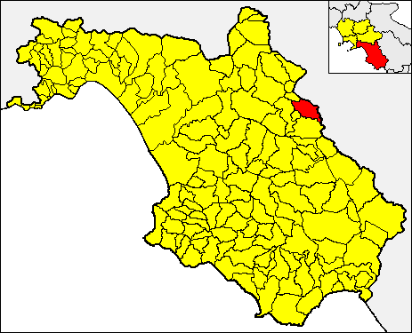
Sant'Angelo Le Fratte (Sant'Angelo Le Fratte)
.svg)
- Italian comune
 Hiking in Sant'Angelo Le Fratte
Sant'Angelo Le Fratte is a charming village located in the Basilicata region of southern Italy, known for its stunning landscapes and rich natural beauty. The area offers various hiking opportunities for both novice and seasoned hikers, providing a unique glimpse into the local environment, culture, and history.
Hiking Trails
-
Monte Ginepro: This trail leads you up to Monte Ginepro, one of the prominent peaks in the vicinity. The route offers panoramic views of the surrounding valleys and is filled with local flora and fauna. The ascent can be steep in places, making it a moderately challenging hike.
-
The Parco Nazionale del Pollino: A bit further afield, this national park offers extensive hiking trails that cater to all levels. You can explore diverse landscapes ranging from rugged mountains to lush forests, and witness its unique biodiversity. Guided tours are often available if you prefer a more structured hike.
-
Local Trails: There are various paths interspersed throughout the countryside around Sant'Angelo Le Fratte. These trails often lead to historical sites, such as old ruins or ancient churches, providing a cultural aspect to your hiking experience.
Best Times to Hike
The best time to hike in the area is during the spring (April to June) and early autumn (September to October). During these months, the weather is generally mild, and the natural surroundings are in full bloom. Summer can be quite hot, while winter may see snowfall in higher elevations.
Preparing for Your Hike
- Footwear: Ensure you have sturdy hiking boots for better grip and comfort.
- Weather Check: Always check the local weather before heading out, as conditions can change rapidly.
- Hydration and Snacks: Bring enough water and some energy-boosting snacks, particularly for longer hikes.
- Maps and Guides: Having a map or a local guide can enhance your experience, especially if you're unfamiliar with the terrain.
Nature and Wildlife
While hiking, keep an eye out for the local wildlife, which may include various bird species, small mammals, and unique plant life typical of the Mediterranean climate.
Cultural Considerations
As you hike, you'll also encounter the rich culture of the region. Look for opportunities to interact with locals, sample traditional food, and enjoy the stunning vistas that make Sant'Angelo Le Fratte a hidden gem for outdoor enthusiasts.
Remember to respect the environment and practice the "Leave No Trace" principles to preserve the natural beauty of the area. Enjoy your hiking experience!
- Country:

- Postal Code: 85050
- Local Dialing Code: 0975
- Licence Plate Code: PZ
- Coordinates: 40° 32' 49" N, 15° 33' 27" E


- GPS tracks (wikiloc): [Link]
- AboveSeaLevel: 560 м m
- Area: 23.1 sq km
- Population: 1395
- Web site: http://www.comune.santangelolefratte.pz.it/
- Wikipedia en: wiki(en)
- Wikipedia: wiki(it)
- Wikidata storage: Wikidata: Q52668
- Wikipedia Commons Category: [Link]
- Freebase ID: [/m/0fh3vn]
- GeoNames ID: Alt: [6539013]
- VIAF ID: Alt: [304910769]
- OSM relation ID: [40577]
- UN/LOCODE: [ITSAF]
- EMLO location ID: [d3b33deb-db4a-40d9-94f2-529966ee0d3d]
- Trismegistos Geo ID: [33071]
- ISTAT ID: 076079
- Italian cadastre code: I288
Shares border with regions:


Brienza
- Italian comune
Hiking in Brienza
Brienza, located in the province of Potenza in the Basilicata region of Italy, is surrounded by beautiful landscapes, making it an excellent destination for hiking enthusiasts. The area features a mix of forested areas, rolling hills, and stunning views of the surrounding mountains....
- Country:
- Postal Code: 85050
- Local Dialing Code: 0975
- Licence Plate Code: PZ
- Coordinates: 40° 28' 43" N, 15° 37' 48" E
- GPS tracks (wikiloc): [Link]
- AboveSeaLevel: 706 м m
- Area: 82.94 sq km
- Population: 4030
- Web site: [Link]


Satriano di Lucania
- Italian comune
Hiking in Satriano di Lucania
Satriano di Lucania, located in the Basilicata region of southern Italy, is a charming destination for hiking enthusiasts. The surrounding landscape offers a variety of trails that showcase the beauty of the Apennine Mountains and the rich natural environment of the area....
- Country:
- Postal Code: 85050
- Local Dialing Code: 0975
- Licence Plate Code: PZ
- Coordinates: 40° 32' 42" N, 15° 38' 21" E
- GPS tracks (wikiloc): [Link]
- AboveSeaLevel: 650 м m
- Area: 33.02 sq km
- Population: 2342
- Web site: [Link]


Savoia di Lucania
- Italian comune
Hiking in Savoia di Lucania
Savoia di Lucania is a charming town in the mountainous region of Basilicata, Italy, known for its beautiful landscapes and rich cultural heritage. If you're considering hiking in this area, here are some key aspects to keep in mind:...
- Country:
- Postal Code: 85050
- Local Dialing Code: 0971
- Licence Plate Code: PZ
- Coordinates: 40° 34' 0" N, 15° 33' 0" E
- GPS tracks (wikiloc): [Link]
- AboveSeaLevel: 750 м m
- Area: 32.84 sq km
- Population: 1089
- Web site: [Link]


Tito
- Italian comune
Hiking in Tito
Hiking in Tito, a town situated in the Basilicata region of Italy, offers a wonderful blend of natural beauty, historical sites, and diverse landscapes. Here are some key points to consider:...
- Country:
- Postal Code: 85050
- Local Dialing Code: 0971
- Licence Plate Code: PZ
- Coordinates: 40° 35' 0" N, 15° 41' 0" E
- GPS tracks (wikiloc): [Link]
- AboveSeaLevel: 650 м m
- Area: 71.27 sq km
- Population: 7355
- Web site: [Link]

Caggiano
- Italian comune
Hiking in Caggiano
Caggiano is a charming town located in the province of Salerno, in the Campania region of Italy. It’s positioned in the beautiful Apennine Mountains, which provides a stunning backdrop for hiking enthusiasts. Here are some key points about hiking in and around Caggiano:...
- Country:
- Postal Code: 84030
- Local Dialing Code: 0975
- Licence Plate Code: SA
- Coordinates: 40° 34' 0" N, 15° 30' 0" E
- GPS tracks (wikiloc): [Link]
- AboveSeaLevel: 828 м m
- Area: 35.43 sq km
- Population: 2676
- Web site: [Link]


Polla
- Italian comune
Hiking in Polla
Polla, a charming town located in the Campania region of Italy, is often overlooked by tourists but offers a wealth of natural beauty and hiking opportunities. Nestled in the heart of the Alburni Mountains, it serves as an ideal base for those looking to explore scenic trails, lush landscapes, and authentic Italian culture....
- Country:
- Postal Code: 84035
- Local Dialing Code: 0975
- Licence Plate Code: SA
- Coordinates: 40° 31' 0" N, 15° 30' 0" E
- GPS tracks (wikiloc): [Link]
- AboveSeaLevel: 468 м m
- Area: 48.08 sq km
- Population: 5273
- Web site: [Link]