Sant'Egidio alla Vibrata (Sant'Egidio alla Vibrata)
.svg)
- Italian comune
 Hiking in Sant'Egidio alla Vibrata
Sant'Egidio alla Vibrata is a quaint town located in the Abruzzo region of Italy, surrounded by picturesque landscapes that make it a great destination for hiking enthusiasts. The area is characterized by its rolling hills, lush valleys, and proximity to the Gran Sasso and Monti della Laga National Park, which offers numerous hiking trails with varying difficulty levels.
Popular Hiking Trails
-
Gran Sasso and Monti della Laga National Park: This national park is just a short drive from Sant'Egidio alla Vibrata and boasts some of the most stunning landscapes in Italy. You can find trails that range from easy walks to more strenuous hikes, with options for guided tours.
-
Monti della Laga: The trails here offer a chance to see diverse flora and fauna, as well as breathtaking views of both mountains and valleys. Look for the trail that leads to the peaks for a rewarding panoramic view.
-
Local Nature Trails: Explore the local area around Sant'Egidio, where you can find smaller, well-marked trails that take you through serene countryside, vineyards, and olive groves.
Tips for Hiking in Sant'Egidio alla Vibrata
-
Best Time to Hike: Spring and fall are ideal for hiking, offering mild weather and beautiful scenery. Summers can be hot, while winters may bring snow to higher elevations.
-
Gear Up: Ensure you have appropriate footwear, water, snacks, a map, and a first-aid kit. Always check trail conditions before heading out.
-
Respect Nature: Follow Leave No Trace principles to protect the natural environment. Stay on marked trails, and pack out what you pack in.
-
Local Guidance: If you're unfamiliar with the area, consider joining a guided hike or reaching out to local hiking clubs for recommendations and guided experiences.
Whether you're looking for a leisurely walk or an adventurous climb, hiking in and around Sant'Egidio alla Vibrata offers a memorable experience immersed in nature. Enjoy your hike!
- Country:

- Postal Code: 64016
- Local Dialing Code: 0861
- Licence Plate Code: TE
- Coordinates: 42° 50' 0" N, 13° 43' 0" E


- GPS tracks (wikiloc): [Link]
- AboveSeaLevel: 239 м m
- Area: 18.36 sq km
- Population: 9753
- Web site: http://www.comune.santegidioallavibrata.te.it/
- Wikipedia en: wiki(en)
- Wikipedia: wiki(it)
- Wikidata storage: Wikidata: Q51464
- Wikipedia Commons Category: [Link]
- Freebase ID: [/m/0fs4b7]
- GeoNames ID: Alt: [6541926]
- VIAF ID: Alt: [240158070]
- OSM relation ID: [42180]
- WOEID: [723411]
- UN/LOCODE: [ITEGV]
- ISTAT ID: 067038
- Italian cadastre code: I318
Shares border with regions:

Ancarano
- Italian comune
Hiking in Ancarano
Ancarano, a small town in the Abruzzo region of Italy, is surrounded by beautiful natural landscapes that offer great opportunities for hiking enthusiasts. The area is characterized by rolling hills, lush greenery, and stunning views of the Gran Sasso and Monti della Laga National Park, making it an ideal destination for outdoor activities....
- Country:
- Postal Code: 64010
- Local Dialing Code: 0861
- Licence Plate Code: TE
- Coordinates: 42° 50' 13" N, 13° 44' 25" E
- GPS tracks (wikiloc): [Link]
- AboveSeaLevel: 294 м m
- Area: 13.92 sq km
- Population: 1890
- Web site: [Link]

Civitella del Tronto
- Italian comune
Hiking in Civitella del Tronto
Civitella del Tronto is a charming hilltop village located in the Abruzzo region of Italy, known for its historical architecture and stunning natural surroundings. Hiking in this area offers a mix of cultural heritage and beautiful landscapes....
- Country:
- Postal Code: 64010
- Local Dialing Code: 0861
- Licence Plate Code: TE
- Coordinates: 42° 46' 19" N, 13° 40' 0" E
- GPS tracks (wikiloc): [Link]
- AboveSeaLevel: 589 м m
- Area: 77.74 sq km
- Population: 4918
- Web site: [Link]

Sant'Omero
- Italian comune
Hiking in Sant'Omero
Sant'Omero, located in the Abruzzo region of Italy, is a charming town known for its scenic beauty and proximity to the Monti della Laga National Park. Hiking in and around Sant'Omero offers a variety of trails that cater to different skill levels, giving you the opportunity to explore the stunning landscapes, rich biodiversity, and cultural heritage of the area....
- Country:
- Postal Code: 64027
- Local Dialing Code: 0861
- Licence Plate Code: TE
- Coordinates: 42° 47' 0" N, 13° 48' 0" E
- GPS tracks (wikiloc): [Link]
- AboveSeaLevel: 209 м m
- Area: 34.2 sq km
- Population: 5317
- Web site: [Link]

Torano Nuovo
- Italian comune
Hiking in Torano Nuovo
Torano Nuovo is a small town located in the Abruzzo region of Italy, known for its scenic landscapes and proximity to the Gran Sasso and Monti della Laga National Park. While it may not be as well-known as some larger hiking destinations, it offers a variety of trails that can cater to both casual walkers and more experienced hikers....
- Country:
- Postal Code: 64010
- Local Dialing Code: 0861
- Licence Plate Code: TE
- Coordinates: 42° 49' 0" N, 13° 47' 0" E
- GPS tracks (wikiloc): [Link]
- AboveSeaLevel: 237 м m
- Area: 10.22 sq km
- Population: 1584
- Web site: [Link]
Folignano
- Italian comune
Hiking in Folignano
Folignano, a charming town located in the Marche region of Italy, offers a variety of hiking opportunities that showcase the area's natural beauty and cultural heritage. Here are some key points to consider if you're planning to hike in Folignano:...
- Country:
- Postal Code: 63084
- Local Dialing Code: 0736
- Licence Plate Code: AP
- Coordinates: 42° 49' 16" N, 13° 37' 59" E
- GPS tracks (wikiloc): [Link]
- AboveSeaLevel: 310 м m
- Area: 14.86 sq km
- Population: 9182
- Web site: [Link]


Maltignano
- Italian comune
Hiking in Maltignano
Maltignano is a small town located in the province of Ascoli Piceno in the Marche region of Italy. While it's not as widely known for hiking as some other areas in Italy, it offers beautiful scenery, a charming rural atmosphere, and access to the stunning landscapes of the surrounding Marche countryside....
- Country:
- Postal Code: 63085
- Local Dialing Code: 0736
- Licence Plate Code: AP
- Coordinates: 42° 49' 54" N, 13° 41' 14" E
- GPS tracks (wikiloc): [Link]
- AboveSeaLevel: 307 м m
- Area: 8.17 sq km
- Population: 2361
- Web site: [Link]
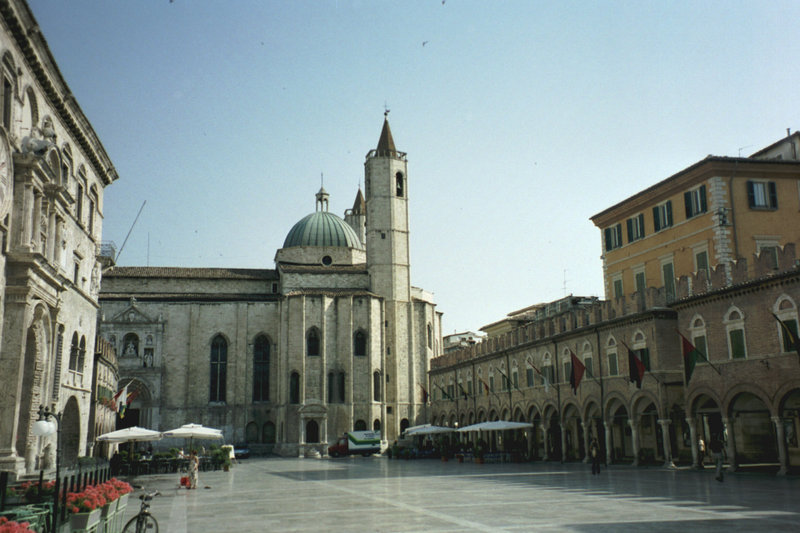

Ascoli Piceno
- Italian comune
Hiking in Ascoli Piceno
Ascoli Piceno, a charming town in the Marche region of Italy, offers a variety of hiking opportunities that allow you to explore its stunning landscapes, rich history, and charming villages. Here are some details about hiking in and around Ascoli Piceno:...
- Country:
- Postal Code: 63100
- Local Dialing Code: 0736
- Licence Plate Code: AP
- Coordinates: 42° 51' 17" N, 13° 34' 31" E
- GPS tracks (wikiloc): [Link]
- AboveSeaLevel: 154 м m
- Area: 158.02 sq km
- Population: 48773
- Web site: [Link]