
Civitella del Tronto (Civitella del Tronto)
.svg)
- Italian comune
 Hiking in Civitella del Tronto
Civitella del Tronto is a charming hilltop village located in the Abruzzo region of Italy, known for its historical architecture and stunning natural surroundings. Hiking in this area offers a mix of cultural heritage and beautiful landscapes.
Hiking Trails
-
Historical Trails: Many hikes can start from Civitella del Tronto itself, where you can explore the ancient fortress and the narrow streets of the village. The fortress offers a panoramic view of the surrounding countryside.
-
Natural Paths: The area around Civitella del Tronto is characterized by rolling hills, vineyards, and olive groves, making for pleasant hiking trails. The nearby Gran Sasso and Monti della Laga National Park offers more rugged terrain and diverse ecosystems.
-
The “Sentiero dei Ciclamini”: This is a well-known hiking path that can take you through some of the picturesque countryside. It's an easy-to-moderate trail that showcases the region's flora.
-
Wildlife Watching: The park and surrounding areas are rich in biodiversity, providing opportunities to spot a variety of wildlife, including deer, birds, and other fauna which can be often seen while hiking.
Best Time to Visit
The best hiking conditions are typically from late spring (April to June) and early autumn (September to October), when the weather is mild. Summers can be hot, prompting early starts to avoid the heat of the day.
Tips for Hiking in Civitella del Tronto
- Footwear: Wear sturdy hiking boots to navigate the sometimes rocky and uneven terrain.
- Water and Snacks: Always carry plenty of water and some snacks, especially on longer hikes.
- Maps and Guides: Consider obtaining a hiking map of the area or hiring a local guide to lead you on more complex trails for safety and to enhance your experience.
- Weather Conditions: Always check the local weather conditions before heading out, as the weather can change rapidly in the mountainous regions.
Local Culture
While hiking, don’t miss the opportunity to explore the local culture. Civitella del Tronto has a rich history, and you can enjoy local cuisine in one of the village's restaurants after a day on the trails.
Overall, hiking in Civitella del Tronto provides a wonderful combination of physical activity, stunning views, and cultural exploration, making it a great destination for outdoor enthusiasts.
- Country:

- Postal Code: 64010
- Local Dialing Code: 0861
- Licence Plate Code: TE
- Coordinates: 42° 46' 19" N, 13° 40' 0" E


- GPS tracks (wikiloc): [Link]
- AboveSeaLevel: 589 м m
- Area: 77.74 sq km
- Population: 4918
- Web site: http://www.comune.civitelladeltronto.te.it/
- Wikipedia en: wiki(en)
- Wikipedia: wiki(it)
- Wikidata storage: Wikidata: Q51440
- Wikipedia Commons Gallery: [Link]
- Wikipedia Commons Category: [Link]
- Freebase ID: [/m/0fs40k]
- GeoNames ID: Alt: [6537456]
- VIAF ID: Alt: [137559142]
- OSM relation ID: [42166]
- GND ID: Alt: [4757474-4]
- Library of Congress authority ID: Alt: [no2004078897]
- UN/LOCODE: [ITELT]
- DMOZ ID: Alt: [Regional/Europe/Italy/Abruzzo/Localities/Civitella_del_Tronto/]
- ISTAT ID: 067017
- Italian cadastre code: C781
Shares border with regions:

Campli
- Italian comune
Hiking in Campli
Campli, a charming town located in the Abruzzo region of Italy, offers some beautiful hiking opportunities amidst stunning landscapes, historical sites, and natural parks. Here are some key points to consider if you are planning a hiking trip in and around Campli:...
- Country:
- Postal Code: 64012
- Local Dialing Code: 0861
- Licence Plate Code: TE
- Coordinates: 42° 43' 34" N, 13° 41' 10" E
- GPS tracks (wikiloc): [Link]
- AboveSeaLevel: 393 м m
- Area: 73.43 sq km
- Population: 7110
- Web site: [Link]
Sant'Egidio alla Vibrata
- Italian comune
Hiking in Sant'Egidio alla Vibrata
Sant'Egidio alla Vibrata is a quaint town located in the Abruzzo region of Italy, surrounded by picturesque landscapes that make it a great destination for hiking enthusiasts. The area is characterized by its rolling hills, lush valleys, and proximity to the Gran Sasso and Monti della Laga National Park, which offers numerous hiking trails with varying difficulty levels....
- Country:
- Postal Code: 64016
- Local Dialing Code: 0861
- Licence Plate Code: TE
- Coordinates: 42° 50' 0" N, 13° 43' 0" E
- GPS tracks (wikiloc): [Link]
- AboveSeaLevel: 239 м m
- Area: 18.36 sq km
- Population: 9753
- Web site: [Link]

Sant'Omero
- Italian comune
Hiking in Sant'Omero
Sant'Omero, located in the Abruzzo region of Italy, is a charming town known for its scenic beauty and proximity to the Monti della Laga National Park. Hiking in and around Sant'Omero offers a variety of trails that cater to different skill levels, giving you the opportunity to explore the stunning landscapes, rich biodiversity, and cultural heritage of the area....
- Country:
- Postal Code: 64027
- Local Dialing Code: 0861
- Licence Plate Code: TE
- Coordinates: 42° 47' 0" N, 13° 48' 0" E
- GPS tracks (wikiloc): [Link]
- AboveSeaLevel: 209 м m
- Area: 34.2 sq km
- Population: 5317
- Web site: [Link]

Valle Castellana
- Italian comune
Hiking in Valle Castellana
Valle Castellana, located in the Abruzzo region of Italy, is a beautiful area known for its stunning landscapes and diverse hiking trails. The region is characterized by its mountainous terrain, rolling hills, and picturesque villages, providing a rich experience for outdoor enthusiasts....
- Country:
- Postal Code: 64010
- Local Dialing Code: 0861
- Licence Plate Code: TE
- Coordinates: 42° 44' 0" N, 13° 30' 0" E
- GPS tracks (wikiloc): [Link]
- AboveSeaLevel: 625 м m
- Area: 131.76 sq km
- Population: 952
- Web site: [Link]
Folignano
- Italian comune
Hiking in Folignano
Folignano, a charming town located in the Marche region of Italy, offers a variety of hiking opportunities that showcase the area's natural beauty and cultural heritage. Here are some key points to consider if you're planning to hike in Folignano:...
- Country:
- Postal Code: 63084
- Local Dialing Code: 0736
- Licence Plate Code: AP
- Coordinates: 42° 49' 16" N, 13° 37' 59" E
- GPS tracks (wikiloc): [Link]
- AboveSeaLevel: 310 м m
- Area: 14.86 sq km
- Population: 9182
- Web site: [Link]
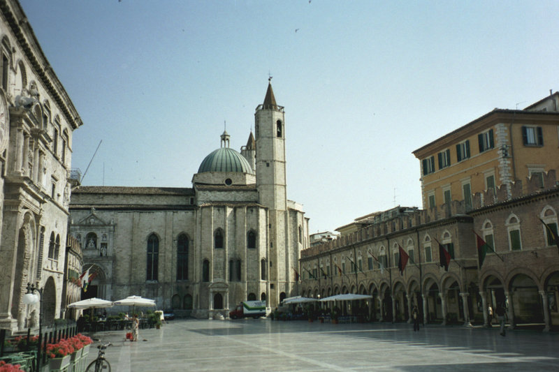

Ascoli Piceno
- Italian comune
Hiking in Ascoli Piceno
Ascoli Piceno, a charming town in the Marche region of Italy, offers a variety of hiking opportunities that allow you to explore its stunning landscapes, rich history, and charming villages. Here are some details about hiking in and around Ascoli Piceno:...
- Country:
- Postal Code: 63100
- Local Dialing Code: 0736
- Licence Plate Code: AP
- Coordinates: 42° 51' 17" N, 13° 34' 31" E
- GPS tracks (wikiloc): [Link]
- AboveSeaLevel: 154 м m
- Area: 158.02 sq km
- Population: 48773
- Web site: [Link]