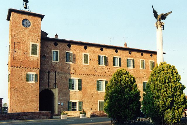
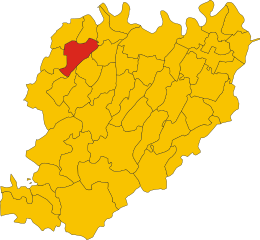
Sarmato (Sarmato)
- Italian comune
Sarmato is a small town located in the Emilia-Romagna region of Italy, and while it may not be a well-known hiking destination, there are opportunities for walking and exploring the surrounding countryside. Here are some suggestions for hiking in and around Sarmato:
-
Local Trails: The area around Sarmato features various trails that are suitable for both beginner and experienced hikers. Look for local paths that meander through farms, vineyards, and picturesque landscapes typical of Emilia-Romagna.
-
Cremona Province: Since Sarmato is located near Cremona, consider exploring hiking routes that lead to nearby sites of interest in the province. For example, hiking trails near Po River can offer scenic views and a taste of nature.
-
Nature Reserves: Check out nearby natural parks or reserves where you can enjoy more organized hiking trails. The Parco del Mincio is a bit further away but offers beautiful landscapes and rich biodiversity.
-
Cultural Hiking: Combine your hiking with cultural experiences by planning routes that pass through historical sites, such as churches, castles, and traditional villages.
-
Hiking Groups: Consider joining local hiking clubs or groups. They can provide guided hikes, which would give you a richer experience, as they often share insights about the local flora, fauna, and history.
-
Best Seasons: The best times to hike in the Emilia-Romagna region are in spring (April to June) and autumn (September to October) when the weather is mild, and the countryside is particularly vibrant.
-
Preparation: As always, make sure to wear appropriate hiking footwear, bring water, snacks, a map or GPS device, and inform someone about your hiking plans before you head out.
While Sarmato may not be a major hiking destination, the surrounding area offers plenty of opportunities for outdoor enthusiasts to explore the beautiful Italian countryside.
- Country:

- Postal Code: 29010
- Local Dialing Code: 0523
- Licence Plate Code: PC
- Coordinates: 45° 4' 0" N, 9° 29' 0" E


- GPS tracks (wikiloc): [Link]
- AboveSeaLevel: 74 м m
- Area: 27.26 sq km
- Population: 2845
- Web site: http://www.comune.sarmato.pc.it/
- Wikipedia en: wiki(en)
- Wikipedia: wiki(it)
- Wikidata storage: Wikidata: Q102985
- Wikipedia Commons Gallery: [Link]
- Wikipedia Commons Category: [Link]
- Freebase ID: [/m/0gkd78]
- GeoNames ID: Alt: [6541024]
- VIAF ID: Alt: [241072537]
- OSM relation ID: [44085]
- WOEID: [723730]
- TGN ID: [7040274]
- UN/LOCODE: [ITARM]
- ISTAT ID: 033042
- Italian cadastre code: I434
Shares border with regions:


Borgonovo Val Tidone
- Italian comune
 Hiking in Borgonovo Val Tidone
Borgonovo Val Tidone is a charming town located in the Piacenza province of Emilia-Romagna in Italy, nestled in the beautiful Tidone Valley. The region is known for its picturesque landscapes, rolling hills, vineyards, and rich history, making it a fantastic destination for hiking enthusiasts....
- Country:

- Postal Code: 29011
- Local Dialing Code: 0523
- Licence Plate Code: PC
- Coordinates: 45° 1' 0" N, 9° 27' 0" E


- GPS tracks (wikiloc): [Link]
- AboveSeaLevel: 114 м m
- Area: 51.22 sq km
- Population: 7952
- Web site: [Link]


Castel San Giovanni
- Italian comune
Castel San Giovanni, located in the Emilia-Romagna region of Italy, offers a range of hiking experiences amid its picturesque landscapes and historical significance. While the town itself may not be a major hiking destination, it acts as a gateway to several natural parks and trails in the surrounding area....
- Country:

- Postal Code: 29015
- Local Dialing Code: 0523
- Licence Plate Code: PC
- Coordinates: 45° 3' 37" N, 9° 26' 16" E


- GPS tracks (wikiloc): [Link]
- AboveSeaLevel: 74 м m
- Area: 44.04 sq km
- Population: 13756
- Web site: [Link]


Rottofreno
- Italian comune
Rottofreno is a small municipality in the province of Piacenza, located in the Emilia-Romagna region of Northern Italy. While it's not as widely known for its hiking routes as larger national parks or mountainous areas, there are still opportunities for scenic walks and hikes in and around Rottofreno....
- Country:

- Postal Code: 29010
- Local Dialing Code: 0523
- Licence Plate Code: PC
- Coordinates: 45° 3' 29" N, 9° 32' 56" E


- GPS tracks (wikiloc): [Link]
- AboveSeaLevel: 65 м m
- Area: 35.17 sq km
- Population: 12220
- Web site: [Link]
Monticelli Pavese
- Italian comune
Monticelli Pavese, located in the Lombardy region of northern Italy, offers a beautiful backdrop for hikers seeking to explore the stunning Italian countryside. The terrain is characterized by rolling hills, vineyards, and charming small villages, making it perfect for both casual walkers and more serious hikers....
- Country:

- Postal Code: 27010
- Local Dialing Code: 0382
- Licence Plate Code: PV
- Coordinates: 45° 7' 0" N, 9° 31' 0" E


- GPS tracks (wikiloc): [Link]
- AboveSeaLevel: 53 м m
- Area: 20.19 sq km
- Population: 737
- Web site: [Link]
Pieve Porto Morone
- Italian comune
Pieve Porto Morone is a small town located in the province of Lodi in the Lombardy region of Italy. While it may not be as widely recognized as popular hiking destinations, it offers a peaceful rural landscape that can be enjoyed by those looking for a more tranquil outdoor experience....
- Country:

- Postal Code: 27017
- Local Dialing Code: 0382
- Licence Plate Code: PV
- Coordinates: 45° 6' 37" N, 9° 26' 13" E


- GPS tracks (wikiloc): [Link]
- AboveSeaLevel: 58 м m
- Area: 16.4 sq km
- Population: 2670
- Web site: [Link]
