Saulxures, Haute-Marne (Saulxures)
- commune in Haute-Marne, France
- Country:

- Postal Code: 52240; 52140
- Coordinates: 47° 57' 15" N, 5° 35' 16" E


- GPS tracks (wikiloc): [Link]
- Area: 8.19 sq km
- Population: 129
- Web site: http://www.saulxures52.fr/
- Wikipedia en: wiki(en)
- Wikipedia: wiki(fr)
- Wikidata storage: Wikidata: Q3474223
- Wikipedia Commons Category: [Link]
- SIREN number: [200031334]
- BnF ID: [15263710d]
- INSEE municipality code: 52465
Shares border with regions:

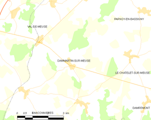
Dammartin-sur-Meuse
- commune in Haute-Marne, France
- Country:
- Postal Code: 52140
- Coordinates: 47° 58' 42" N, 5° 34' 37" E
- GPS tracks (wikiloc): [Link]
- Area: 15.58 sq km
- Population: 201
Vicq
- commune in Haute-Marne, France
- Country:
- Postal Code: 52400
- Coordinates: 47° 55' 26" N, 5° 36' 3" E
- GPS tracks (wikiloc): [Link]
- Area: 13.72 sq km
- Population: 155
Rançonnières
- commune in Haute-Marne, France
- Country:
- Postal Code: 52140
- Coordinates: 47° 56' 10" N, 5° 33' 30" E
- GPS tracks (wikiloc): [Link]
- Area: 8.35 sq km
- Population: 111

Avrecourt
- commune in Haute-Marne, France
- Country:
- Postal Code: 52140, 52240
- Coordinates: 47° 57' 42" N, 5° 32' 16" E
- GPS tracks (wikiloc): [Link]
- Area: 7.64 sq km
- Population: 127


Le Châtelet-sur-Meuse
- commune in Haute-Marne, France
- Country:
- Postal Code: 52400
- Coordinates: 47° 58' 58" N, 5° 37' 39" E
- GPS tracks (wikiloc): [Link]
- AboveSeaLevel: 409 м m
- Area: 21.31 sq km
- Population: 159