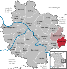
Schöllnach (Schöllnach)
- municipality of Germany
Schöllnach is a beautiful region located in Bavaria, Germany, known for its lush landscapes and scenic hiking trails. Nestled in the heart of the Bavarian Forest, it offers a variety of hiking opportunities suitable for all levels, from beginners to experienced hikers.
Hiking Trails
-
Local Trails: There are many marked trails that showcase the stunning natural beauty of the area, including dense forests, rolling hills, and rivers. Most of these trails vary in length and difficulty, allowing hikers to choose according to their ability and interest.
-
Bavarian Forest National Park: Just a short drive from Schöllnach, this national park features extensive hiking routes, including the famous "Goldsteig" trail, which runs through the park and offers picturesque views of the landscape.
-
Nature and Themed Trails: Some trails are designed with specific themes in mind, such as educational trails that provide insights into local flora and fauna or trails that focus on historical aspects of the region.
Things to Note
-
Trail Markings: Trails in the area are well-marked with signs. It’s essential to follow these markers to stay on designated paths for safety.
-
Terrain: The terrain can vary significantly, from flat and easy paths suitable for families to more challenging hill climbs requiring good hiking boots and experience.
-
Weather Conditions: Always check the weather before heading out, as conditions can change rapidly, particularly in forested or mountainous areas.
-
Packing Essentials: Make sure to pack water, snacks, a first-aid kit, and appropriate clothing layers depending on the weather. A map or GPS device can also be very helpful.
Wildlife and Flora
While hiking, keep an eye out for the diverse wildlife that inhabits the region, including deer, birds, and various plant species. The Bavarian Forest is known for its rich biodiversity, so it’s a wonderful place for nature enthusiasts.
Local Culture
After a day of hiking, you can explore the quaint village of Schöllnach, where you might find local eateries serving traditional Bavarian cuisine, offering a perfect way to unwind and recharge.
Before you head out, always ensure you have a good understanding of your route, and consider sharing your plans with someone for safety. Happy hiking!
- Country:

- Postal Code: 94508
- Local Dialing Code: 09903
- Licence Plate Code: DEG
- Coordinates: 48° 45' 0" N, 13° 10' 0" E


- GPS tracks (wikiloc): [Link]
- AboveSeaLevel: 371 м m
- Area: 39.9 sq km
- Population: 4772
- Web site: https://www.schoellnach.info/
- Wikipedia en: wiki(en)
- Wikipedia: wiki(de)
- Wikidata storage: Wikidata: Q503400
- Wikipedia Commons Category: [Link]
- Freebase ID: [/m/02q102x]
- GeoNames ID: Alt: [6558832]
- VIAF ID: Alt: [234309350]
- OSM relation ID: [959812]
- GND ID: Alt: [4355576-7]
- Bavarikon ID: [ODB_A00001454]
- German municipality key: 09271149
Shares border with regions:


Zenting
- municipality of Germany
Zenting, located in Bavaria, Germany, is surrounded by beautiful landscapes perfect for hiking enthusiasts. Here are some details to consider when planning your hikes in the Zenting area:...
- Country:

- Postal Code: 94579
- Local Dialing Code: 09907
- Licence Plate Code: FRG
- Coordinates: 48° 48' 0" N, 13° 16' 0" E


- GPS tracks (wikiloc): [Link]
- AboveSeaLevel: 450 м m
- Area: 22.26 sq km
- Population: 1170
- Web site: [Link]


Außernzell
- municipality of Germany
Außernzell is a picturesque area located in Bavaria, Germany, known for its beautiful landscapes, rolling hills, and lush greenery. Hiking in this region can be quite rewarding for both beginners and experienced hikers. Here are some highlights and tips for hiking in Außernzell:...
- Country:

- Postal Code: 94532
- Local Dialing Code: 08544; 09903
- Licence Plate Code: DEG
- Coordinates: 48° 43' 0" N, 13° 12' 0" E


- GPS tracks (wikiloc): [Link]
- AboveSeaLevel: 372 м m
- Area: 24.11 sq km
- Population: 1377
- Web site: [Link]


Iggensbach
- municipality of Germany
Iggensbach is a beautiful village located in Bavaria, Germany, known for its picturesque landscapes and outdoor recreational opportunities, including hiking. Here's a brief overview of what you can expect when hiking in and around Iggensbach:...
- Country:

- Postal Code: 94547
- Local Dialing Code: 09903
- Licence Plate Code: DEG
- Coordinates: 48° 44' 0" N, 13° 8' 0" E


- GPS tracks (wikiloc): [Link]
- AboveSeaLevel: 382 м m
- Area: 19.08 sq km
- Population: 2014
- Web site: [Link]


Schöfweg
- municipality of Germany
Schöfweg, located in the Bavarian Forest in Germany, offers beautiful hiking opportunities for outdoor enthusiasts. The region is known for its stunning natural landscapes, dense forests, and diverse wildlife, making it a great destination for hikers of all skill levels....
- Country:

- Postal Code: 94572
- Local Dialing Code: 09908
- Licence Plate Code: FRG
- Coordinates: 48° 50' 20" N, 13° 13' 43" E


- GPS tracks (wikiloc): [Link]
- AboveSeaLevel: 772 м m
- Area: 19.02 sq km
- Population: 1174
- Web site: [Link]


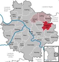
Grattersdorf
- municipality of Germany
Grattersdorf, a small village in Bavaria, Germany, is situated in a scenic area ideal for hiking enthusiasts. Here are some features to consider if you're planning a hike in this picturesque region:...
- Country:

- Postal Code: 94551; 94541
- Local Dialing Code: 09904
- Licence Plate Code: DEG
- Coordinates: 48° 48' 0" N, 13° 9' 0" E


- GPS tracks (wikiloc): [Link]
- AboveSeaLevel: 476 м m
- Area: 25.98 sq km
- Population: 1258
- Web site: [Link]


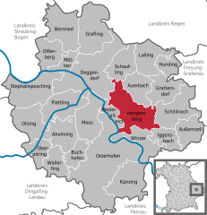
Hengersberg
- human settlement in Germany
Hengersberg is located in the Bavarian Forest region of Germany, which offers a variety of hiking opportunities amid picturesque landscapes and diverse natural surroundings. Here are some highlights you might appreciate while hiking in Hengersberg:...
- Country:

- Postal Code: 94491
- Local Dialing Code: 09901
- Licence Plate Code: DEG
- Coordinates: 48° 47' 0" N, 13° 3' 0" E


- GPS tracks (wikiloc): [Link]
- AboveSeaLevel: 311 м m
- Area: 45.81 sq km
- Population: 7190
- Web site: [Link]

