Scheggia e Pascelupo (Scheggia e Pascelupo)
- Italian comune
 Hiking in Scheggia e Pascelupo
Scheggia e Pascelupo is a picturesque municipality located in the Umbria region of Italy, renowned for its scenic landscapes, lush forests, and rugged hills. It is part of the larger Monte Cucco Regional Park, which offers a diverse array of outdoor activities, including hiking.
Hiking Highlights in Scheggia e Pascelupo:
-
Trail Variety: The area features numerous hiking trails ranging in difficulty from easy walks that are family-friendly to more challenging routes for experienced hikers. You can find trails that lead through historical sites, natural woodlands, and offer stunning views of the surrounding countryside.
-
Monte Cucco: This is one of the most notable peaks in the region and a popular destination for hikers. The trails here can lead you to breathtaking viewpoints and are often well-marked. The ascent can be steep in places, so proper hiking gear and preparation are essential.
-
Wildlife and Nature: Hikers can experience diverse flora and fauna throughout the national park. Depending on the season, you may see various bird species, native plants, and even some wildlife like deer in the less-trafficked areas.
-
Historical and Cultural Sites: While hiking, you may encounter ancient hermitages, ruins of old villages, and other historical landmarks that are scattered throughout the region. These add a cultural element to your hiking experience.
-
Seasonal Hiking: The best time to hike in Scheggia e Pascelupo is in the spring and autumn months when the weather is mild, and the natural beauty is at its peak. Summer hikes can be hot, but early morning or late afternoon treks can still be enjoyable.
-
Local Amenities: Scheggia e Pascelupo has various accommodations and local eateries where you can try regional cuisine. Many hikers enjoy sampling the local delicacies after a long day on the trails.
Preparation Tips:
- Maps and Guides: It's recommended to have a good map of the trails, or you can hire a local guide who knows the area well.
- Gear: Wear sturdy hiking boots, carry enough water, snacks, and a first-aid kit, and be sure to dress in layers as the weather can change.
- Leave No Trace: Be mindful of your impact on the environment. Stick to marked trails, and take all rubbish with you.
Hiking in Scheggia e Pascelupo offers a fantastic blend of natural beauty, adventure, and cultural exploration, making it a wonderful destination for outdoor enthusiasts.
- Country:

- Postal Code: 06027
- Local Dialing Code: 075
- Licence Plate Code: PG
- Coordinates: 43° 24' 13" N, 12° 39' 57" E


- GPS tracks (wikiloc): [Link]
- AboveSeaLevel: 580 м m
- Area: 64.16 sq km
- Population: 1349
- Web site: http://www.comunescheggiaepascelupo.it
- Wikipedia en: wiki(en)
- Wikipedia: wiki(it)
- Wikidata storage: Wikidata: Q20522
- Wikipedia Commons Category: [Link]
- Freebase ID: [/m/0gm2jc]
- GeoNames ID: Alt: [6536358]
- VIAF ID: Alt: [306267724]
- OSM relation ID: [42439]
- GND ID: Alt: [1046480391]
- Digital Atlas of the Roman Empire ID: [22347]
- ISTAT ID: 054046
- Italian cadastre code: I522
Shares border with regions:


Sassoferrato
- Italian comune
Hiking in Sassoferrato
Sassoferrato, located in the Marche region of Italy, is a fantastic destination for hiking enthusiasts. The area is characterized by its stunning natural landscapes, rich history, and diverse trails that cater to a variety of skill levels. Here are some key highlights about hiking in Sassoferrato:...
- Country:
- Postal Code: 60041
- Local Dialing Code: 0732
- Licence Plate Code: AN
- Coordinates: 43° 25' 39" N, 12° 51' 23" E
- GPS tracks (wikiloc): [Link]
- AboveSeaLevel: 386 м m
- Area: 137.23 sq km
- Population: 7104
- Web site: [Link]


Cantiano
- comune of Italy
Hiking in Cantiano
Cantiano is a charming town located in the Marche region of Italy, surrounded by the beautiful landscapes of the Apennine Mountains. It's a great destination for hiking enthusiasts, offering a variety of trails that cater to different skill levels and preferences....
- Country:
- Postal Code: 61044
- Local Dialing Code: 0721
- Licence Plate Code: PU
- Coordinates: 43° 28' 21" N, 12° 37' 43" E
- GPS tracks (wikiloc): [Link]
- AboveSeaLevel: 360 м m
- Area: 83.25 sq km
- Population: 2206
- Web site: [Link]


Costacciaro
- Italian comune
Hiking in Costacciaro
Costacciaro, located in the region of Umbria in Italy, is known for its stunning natural beauty and rich cultural heritage, making it a fantastic destination for hiking enthusiasts. Here’s an overview of what you can expect when hiking in the area:...
- Country:
- Postal Code: 06021
- Local Dialing Code: 075
- Licence Plate Code: PG
- Coordinates: 43° 21' 37" N, 12° 42' 45" E
- GPS tracks (wikiloc): [Link]
- AboveSeaLevel: 567 м m
- Area: 41.06 sq km
- Population: 1172
- Web site: [Link]
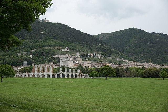

Gubbio
- Italian comune
Hiking in Gubbio
Gubbio, located in the Umbria region of Italy, is surrounded by beautiful landscapes that offer numerous hiking opportunities. Known for its medieval architecture, historical significance, and stunning views, Gubbio provides both charming trails and natural beauty for hikers of all levels. Here are some highlights of hiking in this area:...
- Country:
- Postal Code: 06020; 06024
- Local Dialing Code: 075
- Licence Plate Code: PG
- Coordinates: 43° 21' 6" N, 12° 34' 38" E
- GPS tracks (wikiloc): [Link]
- AboveSeaLevel: 522 м m
- Area: 525.78 sq km
- Population: 31939
- Web site: [Link]


Frontone
- Italian comune
Hiking in Frontone
Frontone, a charming village in the Marche region of Italy, offers a variety of hiking opportunities for enthusiasts of all levels. Nestled in the Apennine Mountains, it boasts stunning landscapes, rich history, and breathtaking views....
- Country:
- Postal Code: 61040
- Local Dialing Code: 0721
- Licence Plate Code: PU
- Coordinates: 43° 30' 52" N, 12° 44' 18" E
- GPS tracks (wikiloc): [Link]
- AboveSeaLevel: 412 м m
- Area: 36.08 sq km
- Population: 1293
- Web site: [Link]


Serra Sant'Abbondio
- Italian comune
Hiking in Serra Sant'Abbondio
Serra Sant'Abbondio is a beautiful area located in the Marche region of Italy, known for its stunning landscapes, rich natural diversity, and charming villages. When it comes to hiking in this region, there are plenty of trails that cater to various skill levels, offering both easy walks and more challenging hikes....
- Country:
- Postal Code: 61040
- Local Dialing Code: 0721
- Licence Plate Code: PU
- Coordinates: 43° 29' 27" N, 12° 46' 14" E
- GPS tracks (wikiloc): [Link]
- AboveSeaLevel: 523 м m
- Area: 32.8 sq km
- Population: 1001
- Web site: [Link]