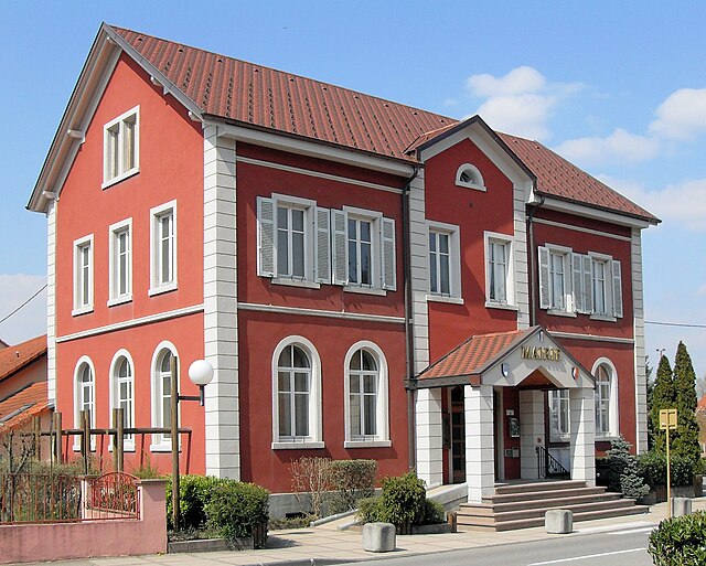
Schlierbach (Schlierbach)

- commune in Haut-Rhin, France
 Hiking in Schlierbach
Schlierbach, located in the Haut-Rhin department in the Alsace region of France, offers beautiful landscapes and a variety of hiking opportunities. Here are some key points about hiking in this charming area:
Natural Features:
- Scenic Views: The region is known for its picturesque landscapes that include rolling hills, vineyards, and the backdrop of the Vosges mountains.
- Flora and Fauna: As you hike, you'll encounter diverse plant life and wildlife, particularly in the more wooded areas. This makes for a great experience for nature lovers.
Hiking Trails:
- Marked Trails: There are numerous well-marked hiking trails that cater to various skill levels. Popular trails often include routes through forests, vineyards, and along the hillsides, providing both easy and moderate options.
- Local Highlights: Look for trails that lead to interesting spots, such as historic sites, viewpoints, and local areas of cultural significance. The nearby town of Mulhouse might also offer connecting trails worth exploring.
Recommendations:
- Preparation: Make sure to wear comfortable hiking shoes and bring water and snacks. The weather can change, so consider bringing a light jacket or rain gear.
- Trail Maps: It’s advisable to carry a map or have a GPS app on your phone to help navigate the trails, especially if you're venturing into less-traveled areas.
- Respect Nature: As with any hiking activity, be mindful of the environment. Stick to marked paths and follow Leave No Trace principles to help preserve the beauty of the landscape.
Local Amenities:
- Accommodations: The area around Schlierbach has various options for lodging, including guesthouses and hotels that can provide a comfortable stay after a day of hiking.
- Dining: Enjoy the local cuisine by stopping at restaurants or bakeries along the way to sample regional specialties, especially Alsatian dishes and wines.
Hiking in Schlierbach can be a tranquil and rewarding experience, combining the serenity of nature with the cultural charm of the Alsace region. If you prepare properly, you can have an enjoyable adventure exploring the scenic trails.
- Country:

- Postal Code: 68440
- Coordinates: 47° 40' 58" N, 7° 24' 30" E


- GPS tracks (wikiloc): [Link]
- Area: 11.8 sq km
- Population: 1205
- Wikipedia en: wiki(en)
- Wikipedia: wiki(fr)
- Wikidata storage: Wikidata: Q635273
- Wikipedia Commons Category: [Link]
- Freebase ID: [/m/03nstv5]
- Freebase ID: [/m/03nstv5]
- GeoNames ID: Alt: [6441610]
- GeoNames ID: Alt: [6441610]
- SIREN number: [216803015]
- SIREN number: [216803015]
- BnF ID: [152720035]
- BnF ID: [152720035]
- INSEE municipality code: 68301
- INSEE municipality code: 68301
Shares border with regions:


Landser
- commune in Haut-Rhin, France
Hiking in Landser
Landser, located in the Haut-Rhin department of France, is a charming town that offers a variety of hiking opportunities. Nestled in the Alsace region, near the foothills of the Vosges Mountains, Landser is surrounded by picturesque landscapes, vineyards, and forests, making it a great destination for outdoor enthusiasts....
- Country:
- Postal Code: 68440
- Coordinates: 47° 41' 6" N, 7° 23' 27" E
- GPS tracks (wikiloc): [Link]
- Area: 3.04 sq km
- Population: 1567


Kœtzingue
- commune in Haut-Rhin, France
Hiking in Kœtzingue
Kœtzingue, a charming commune located in the Alsace region of France, offers picturesque landscapes ideal for hiking enthusiasts. The area is known for its beautiful natural surroundings, including rolling hills, vineyards, and scenic views of the Vosges Mountains....
- Country:
- Postal Code: 68510
- Coordinates: 47° 39' 2" N, 7° 23' 32" E
- GPS tracks (wikiloc): [Link]
- Area: 5.14 sq km
- Population: 607


Geispitzen
- commune in Haut-Rhin, France
Hiking in Geispitzen
Geispitzen, located in the beautiful Bavarian Alps of Germany, offers a variety of hiking opportunities for all experience levels. The region is known for its stunning landscapes, characterized by dramatic mountain peaks, lush valleys, and diverse flora and fauna....
- Country:
- Postal Code: 68510
- Coordinates: 47° 40' 3" N, 7° 25' 15" E
- GPS tracks (wikiloc): [Link]
- Area: 6.02 sq km
- Population: 442

Dietwiller
- commune in Haut-Rhin, France
Hiking in Dietwiller
Dietwiller is a small commune located in the Alsace region of France, near Mulhouse. While it may not be widely known as a hiking destination, there are several opportunities to enjoy nature and explore the local landscape. Here are some points to consider if you're planning a hike in and around Dietwiller:...
- Country:
- Postal Code: 68440
- Coordinates: 47° 41' 29" N, 7° 24' 5" E
- GPS tracks (wikiloc): [Link]
- Area: 11.06 sq km
- Population: 1442
- Web site: [Link]

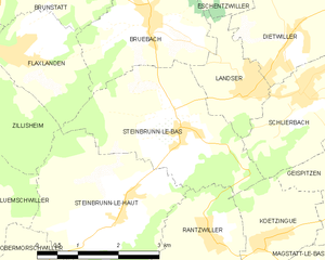
Steinbrunn-le-Bas
- commune in Haut-Rhin, France
Hiking in Steinbrunn-le-Bas
Steinbrunn-le-Bas is a small village located in the Alsace region of France, near the border with Germany. This area is characterized by its scenic countryside, vineyards, and picturesque landscapes, making it a great spot for hiking enthusiasts....
- Country:
- Postal Code: 68440
- Coordinates: 47° 40' 33" N, 7° 22' 2" E
- GPS tracks (wikiloc): [Link]
- Area: 8.58 sq km
- Population: 688


Kembs
- commune in Haut-Rhin, France
Hiking in Kembs
Kembs is located in the Alsace region of France, near the borders of Germany and Switzerland. The area offers a rich blend of natural beauty and cultural heritage, making it an interesting destination for hikers....
- Country:
- Postal Code: 68680
- Coordinates: 47° 41' 20" N, 7° 30' 13" E
- GPS tracks (wikiloc): [Link]
- Area: 16.45 sq km
- Population: 5106
- Web site: [Link]