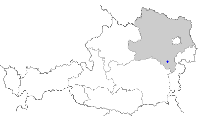
Schrattenbach (Schrattenbach)
- municipality in Austria
 Hiking in Schrattenbach
Schrattenbach is a picturesque area located in Austria, known for its stunning landscapes and hiking opportunities. It’s often appreciated for its natural beauty, featuring a mix of forested areas, open meadows, and rocky terrain.
Here are some key highlights and tips for hiking in Schrattenbach:
Trails
-
Scenic Routes: There are various trails that cater to different skill levels, from easy walks suitable for families to more challenging hikes for experienced trekkers.
-
Marked Paths: Trails are typically well-marked, so it's advisable to follow the signs to ensure you stay on the right path.
-
Breathtaking Views: Many trails offer stunning views of the surrounding mountains and valleys. Look for viewpoints along the routes to take in the scenery.
Best Times to Hike
- Season: Spring and fall are particularly pleasant for hiking, with mild weather and beautiful foliage. Summer can get hot, while winter hikes might require special gear or skills, as snow can cover the trails.
Preparation
-
Gear: Wear appropriate hiking boots and bring layers of clothing, as weather can change quickly in mountainous regions.
-
Water and Snacks: Always carry enough water and some snacks to keep your energy levels up while on the trail.
-
Navigation: A map or a reliable hiking app can be beneficial, especially if you decide to explore lesser-known paths.
Safety
-
Wildlife Caution: Be aware of local wildlife and respect their habitats.
-
Emergency Kit: Carry a small first-aid kit, and let someone know your hiking plans, especially if you're heading out on more solitary paths.
Local Culture
-
Wildlife and Flora: The region boasts rich biodiversity, including various plant species and animal life. Take a moment to appreciate the local ecology.
-
Photography: The stunning landscapes make it a great spot for photography — don’t forget your camera or smartphone!
Hiking in Schrattenbach can be a rewarding experience, offering opportunities for adventure, relaxation, and connection with nature. Make sure to check local resources for specific trail information and conditions before heading out. Happy hiking!
- Country:

- Postal Code: 2733
- Local Dialing Code: 02637
- Licence Plate Code: NK
- Coordinates: 47° 47' 0" N, 16° 0' 0" E


- GPS tracks (wikiloc): [Link]
- AboveSeaLevel: 517 м m
- Area: 10.82 sq km
- Population: 363
- Web site: http://www.schrattenbach.at/
- Wikipedia en: wiki(en)
- Wikipedia: wiki(de)
- Wikidata storage: Wikidata: Q675125
- Wikipedia Commons Gallery: [Link]
- Wikipedia Commons Category: [Link]
- Freebase ID: [/m/02qzlzc]
- GeoNames ID: Alt: [7871869]
- Austrian municipality key: [31834]
Shares border with regions:

Ternitz
- municipality in Austria
Hiking in Ternitz
Ternitz, located in Lower Austria, offers a variety of hiking opportunities that cater to different skill levels. The region is characterized by its beautiful landscapes, rolling hills, and lush forests, providing a scenic backdrop for outdoor enthusiasts....
- Country:
- Postal Code: 2620, 2630, 2631, 2632, 2732, 2733, 2734
- Local Dialing Code: 02630
- Licence Plate Code: NK
- Coordinates: 47° 43' 0" N, 16° 2' 0" E
- GPS tracks (wikiloc): [Link]
- AboveSeaLevel: 393 м m
- Area: 65.35 sq km
- Population: 14632
- Web site: [Link]

Puchberg am Schneeberg
- municipality in Austria
Hiking in Puchberg am Schneeberg
Puchberg am Schneeberg is a charming village located in Lower Austria, surrounded by the scenic Beauty of the Schneeberg massif, which is the highest mountain in the Eastern Alps. Hiking in this area offers a range of experiences, from gentle walks to challenging climbs, making it suitable for hikers of all abilities....
- Country:
- Local Dialing Code: 02636
- Licence Plate Code: NK
- Coordinates: 47° 47' 0" N, 15° 54' 0" E
- GPS tracks (wikiloc): [Link]
- AboveSeaLevel: 585 м m
- Area: 83.17 sq km
- Population: 2683
- Web site: [Link]

Höflein an der Hohen Wand
- town in the district of Neunkirchen in the Austrian state of Lower Austria
Hiking in Höflein an der Hohen Wand
Höflein an der Hohen Wand is a charming village located in Austria, nestled at the foothills of the Hohe Wand mountain range, which offers a variety of hiking opportunities for outdoor enthusiasts. The area is known for its stunning landscapes, with panoramic views, rocky cliffs, and diverse flora and fauna....
- Country:
- Local Dialing Code: 02620
- Licence Plate Code: NK
- Coordinates: 47° 47' 47" N, 16° 1' 42" E
- GPS tracks (wikiloc): [Link]
- AboveSeaLevel: 490 м m
- Area: 8.94 sq km
- Population: 895
- Web site: [Link]
Würflach
- town in the district of Neunkirchen in the Austrian state of Lower Austria
Hiking in Würflach
Würflach is a picturesque village located in Lower Austria, surrounded by beautiful landscapes that are perfect for hiking enthusiasts. The region boasts a variety of trails that cater to different skill levels, making it a great destination for both beginners and experienced hikers....
- Country:
- Postal Code: 2732
- Local Dialing Code: 0 26 20
- Licence Plate Code: NK
- Coordinates: 47° 46' 26" N, 16° 3' 17" E
- GPS tracks (wikiloc): [Link]
- AboveSeaLevel: 430 м m
- Area: 12.33 sq km
- Population: 1592
- Web site: [Link]

Grünbach am Schneeberg
- town in the Neunkirchen district in Lower Austria.
Hiking in Grünbach am Schneeberg
Grünbach am Schneeberg is a picturesque village located in the Lower Austrian region, nestled near the Schneeberg mountain, which is one of the most sought-after hiking destinations in the area. Here’s what you can expect when hiking around Grünbach am Schneeberg:...
- Country:
- Postal Code: 2733
- Local Dialing Code: 02637
- Licence Plate Code: NK
- Coordinates: 47° 47' 53" N, 15° 59' 13" E
- GPS tracks (wikiloc): [Link]
- AboveSeaLevel: 557 м m
- Area: 7.37 sq km
- Population: 1647
- Web site: [Link]