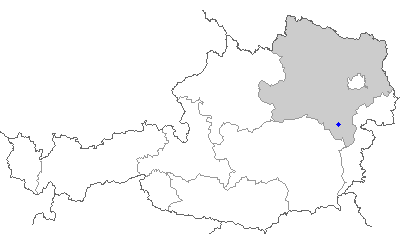
Würflach (Würflach)
- town in the district of Neunkirchen in the Austrian state of Lower Austria
 Hiking in Würflach
Würflach is a picturesque village located in Lower Austria, surrounded by beautiful landscapes that are perfect for hiking enthusiasts. The region boasts a variety of trails that cater to different skill levels, making it a great destination for both beginners and experienced hikers.
Popular Hiking Trails:
-
Würflach Circular Trail (Würflacher Rundwanderweg):
- This is a popular circular route that showcases the natural beauty of the surrounding countryside. The trail typically lasts a few hours and provides stunning views of the rolling hills and forests.
-
Hiking to the Ratzersdorfer Teich:
- This shorter hike will take you to the Ratzersdorfer Teich, a serene pond where you can relax and enjoy nature. The trail is well-maintained and suitable for families.
-
Forest Trails:
- The area is rich with forested paths, ideal for shaded walks and enjoying the tranquility of nature. These trails often have varied terrain, making them exciting for those who enjoy a little challenge.
Tips for Hiking in Würflach:
- Check Weather Conditions: Before heading out, check the weather as conditions can change quickly in mountainous areas.
- Wear Appropriate Gear: Sturdy hiking boots and weather-appropriate clothing are essential.
- Stay Hydrated: Always carry enough water, especially on longer hikes.
- Respect Nature: Stay on marked trails, take your trash with you, and be mindful of local wildlife.
- Local Map: Consider obtaining a local hiking map for the best possible navigation of trails, as they may not all be well marked.
Points of Interest:
- The region is known for its diverse flora and fauna, so keep your eyes peeled for wildlife.
- Historical sites and local culture can be explored during hikes, offering insights into the area’s history and traditions.
Whether you are looking for a leisurely walk or a more challenging hike, Würflach provides excellent opportunities to enjoy the great outdoors in a beautiful and serene setting.
- Country:

- Postal Code: 2732
- Local Dialing Code: 0 26 20
- Licence Plate Code: NK
- Coordinates: 47° 46' 26" N, 16° 3' 17" E


- GPS tracks (wikiloc): [Link]
- AboveSeaLevel: 430 м m
- Area: 12.33 sq km
- Population: 1592
- Web site: http://www.wuerflach.at/
- Wikipedia en: wiki(en)
- Wikipedia: wiki(de)
- Wikidata storage: Wikidata: Q673674
- Wikipedia Commons Category: [Link]
- Freebase ID: [/m/02r45pl]
- GeoNames ID: Alt: [2760806]
- VIAF ID: Alt: [148695720]
- GND ID: Alt: [4802557-4]
- Austrian municipality key: [31847]
Shares border with regions:

Neunkirchen
- town in Lower Austria
Hiking in Neunkirchen
Neunkirchen, a charming town nestled in Lower Austria, offers various hiking opportunities that cater to different skill levels and interests. Here are some key highlights you can expect when hiking in and around Neunkirchen:...
- Country:
- Postal Code: 2620
- Local Dialing Code: 02635
- Licence Plate Code: NK
- Coordinates: 47° 43' 37" N, 16° 4' 54" E
- GPS tracks (wikiloc): [Link]
- AboveSeaLevel: 371 м m
- Area: 20.28 sq km
- Population: 12879
- Web site: [Link]

Willendorf
- municipality in Austria
Hiking in Willendorf
Willendorf, located in Austria, is known primarily for the famous Willendorf Venus figurine, an archaeological artifact, rather than for its hiking trails. However, the broader region of Lower Austria offers various opportunities for hiking enthusiasts. Here are some key points you might find helpful if you're interested in hiking around Willendorf and its surroundings:...
- Country:
- Local Dialing Code: 02620
- Licence Plate Code: NK
- Coordinates: 47° 47' 0" N, 16° 3' 0" E
- GPS tracks (wikiloc): [Link]
- AboveSeaLevel: 389 м m
- Area: 7.32 sq km
- Population: 971
- Web site: [Link]

Ternitz
- municipality in Austria
Hiking in Ternitz
Ternitz, located in Lower Austria, offers a variety of hiking opportunities that cater to different skill levels. The region is characterized by its beautiful landscapes, rolling hills, and lush forests, providing a scenic backdrop for outdoor enthusiasts....
- Country:
- Postal Code: 2620, 2630, 2631, 2632, 2732, 2733, 2734
- Local Dialing Code: 02630
- Licence Plate Code: NK
- Coordinates: 47° 43' 0" N, 16° 2' 0" E
- GPS tracks (wikiloc): [Link]
- AboveSeaLevel: 393 м m
- Area: 65.35 sq km
- Population: 14632
- Web site: [Link]

Höflein an der Hohen Wand
- town in the district of Neunkirchen in the Austrian state of Lower Austria
Hiking in Höflein an der Hohen Wand
Höflein an der Hohen Wand is a charming village located in Austria, nestled at the foothills of the Hohe Wand mountain range, which offers a variety of hiking opportunities for outdoor enthusiasts. The area is known for its stunning landscapes, with panoramic views, rocky cliffs, and diverse flora and fauna....
- Country:
- Local Dialing Code: 02620
- Licence Plate Code: NK
- Coordinates: 47° 47' 47" N, 16° 1' 42" E
- GPS tracks (wikiloc): [Link]
- AboveSeaLevel: 490 м m
- Area: 8.94 sq km
- Population: 895
- Web site: [Link]
Schrattenbach
- municipality in Austria
Hiking in Schrattenbach
Schrattenbach is a picturesque area located in Austria, known for its stunning landscapes and hiking opportunities. It’s often appreciated for its natural beauty, featuring a mix of forested areas, open meadows, and rocky terrain....
- Country:
- Postal Code: 2733
- Local Dialing Code: 02637
- Licence Plate Code: NK
- Coordinates: 47° 47' 0" N, 16° 0' 0" E
- GPS tracks (wikiloc): [Link]
- AboveSeaLevel: 517 м m
- Area: 10.82 sq km
- Population: 363
- Web site: [Link]

Sankt Egyden am Steinfeld
- municipality in Austria
Hiking in Sankt Egyden am Steinfeld
Sankt Egyden am Steinfeld is a charming village located in Austria, surrounded by beautiful landscapes that are ideal for hiking enthusiasts. The area offers a mix of gentle rolling hills, forested paths, and scenic views, making it a great spot for both casual walkers and more experienced hikers....
- Country:
- Postal Code: 2731
- Local Dialing Code: 02638
- Licence Plate Code: NK
- Coordinates: 47° 46' 54" N, 16° 6' 12" E
- GPS tracks (wikiloc): [Link]
- AboveSeaLevel: 350 м m
- Area: 26.17 sq km
- Population: 1924
- Web site: [Link]