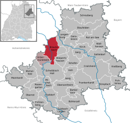
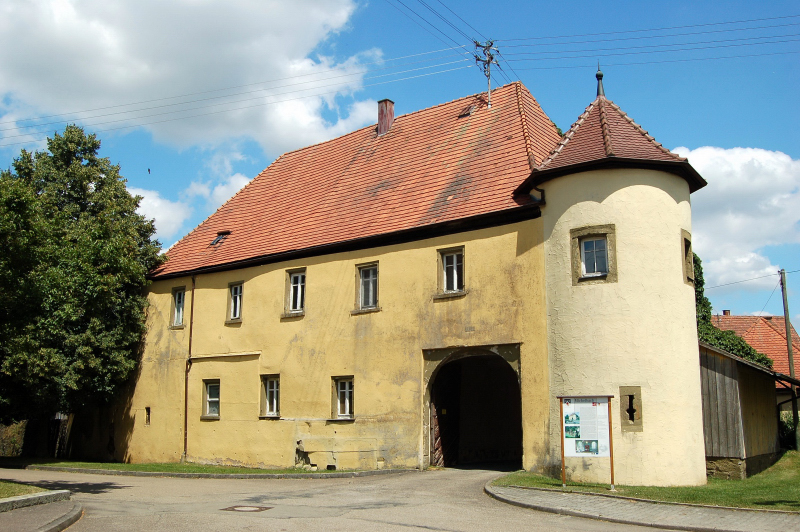
Landkreis Schwäbisch Hall (Landkreis Schwäbisch Hall)

- district of Baden-Württemberg, Germany
 Hiking in Landkreis Schwäbisch Hall
Schwäbisch Hall district, located in Baden-Württemberg, Germany, is known for its picturesque landscapes, charming villages, and rich history, making it a great destination for hiking enthusiasts. Here are some highlights and tips for hiking in the area:
Scenic Trails
-
Kocher-Jagst Trail: This long-distance trail runs along the Kocher and Jagst rivers, offering beautiful views of rolling hills, wooded areas, and fields. It's ideal for both short and multi-day hikes.
-
Local Trails: There are numerous well-marked local trails that range in difficulty, making it suitable for different skill levels. Look out for circular routes that can be completed in a day.
-
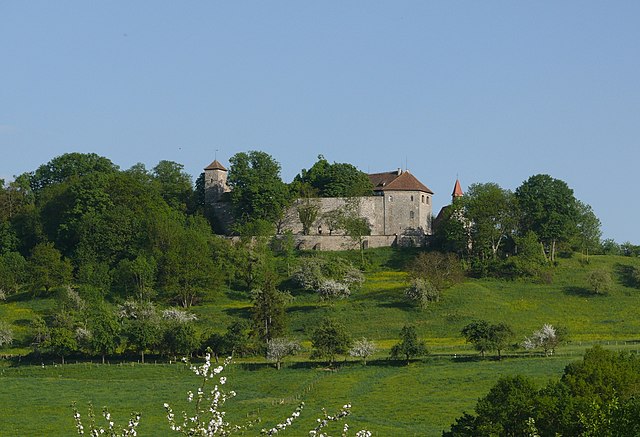
Protected Areas: The district is home to nature parks and reserves, such as the Schwäbisch-Fränkischer Wald, where you can experience diverse flora and fauna along the trails.
Points of Interest
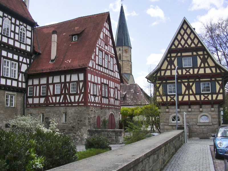
- Historic Towns: Many hikes can take you through charming villages like Schwäbisch Hall, known for its medieval architecture and vibrant culture.
- Cultural Sites: Along the hiking routes, you might encounter historic churches, old castles, and remnants of the region's rich history.
Nature Highlights
- Vibrant Flora and Fauna: Depending on the season, you can enjoy blooming flowers in spring, lush greenery in summer, and stunning fall foliage.
- Observation Points: Certain trails lead to viewpoints that offer breathtaking panoramas of the surrounding countryside, perfect for photography.
Tips for Hiking in Schwäbisch Hall
- Trail Maps: Always carry a map or use a GPS app to stay on track, especially if you're exploring lesser-known paths.
- Seasonal Considerations: Check the trail conditions and weather forecast before you go, as some trails may be less accessible during winter or after heavy rain.
- Appropriate Gear: Wear comfortable hiking shoes, and pack necessary supplies, including water, snacks, a first-aid kit, and weather-appropriate clothing.
Safety and Regulations
- Stay on Marked Trails: To protect the natural environment and ensure your safety, it's important to stick to well-marked paths.
- Respect Nature: Follow Leave No Trace principles to preserve the beauty of the area for future hikers.
Hiking in the Schwäbisch Hall district can be a rewarding experience filled with natural beauty, history, and adventure. Enjoy discovering this hidden gem on your hiking journey!
- Country:

- Capital: Schwäbisch Hall
- Licence Plate Code: SHA
- Coordinates: 49° 9' 0" N, 9° 54' 36" E


- GPS tracks (wikiloc): [Link]
- AboveSeaLevel: 426 м m
- Area: 1484.00 sq km
- Population: 191614
- Web site: http://www.landkreis-schwaebisch-hall.de/
- Wikipedia en: wiki(en)
- Wikipedia: wiki(de)
- Wikidata storage: Wikidata: Q8520
- Wikipedia Commons Category: [Link]
- Freebase ID: [/m/01l626]
- GeoNames ID: Alt: [3220784]
- VIAF ID: Alt: [146684921]
- OSM relation ID: [62582]
- GND ID: Alt: [4053685-3]
- archINFORM location ID: [2604]
- Library of Congress authority ID: Alt: [n88083579]
- NUTS code: [DE11A]
- German district key: 08127
Includes regions:


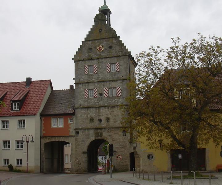
Schwäbisch Hall
- town in Baden-Württemberg, Germany
Hiking in Schwäbisch Hall
Hiking in Schwäbisch Hall, a charming town in the Baden-Württemberg region of Germany, offers a unique blend of natural beauty and cultural heritage. The town is situated near the picturesque Kocher River and surrounded by rolling hills, vineyards, and lush forests, providing plenty of opportunities for outdoor enthusiasts....
- Country:
- Postal Code: 74523
- Local Dialing Code: 0791
- Licence Plate Code: SHA
- Coordinates: 49° 6' 44" N, 9° 44' 15" E
- GPS tracks (wikiloc): [Link]
- AboveSeaLevel: 301 м m
- Area: 104.23 sq km
- Population: 37452
- Web site: [Link]


Crailsheim
- town in Germany
Hiking in Crailsheim
Crailsheim, located in the state of Baden-Württemberg, Germany, is surrounded by beautiful landscapes that provide plenty of opportunities for hiking enthusiasts. The region boasts a mix of rolling hills, forested areas, and scenic views, making it a pleasant destination for outdoor activities....
- Country:
- Postal Code: 74564
- Local Dialing Code: 07904; 07954; 07951
- Coordinates: 49° 8' 5" N, 10° 4' 14" E
- GPS tracks (wikiloc): [Link]
- AboveSeaLevel: 413 м m
- Area: 109.08 sq km
- Population: 33209
- Web site: [Link]

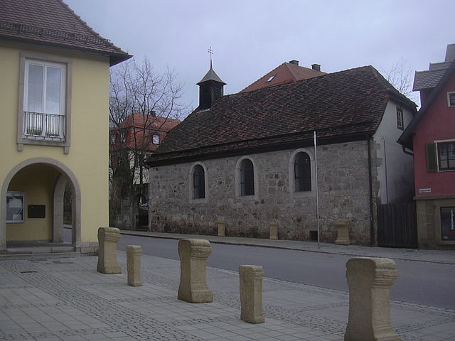
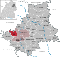
Braunsbach
- municipality in Germany
Hiking in Braunsbach
Braunsbach is a picturesque town located in the Baden-Württemberg region of Germany, known for its beautiful landscapes and outdoor opportunities, making it a great destination for hiking enthusiasts. The area's scenic routes offer a mix of nature, culture, and history. Here are a few highlights and tips for hiking in Braunsbach:...
- Country:
- Postal Code: 74542
- Local Dialing Code: 07906
- Licence Plate Code: SHA
- Coordinates: 49° 11' 57" N, 9° 47' 26" E
- GPS tracks (wikiloc): [Link]
- AboveSeaLevel: 248 м m
- Area: 52.85 sq km
- Population: 2455
- Web site: [Link]

Kreßberg
- municipality in Germany
Hiking in Kreßberg
Kreßberg, located in the scenic region of Baden-Württemberg, Germany, offers a variety of hiking opportunities set amidst picturesque landscapes, forests, and charming villages. Here’s an overview of what you can expect when hiking in this area:...
- Country:
- Postal Code: 74594
- Local Dialing Code: 07957
- Licence Plate Code: SHA
- Coordinates: 49° 7' 52" N, 10° 11' 3" E
- GPS tracks (wikiloc): [Link]
- AboveSeaLevel: 470 м m
- Area: 48.45 sq km
- Population: 3871
- Web site: [Link]


Bühlerzell
- municipality in Germany
Hiking in Bühlerzell
Bühlerzell, located in Baden-Württemberg, Germany, is a charming area that offers various hiking opportunities amidst beautiful landscapes, forests, and rolling hills. Here are some insights that could enhance your hiking experience there:...
- Country:
- Postal Code: 74426
- Local Dialing Code: 07974
- Licence Plate Code: SHA
- Coordinates: 49° 0' 12" N, 9° 55' 14" E
- GPS tracks (wikiloc): [Link]
- AboveSeaLevel: 393 м m
- Area: 49.31 sq km
- Population: 2017
- Web site: [Link]


Michelbach an der Bilz
- municipality in Germany
Hiking in Michelbach an der Bilz
Michelbach an der Bilz is a charming village located in the Baden-Württemberg region of Germany, surrounded by beautiful landscapes that are perfect for hiking enthusiasts. The area is known for its picturesque scenery, including rolling hills, forests, and serene fields, making it an ideal destination for both novice and experienced hikers....
- Country:
- Postal Code: 74544
- Local Dialing Code: 0791
- Licence Plate Code: SHA
- Coordinates: 49° 4' 13" N, 9° 45' 45" E
- GPS tracks (wikiloc): [Link]
- AboveSeaLevel: 364 м m
- Area: 17.69 sq km
- Population: 3389
- Web site: [Link]

Mainhardt
- municipality in Germany
Hiking in Mainhardt
Mainhardt, located in the beautiful region of Baden-Württemberg, Germany, offers a variety of hiking opportunities that cater to different skill levels. Nestled within the scenic landscapes of the Swabian Forest, the area is known for its rolling hills, lush forests, and picturesque vineyards. Here are some highlights for hiking in Mainhardt:...
- Country:
- Postal Code: 74535
- Local Dialing Code: 07903
- Licence Plate Code: SHA
- Coordinates: 49° 5' 0" N, 9° 33' 0" E
- GPS tracks (wikiloc): [Link]
- AboveSeaLevel: 471 м m
- Area: 58.69 sq km
- Population: 5864
- Web site: [Link]

Michelfeld
- municipality in Germany
Hiking in Michelfeld
Michelfeld, located in the heart of Germany, offers various hiking opportunities set against a picturesque backdrop of rolling hills, forests, and scenic landscapes. Here’s an overview of what you can expect when hiking in and around Michelfeld:...
- Country:
- Postal Code: 74545
- Local Dialing Code: 0791
- Licence Plate Code: SHA
- Coordinates: 49° 5' 51" N, 9° 40' 43" E
- GPS tracks (wikiloc): [Link]
- AboveSeaLevel: 362 м m
- Area: 35.22 sq km
- Population: 3690
- Web site: [Link]


Sulzbach-Laufen
- municipality in Germany
Hiking in Sulzbach-Laufen
Sulzbach-Laufen, located in the scenic region of Baden-Württemberg, Germany, offers a variety of hiking opportunities for outdoor enthusiasts. The area is characterized by its picturesque landscapes, including rolling hills, lush forests, and charming villages, making it ideal for both casual walkers and experienced hikers....
- Country:
- Postal Code: 74429
- Local Dialing Code: 07976
- Licence Plate Code: SHA
- Coordinates: 48° 57' 48" N, 9° 50' 43" E
- GPS tracks (wikiloc): [Link]
- AboveSeaLevel: 420 м m
- Area: 43.95 sq km
- Population: 2514
- Web site: [Link]


Fichtenau
- municipality in Germany
Hiking in Fichtenau
Fichtenau, located in the beautiful region of Baden-Württemberg, Germany, offers a serene and picturesque hiking experience. The landscape is characterized by rolling hills, lush forests, and scenic meadows, making it perfect for both casual walkers and more experienced hikers. Here are some key aspects to consider when hiking in Fichtenau:...
- Country:
- Postal Code: 74579
- Local Dialing Code: 07962
- Licence Plate Code: SHA
- Coordinates: 49° 4' 10" N, 10° 12' 47" E
- GPS tracks (wikiloc): [Link]
- AboveSeaLevel: 528 м m
- Area: 31.28 sq km
- Population: 4538
- Web site: [Link]


Vellberg
- municipality in Germany
Hiking in Vellberg
Vellberg, a charming town located in the state of Baden-Württemberg, Germany, is nestled in the scenic landscapes of the Swabian Jura. The region is known for its picturesque hiking trails, historical significance, and natural beauty....
- Country:
- Postal Code: 74541
- Local Dialing Code: 07907
- Licence Plate Code: SHA
- Coordinates: 49° 5' 16" N, 9° 52' 54" E
- GPS tracks (wikiloc): [Link]
- AboveSeaLevel: 375 м m
- Area: 31.89 sq km
- Population: 4390
- Web site: [Link]

Ilshofen
- municipality in Germany
Hiking in Ilshofen
Ilshofen is a charming town located in the Baden-Württemberg region of Germany. While it might not be as well-known for hiking as some other areas, it offers some lovely opportunities to enjoy the outdoors and explore the surrounding countryside. Here are some details to consider if you plan to hike in and around Ilshofen:...
- Country:
- Postal Code: 74532
- Local Dialing Code: 07904
- Licence Plate Code: SHA
- Coordinates: 49° 10' 13" N, 9° 55' 13" E
- GPS tracks (wikiloc): [Link]
- AboveSeaLevel: 441 м m
- Area: 54.87 sq km
- Population: 6259
- Web site: [Link]


Stimpfach
- municipality in Germany
Hiking in Stimpfach
Stimpfach is a small municipality located in the state of Baden-Württemberg, Germany. While it may not be as widely recognized as a hiking destination compared to some larger areas, it offers beautiful landscapes and a peaceful environment for outdoor enthusiasts. Here are some tips and information for hiking in and around Stimpfach:...
- Country:
- Postal Code: 74597
- Local Dialing Code: 07967
- Licence Plate Code: SHA
- Coordinates: 49° 3' 44" N, 10° 5' 24" E
- GPS tracks (wikiloc): [Link]
- AboveSeaLevel: 450 м m
- Area: 33.35 sq km
- Population: 2991
- Web site: [Link]


Wolpertshausen
- municipality in Germany
Hiking in Wolpertshausen
Wolpertshausen is a small village located in the Baden-Württemberg region of Germany, surrounded by picturesque landscapes that make it a great destination for hiking enthusiasts. The area is known for its rolling hills, scenic forests, and charming countryside....
- Country:
- Postal Code: 74549
- Local Dialing Code: 07904
- Licence Plate Code: SHA
- Coordinates: 49° 10' 3" N, 9° 50' 41" E
- GPS tracks (wikiloc): [Link]
- AboveSeaLevel: 439 м m
- Area: 27.42 sq km
- Population: 2066
- Web site: [Link]

Bühlertann
- municipality in Germany
Hiking in Bühlertann
Bühlertann is a charming village located in the state of Baden-Württemberg, Germany. This area offers beautiful landscapes, lush forests, and inviting trails that appeal to hikers of various skill levels. Here are some highlights and tips about hiking in Bühlertann:...
- Country:
- Postal Code: 74424
- Local Dialing Code: 07974; 07973
- Licence Plate Code: SHA
- Coordinates: 49° 2' 28" N, 9° 54' 31" E
- GPS tracks (wikiloc): [Link]
- AboveSeaLevel: 376 м m
- Area: 23.59 sq km
- Population: 3057
- Web site: [Link]

Gaildorf
- municipality in Germany
Hiking in Gaildorf
Gaildorf, located in the state of Baden-Württemberg, Germany, offers a variety of hiking opportunities that cater to both novice and experienced hikers. The region is characterized by its scenic landscapes, with rolling hills, lush forests, and charming rural areas....
- Country:
- Postal Code: 74405
- Local Dialing Code: 07971
- Coordinates: 49° 0' 0" N, 9° 46' 0" E
- GPS tracks (wikiloc): [Link]
- AboveSeaLevel: 329 м m
- Area: 62.57 sq km
- Population: 12084
- Web site: [Link]

Rot am See
- municipality in Germany
Hiking in Rot am See
Rot am See, located in the beautiful Baden-Württemberg region of Germany, is a great destination for hiking enthusiasts. The area is characterized by its picturesque landscapes, rolling hills, and meandering trails, offering a range of hiking experiences suitable for different skill levels....
- Country:
- Postal Code: 74585
- Local Dialing Code: 07955
- Licence Plate Code: SHA
- Coordinates: 49° 15' 3" N, 10° 1' 24" E
- GPS tracks (wikiloc): [Link]
- AboveSeaLevel: 419 м m
- Area: 74.81 sq km
- Population: 5305
- Web site: [Link]


Satteldorf
- municipality in Germany
Hiking in Satteldorf
Satteldorf is a small town located in the Baden-Württemberg region of Germany. While it may not be a widely recognized hiking destination, the surrounding areas offer a variety of outdoor activities, including hiking trails that allow you to explore the beautiful landscapes of southern Germany. Here are some things to consider if you plan to hike in and around Satteldorf:...
- Country:
- Postal Code: 74589
- Local Dialing Code: 07951
- Licence Plate Code: SHA
- Coordinates: 49° 10' 5" N, 10° 4' 51" E
- GPS tracks (wikiloc): [Link]
- AboveSeaLevel: 421 м m
- Area: 46.21 sq km
- Population: 5251
- Web site: [Link]

Wallhausen
- municipality in Baden-Württemberg, Germany
Hiking in Wallhausen
Wallhausen, located in Baden-Württemberg, Germany, offers a serene environment for hiking enthusiasts. Nestled near the Schwäbisch-Fränkischer Wald Nature Park, Wallhausen provides a mix of well-marked trails that wind through picturesque landscapes, forests, and hills....
- Country:
- Postal Code: 74599
- Local Dialing Code: 07955
- Licence Plate Code: SHA
- Coordinates: 49° 12' 39" N, 10° 3' 51" E
- GPS tracks (wikiloc): [Link]
- AboveSeaLevel: 469 м m
- Area: 25.47 sq km
- Population: 3564
- Web site: [Link]


Kirchberg an der Jagst
- municipality in Germany
Hiking in Kirchberg an der Jagst
Kirchberg an der Jagst is a picturesque village located in the Baden-Württemberg region of Germany. It is situated along the Jagst River and surrounded by beautiful landscapes, making it an excellent destination for hiking enthusiasts. Here are some highlights and tips for hiking in this area:...
- Country:
- Postal Code: 74592
- Local Dialing Code: 07954
- Licence Plate Code: SHA
- Coordinates: 49° 12' 14" N, 9° 58' 53" E
- GPS tracks (wikiloc): [Link]
- AboveSeaLevel: 384 м m
- Area: 40.93 sq km
- Population: 4352
- Web site: [Link]


Langenburg
- municipality in Germany
Hiking in Langenburg
Langenburg, located in the German state of Baden-Württemberg, is known for its scenic landscapes and charming surroundings, making it a wonderful destination for hiking enthusiasts. The area is characterized by rolling hills, dense forests, and picturesque views, often featuring vineyards and agricultural land....
- Country:
- Postal Code: 74595
- Local Dialing Code: 07905
- Coordinates: 49° 15' 12" N, 9° 50' 55" E
- GPS tracks (wikiloc): [Link]
- AboveSeaLevel: 439 м m
- Area: 31.4 sq km
- Population: 1735
- Web site: [Link]


Obersontheim
- municipality in Germany
Hiking in Obersontheim
Obersontheim, a small village located in the Swabian region of Germany, offers some picturesque hiking opportunities, particularly for nature lovers and those looking to explore scenic landscapes. Here are some key points to consider when hiking in and around Obersontheim:...
- Country:
- Postal Code: 74423
- Local Dialing Code: 07973
- Licence Plate Code: SHA
- Coordinates: 49° 3' 24" N, 9° 53' 57" E
- GPS tracks (wikiloc): [Link]
- AboveSeaLevel: 371 м m
- Area: 54.82 sq km
- Population: 4950
- Web site: [Link]


Blaufelden
- municipality in Germany
Hiking in Blaufelden
Blaufelden is a charming municipality located in Baden-Württemberg, Germany, and it offers a variety of hiking opportunities for outdoor enthusiasts. The area is characterized by picturesque landscapes, including rolling hills, lush forests, and scenic farmland, making it a great destination for nature lovers....
- Country:
- Postal Code: 74572
- Local Dialing Code: 07936; 07953
- Licence Plate Code: SHA
- Coordinates: 49° 17' 52" N, 9° 58' 26" E
- GPS tracks (wikiloc): [Link]
- AboveSeaLevel: 462 м m
- Area: 90.18 sq km
- Population: 5174
- Web site: [Link]


Schrozberg
- municipality in Germany
Hiking in Schrozberg
Schrozberg is a small town located in the Hohenlohe region of Germany, and it offers some beautiful hiking opportunities surrounded by picturesque landscapes, forests, and rolling hills. Here are some key points regarding hiking in and around Schrozberg:...
- Country:
- Postal Code: 74575
- Local Dialing Code: 07935
- Licence Plate Code: SHA
- Coordinates: 49° 20' 40" N, 9° 58' 50" E
- GPS tracks (wikiloc): [Link]
- AboveSeaLevel: 455 м m
- Area: 105.21 sq km
- Population: 5669
- Web site: [Link]


Untermünkheim
- municipality in Germany
Hiking in Untermünkheim
Untermünkheim is a quaint town located in the Baden-Württemberg region of Germany. It is surrounded by beautiful landscapes, making it an appealing destination for hiking enthusiasts. Here are some highlights and tips for hiking in and around Untermünkheim:...
- Country:
- Postal Code: 74547
- Local Dialing Code: 0791
- Licence Plate Code: SHA
- Coordinates: 49° 9' 9" N, 9° 44' 2" E
- GPS tracks (wikiloc): [Link]
- AboveSeaLevel: 261 м m
- Area: 27.14 sq km
- Population: 2887
- Web site: [Link]


Frankenhardt
- municipality in Germany
Hiking in Frankenhardt
Frankenhardt, located in Baden-Württemberg, Germany, offers a picturesque setting for hiking enthusiasts. The region is characterized by gentle hills, lush forests, and charming villages, making it an ideal destination for both casual walkers and more experienced hikers....
- Country:
- Postal Code: 74586
- Local Dialing Code: 07959
- Licence Plate Code: SHA
- Coordinates: 49° 4' 54" N, 9° 58' 42" E
- GPS tracks (wikiloc): [Link]
- AboveSeaLevel: 455 м m
- Area: 69.87 sq km
- Population: 4821
- Web site: [Link]


Gerabronn
- town in the District of Schwäbisch Hall, Baden-Württemberg, Germany
Hiking in Gerabronn
Gerabronn is a charming town located in the Baden-Württemberg region of Germany, known for its lovely landscapes and picturesque hiking opportunities. Nestled in the Schwäbisch-Fränkischer Wald Nature Park, the area offers a variety of trails suitable for different skill levels, making it a perfect destination for both novice and experienced hikers....
- Country:
- Postal Code: 74582
- Local Dialing Code: 07952
- Licence Plate Code: SHA
- Coordinates: 49° 14' 58" N, 9° 55' 13" E
- GPS tracks (wikiloc): [Link]
- AboveSeaLevel: 460 м m
- Area: 40.39 sq km
- Population: 4223
- Web site: [Link]


Fichtenberg
- municipality in Germany
Hiking in Fichtenberg
Fichtenberg is a small municipality in the state of Baden-Württemberg, Germany, surrounded by picturesque landscapes ideal for hiking. The area is characterized by its dense forests, rolling hills, and charming countryside, making it a great destination for outdoor enthusiasts....
- Country:
- Postal Code: 74427
- Local Dialing Code: 07971
- Licence Plate Code: SHA
- Coordinates: 48° 59' 14" N, 9° 42' 44" E
- GPS tracks (wikiloc): [Link]
- AboveSeaLevel: 345 м m
- Area: 24.19 sq km
- Population: 2822
- Web site: [Link]


Oberrot
- municipality in Germany
Hiking in Oberrot
Oberrot, a small town located in Baden-Württemberg, Germany, offers a range of hiking opportunities for both beginners and experienced hikers. The surrounding region is characterized by beautiful landscapes, lush forests, and rolling hills, making it an ideal spot for outdoor enthusiasts....
- Country:
- Postal Code: 74420
- Local Dialing Code: 07977
- Licence Plate Code: SHA
- Coordinates: 49° 0' 52" N, 9° 40' 2" E
- GPS tracks (wikiloc): [Link]
- AboveSeaLevel: 358 м m
- Area: 37.92 sq km
- Population: 3613
- Web site: [Link]
Shares border with regions:

Ansbach
- district in Bavaria, Germany
Hiking in Ansbach
Ansbach district, located in the region of Bavaria, Germany, offers a variety of hiking opportunities suitable for different skill levels. The region is characterized by its picturesque landscapes, including rolling hills, forests, and historical sites, making it a great destination for outdoor enthusiasts....
- Country:
- Capital: Ansbach
- Licence Plate Code: ROT; FEU; DKB; AN
- Coordinates: 49° 19' 48" N, 10° 30' 0" E
- GPS tracks (wikiloc): [Link]
- AboveSeaLevel: 426 м m
- Area: 1972.00 sq km
- Population: 157632
- Web site: [Link]