Ansbach (Landkreis Ansbach)
- district in Bavaria, Germany
Ansbach district, located in the region of Bavaria, Germany, offers a variety of hiking opportunities suitable for different skill levels. The region is characterized by its picturesque landscapes, including rolling hills, forests, and historical sites, making it a great destination for outdoor enthusiasts.
Hiking Trails
-
Fränkischer Schweiz (Franconian Switzerland): Not far from Ansbach, this area provides numerous trails with stunning rock formations, limestone cliffs, and charming villages. The trails vary in difficulty and can lead you to some breathtaking viewpoints.
-
Nature Reserves: The district is home to several nature reserves, including the Aisch Valley, where you can hike interspersed with opportunities to observe local wildlife and enjoy serene natural landscapes.
-
Historical Routes: There are also thematic hiking trails that connect historical sites, castles, and ancient towns. Walking these routes allows hikers to immerse themselves in the cultural heritage of the region.
-
Local Trails: The Ansbach district features a network of local trails that are well-marked and maintained. You can find short educational hikes suitable for families, as well as longer, more challenging routes for avid hikers.
Tips for Hiking in Ansbach District
- Check Trail Conditions: Before heading out, check local resources or trail websites for updates on conditions, particularly after heavy rain or storms which may affect trail accessibility.
- Weather Preparedness: Bavaria's weather can be unpredictable, so check the forecast and dress in layers. Bring waterproof gear if rain is expected.
- Maps and Navigation: While trails are generally well-marked, having a detailed map or GPS device can enhance your hiking experience, especially in less urban areas.
- Stay Hydrated: Always carry enough water and snacks, especially on longer hikes.
- Respect Nature: Follow Leave No Trace principles, respecting wildlife and natural habitats.
Local Attractions
Aside from hiking, be sure to explore the charming town of Ansbach itself, which is known for its historic architecture, including the Ansbach Residence and the Baroque Gardens. Consider taking time to visit local eateries to experience Bavarian cuisine after a day on the trails.
Overall, hiking in the Ansbach district is a rewarding experience surrounded by nature and rich cultural history. Whether you're looking for a leisurely walk or an invigorating hike, you'll find plenty of options to suit your needs.
- Country:

- Capital: Ansbach
- Licence Plate Code: ROT; FEU; DKB; AN
- Coordinates: 49° 19' 48" N, 10° 30' 0" E


- GPS tracks (wikiloc): [Link]
- AboveSeaLevel: 426 м m
- Area: 1972.00 sq km
- Population: 157632
- Web site: http://www.landkreis-ansbach.de
- Wikipedia en: wiki(en)
- Wikipedia: wiki(de)
- Wikidata storage: Wikidata: Q10454
- Wikipedia Commons Category: [Link]
- Wikipedia Commons Maps Category: [Link]
- Freebase ID: [/m/01bpk_]
- GeoNames ID: Alt: [3220796]
- VIAF ID: Alt: [136124721]
- OSM relation ID: [62609]
- GND ID: Alt: [4002171-3]
- archINFORM location ID: [3923]
- Library of Congress authority ID: Alt: [n86045984]
- Quora topic ID: [Ansbach]
- TGN ID: [7077322]
- Bavarikon ID: [ODB_A00000012]
- ISNI: Alt: [0000 0004 0480 3871]
- NUTS code: [DE256]
- BabelNet ID: [01220302n]
- German district key: 09571
Includes regions:


Wittelshofen
- municipality of Germany
Wittelshofen is a small village located in Bavaria, Germany, known for its picturesque countryside and beautiful natural surroundings. While it may not be as widely recognized as larger hiking destinations, it offers some charming hiking opportunities for those looking to explore the Bavarian landscape....
- Country:

- Postal Code: 91749
- Local Dialing Code: 09854
- Licence Plate Code: AN
- Coordinates: 49° 4' 0" N, 10° 28' 0" E


- GPS tracks (wikiloc): [Link]
- AboveSeaLevel: 430 м m
- Area: 24.23 sq km
- Population: 1261
- Web site: [Link]


Rothenburg ob der Tauber
- town in Germany
 Hiking in Rothenburg ob der Tauber
Rothenburg ob der Tauber, located in Bavaria, Germany, is best known for its well-preserved medieval architecture and picturesque scenery. While the town itself is charming for walking, there are also various hiking opportunities in the surrounding area that offer beautiful views and a chance to experience the natural landscape....
- Country:

- Postal Code: 91541
- Local Dialing Code: 09861
- Coordinates: 49° 22' 38" N, 10° 10' 44" E


- GPS tracks (wikiloc): [Link]
- AboveSeaLevel: 430 м m
- Area: 41.45 sq km
- Population: 11025
- Web site: [Link]


Burk
- municipality of Germany
Hiking in Burk, Bavaria, offers stunning scenery and a unique experience in the heart of the German countryside. Nestled within the larger region of Bavaria, Burk is known for its picturesque landscapes, including rolling hills, dense forests, and charming villages. Here are some highlights and tips for hiking in this area:...
- Country:

- Postal Code: 91596
- Local Dialing Code: 09822
- Licence Plate Code: AN
- Coordinates: 49° 7' 0" N, 10° 28' 0" E


- GPS tracks (wikiloc): [Link]
- AboveSeaLevel: 466 м m
- Area: 14.10 sq km
- Population: 1004
- Web site: [Link]


Mönchsroth
- municipality of Germany
Mönchsroth is a charming village located in the Ansbach district of Bavaria, Germany. While it's not a widely known hiking destination, it is surrounded by scenic landscapes that provide opportunities for enjoyable outdoor activities. Here are some highlights and tips for hiking in and around Mönchsroth:...
- Country:

- Postal Code: 91614
- Local Dialing Code: 09853
- Licence Plate Code: AN
- Coordinates: 49° 1' 11" N, 10° 21' 33" E


- GPS tracks (wikiloc): [Link]
- AboveSeaLevel: 441 м m
- Area: 11.92 sq km
- Population: 1286
- Web site: [Link]
Unterer Wald
- unincorporated in Germany
Unterer Wald is a beautiful area known for its scenic landscapes and hiking opportunities. Here are some details that may enhance your hiking experience:...
- Country:

- Coordinates: 49° 8' 21" N, 10° 38' 31" E


- GPS tracks (wikiloc): [Link]


Unterschwaningen
- municipality in Bavaria, Germany
Unterschwaningen is a charming village located in Bavaria, Germany, offering beautiful natural landscapes that are perfect for hiking enthusiasts. The region is characterized by rolling hills, lush forests, and picturesque meadows, making it an attractive destination for those looking to explore the outdoors....
- Country:

- Postal Code: 91743
- Local Dialing Code: 09836
- Licence Plate Code: AN
- Coordinates: 49° 4' 0" N, 10° 37' 0" E


- GPS tracks (wikiloc): [Link]
- AboveSeaLevel: 440 м m
- Area: 18.57 sq km
- Population: 858
- Web site: [Link]
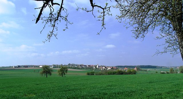

Adelshofen, Middle Franconia
- municipality of Germany
 Hiking in Adelshofen, Middle Franconia
Adelshofen is a charming small village located in Middle Franconia, Germany. While it may not be a well-known hiking destination, the surrounding region offers beautiful landscapes and trails that hiking enthusiasts can enjoy. Here are some aspects of hiking in and around Adelshofen:...
- Country:

- Postal Code: 91587
- Local Dialing Code: 09865
- Licence Plate Code: AN
- Coordinates: 49° 26' 0" N, 10° 10' 0" E


- GPS tracks (wikiloc): [Link]
- AboveSeaLevel: 429 м m
- Area: 27.18 sq km
- Population: 980
- Web site: [Link]


Leutershausen
- town in Germany
Leutershausen is a charming municipality located in the district of Ansbach in Bavaria, Germany. While it may not be as famous as some of the larger hiking destinations in the region, it offers a unique rural landscape and several trails that can provide a great hiking experience. Here are some highlights:...
- Country:

- Postal Code: 91578
- Local Dialing Code: 09823
- Licence Plate Code: AN
- Coordinates: 49° 17' 0" N, 10° 25' 0" E


- GPS tracks (wikiloc): [Link]
- AboveSeaLevel: 426 м m
- Area: 84.11 sq km
- Population: 5052
- Web site: [Link]

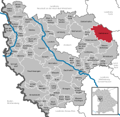
Heilsbronn
- town in Germany
Heilsbronn, located in the region of Middle Franconia in Bavaria, Germany, offers a number of scenic hiking opportunities for outdoor enthusiasts. The area is known for its rolling hills, picturesque countryside, and historic sites, making it a great destination for both casual walkers and more experienced hikers. Here are some key points to consider when hiking in Heilsbronn:...
- Country:

- Postal Code: 91560
- Local Dialing Code: 09872
- Licence Plate Code: AN
- Coordinates: 49° 20' 19" N, 10° 47' 27" E


- GPS tracks (wikiloc): [Link]
- AboveSeaLevel: 400 м m
- Area: 62.23 sq km
- Population: 7409
- Web site: [Link]


Dinkelsbühl
- town in Germany
Dinkelsbühl is a charming medieval town located in the Bavarian region of Germany, known for its well-preserved historical architecture and vibrant culture. While it's not as famous for hiking as some more mountainous regions of Germany, there are still some lovely trails and outdoor activities in and around Dinkelsbühl for hikers to enjoy....
- Country:

- Postal Code: 91550
- Local Dialing Code: 09851
- Coordinates: 49° 4' 15" N, 10° 19' 10" E


- GPS tracks (wikiloc): [Link]
- AboveSeaLevel: 442 м m
- Area: 75.19 sq km
- Population: 11389
- Web site: [Link]


Feuchtwangen
- town in Germany
Feuchtwangen, located in Bavaria, Germany, is surrounded by beautiful landscapes that are perfect for hiking enthusiasts. The area is rich in natural beauty, featuring picturesque woodlands, open fields, and charming rural scenery. Here are some highlights for hiking in and around Feuchtwangen:...
- Country:

- Postal Code: 91555
- Local Dialing Code: 09852
- Coordinates: 49° 10' 0" N, 10° 19' 0" E


- GPS tracks (wikiloc): [Link]
- AboveSeaLevel: 497 м m
- Area: 137.40 sq km
- Population: 10603
- Web site: [Link]

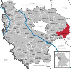
Windsbach
- town in Germany
Windsbach is a charming town located in Bavaria, Germany, known for its beautiful landscapes and opportunities for outdoor activities, including hiking. The region offers a variety of trails catering to different skill levels, from leisurely walks to more challenging hikes. Here’s what you can expect when hiking in and around Windsbach:...
- Country:

- Postal Code: 91575
- Local Dialing Code: 09871
- Licence Plate Code: AN
- Coordinates: 49° 15' 0" N, 10° 49' 0" E


- GPS tracks (wikiloc): [Link]
- AboveSeaLevel: 383 м m
- Area: 68.17 sq km
- Population: 4973
- Web site: [Link]


Wolframs-Eschenbach
- town in Germany
Wolframs-Eschenbach, a picturesque town in Bavaria, Germany, is surrounded by beautiful landscapes that make it an excellent destination for hiking enthusiasts. The region offers a variety of trails that cater to different skill levels, from leisurely walks to more challenging hikes....
- Country:

- Postal Code: 91639
- Local Dialing Code: 09875
- Licence Plate Code: AN • DKB • FEU • ROT
- Coordinates: 49° 14' 0" N, 10° 44' 0" E


- GPS tracks (wikiloc): [Link]
- AboveSeaLevel: 442 м m
- Area: 25.47 sq km
- Population: 2086
- Web site: [Link]


Diebach
- municipality of Germany
Diebach is a small village located in Germany, nestled within Bavaria, known for its serene landscapes and picturesque surroundings. Hiking in and around Diebach can be a delightful experience for outdoor enthusiasts, and offers various trails that cater to different skill levels....
- Country:

- Postal Code: 91583
- Local Dialing Code: 09868
- Licence Plate Code: AN
- Coordinates: 49° 17' 0" N, 10° 10' 0" E


- GPS tracks (wikiloc): [Link]
- AboveSeaLevel: 391 м m
- Area: 22.34 sq km
- Population: 919
- Web site: [Link]


Wassertrüdingen
- town in Germany
Wassertrüdingen is a charming town in Bavaria, Germany, surrounded by beautiful countryside that offers plenty of opportunities for hiking enthusiasts. Here are some highlights and tips for hiking in and around Wassertrüdingen:...
- Country:

- Postal Code: 91717
- Local Dialing Code: 0 98 32
- Licence Plate Code: AN
- Coordinates: 49° 2' 0" N, 10° 36' 0" E


- GPS tracks (wikiloc): [Link]
- AboveSeaLevel: 423 м m
- Area: 53.58 sq km
- Population: 5600
- Web site: [Link]


Buch am Wald
- municipality of Germany
Buch am Wald is a beautiful destination for hiking enthusiasts, located in the scenic region of Bavaria, Germany. While it may not be as widely known as some larger hiking areas, it offers a charming landscape characterized by lush forests, rolling hills, and tranquil streams. Here’s an overview of what you can expect when hiking in the area:...
- Country:

- Postal Code: 91592
- Local Dialing Code: 09868; 09867
- Licence Plate Code: AN
- Coordinates: 49° 19' 49" N, 10° 20' 5" E


- GPS tracks (wikiloc): [Link]
- AboveSeaLevel: 462 м m
- Area: 26.47 sq km
- Population: 858
- Web site: [Link]


Dentlein
- municipality of Germany
Dentlein am Forst is a charming village in Bavaria, Germany, situated in the beautiful landscape of the Franconian region. Hiking in and around Dentlein offers a unique opportunity to explore the serene countryside, lush forests, and picturesque fields that are characteristic of this part of Bavaria. Here are some key points to consider when hiking in Dentlein am Forst:...
- Country:

- Postal Code: 91599
- Local Dialing Code: 09855
- Licence Plate Code: AN
- Coordinates: 49° 8' 0" N, 10° 25' 0" E


- GPS tracks (wikiloc): [Link]
- AboveSeaLevel: 476 м m
- Area: 18.03 sq km
- Population: 2488
- Web site: [Link]


Burgoberbach
- municipality of Germany
Burgoberbach is a quaint village located in the Bavarian region of Germany. It is surrounded by beautiful landscapes and offers various hiking opportunities that cater to different skill levels....
- Country:

- Postal Code: 91595
- Local Dialing Code: 09805
- Licence Plate Code: AN
- Coordinates: 49° 13' 0" N, 10° 34' 0" E


- GPS tracks (wikiloc): [Link]
- AboveSeaLevel: 470 м m
- Area: 13.00 sq km
- Population: 2610
- Web site: [Link]


Neuendettelsau
- municipality of Germany
Neuendettelsau is a charming village located in Bavaria, Germany, known for its picturesque landscapes and scenic hiking trails. The area offers a variety of hiking opportunities, suitable for different skill levels, from leisurely walks to more challenging treks....
- Country:

- Postal Code: 91564
- Local Dialing Code: 09874
- Licence Plate Code: AN
- Coordinates: 49° 16' 0" N, 10° 46' 0" E


- GPS tracks (wikiloc): [Link]
- AboveSeaLevel: 438 м m
- Area: 33.8 sq km
- Population: 6448
- Web site: [Link]


Schillingsfürst
- town in Germany
Schillingsfürst, located in Bavaria, Germany, is a charming village that offers a range of outdoor activities, including hiking. The region is characterized by its scenic landscapes, featuring rolling hills, lush forests, and picturesque views, making it an appealing destination for both novice and experienced hikers....
- Country:

- Postal Code: 91583
- Local Dialing Code: 09868
- Licence Plate Code: AN
- Coordinates: 49° 16' 0" N, 10° 16' 0" E


- GPS tracks (wikiloc): [Link]
- AboveSeaLevel: 516 м m
- Area: 27.52 sq km
- Population: 2290
- Web site: [Link]


Flachslanden
- municipality of Germany
Flachslanden is a small town in Bavaria, Germany, known for its picturesque landscapes and natural surroundings. While it may not be as widely recognized as some of the larger hiking destinations, it offers some wonderful opportunities for hiking enthusiasts, especially if you enjoy tranquil settings and scenic rural views....
- Country:

- Postal Code: 91604
- Local Dialing Code: 09829
- Licence Plate Code: AN
- Coordinates: 49° 23' 0" N, 10° 31' 0" E


- GPS tracks (wikiloc): [Link]
- AboveSeaLevel: 468 м m
- Area: 41.00 sq km
- Population: 2236
- Web site: [Link]


Dürrwangen
- municipality of Germany
Dürrwangen is a charming town located in the district of Ansbach in Bavaria, Germany. While it's not as famous for hiking as some other areas in the region, it does offer a number of beautiful trails for outdoor enthusiasts....
- Country:

- Postal Code: 91602
- Local Dialing Code: 09856
- Licence Plate Code: AN
- Coordinates: 49° 7' 0" N, 10° 22' 0" E


- GPS tracks (wikiloc): [Link]
- AboveSeaLevel: 441 м m
- Area: 23.03 sq km
- Population: 2402
- Web site: [Link]
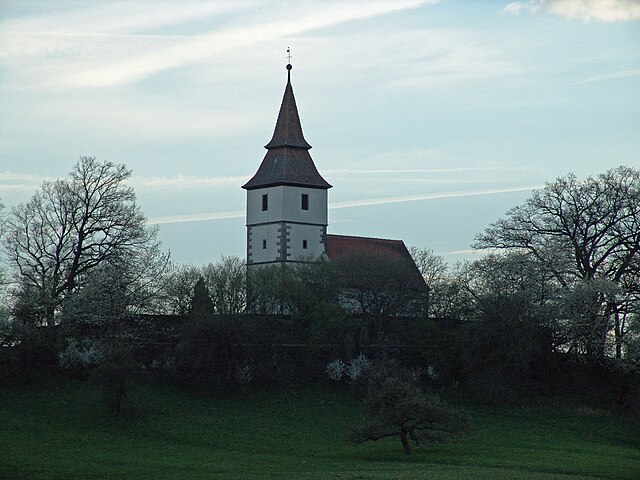

Dombühl
- municipality of Germany
Dombühl is a quaint village located in Bavaria, Germany, and while it may not be as widely known as some other hiking destinations, it offers beautiful scenery and access to lovely trails in the surrounding Franconian region. When planning a hike around Dombühl, here are some aspects to consider:...
- Country:

- Postal Code: 91601
- Local Dialing Code: 09868
- Licence Plate Code: AN
- Coordinates: 49° 15' 12" N, 10° 17' 15" E


- GPS tracks (wikiloc): [Link]
- AboveSeaLevel: 474 м m
- Area: 17.90 sq km
- Population: 1119
- Web site: [Link]


Aurach
- municipality of Germany
Aurach, a charming village in Bavaria, Germany, is surrounded by stunning natural landscapes, making it a delightful destination for hiking enthusiasts. Here are some key points about hiking in and around Aurach:...
- Country:

- Postal Code: 91589
- Local Dialing Code: 09804
- Licence Plate Code: AN
- Coordinates: 49° 14' 45" N, 10° 24' 53" E


- GPS tracks (wikiloc): [Link]
- AboveSeaLevel: 438 м m
- Area: 36.72 sq km
- Population: 2469
- Web site: [Link]

Bechhofen
- municipality of Germany
Bechhofen is a small town in Germany, located in the state of Bavaria. It offers a range of outdoor activities, including hiking, thanks to its picturesque landscapes and proximity to natural reserves. Here are some key points about hiking in and around Bechhofen:...
- Country:

- Postal Code: 91572
- Local Dialing Code: 09822
- Licence Plate Code: AN
- Coordinates: 49° 8' 0" N, 10° 33' 0" E


- GPS tracks (wikiloc): [Link]
- AboveSeaLevel: 432 м m
- Area: 60.12 sq km
- Population: 5384
- Web site: [Link]


Dietenhofen
- municipality of Germany
Dietenhofen, located in Bavaria, Germany, is a great destination for hiking enthusiasts. The region boasts beautiful landscapes, charming villages, and a variety of trails suitable for different skill levels. Here are some key points to consider when hiking in and around Dietenhofen:...
- Country:

- Postal Code: 90599
- Local Dialing Code: 09824
- Licence Plate Code: AN
- Coordinates: 49° 24' 0" N, 10° 41' 24" E


- GPS tracks (wikiloc): [Link]
- AboveSeaLevel: 353 м m
- Area: 63.96 sq km
- Population: 4260
- Web site: [Link]
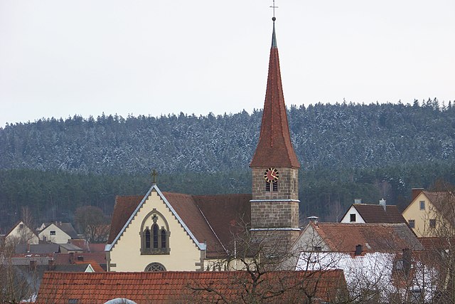

Mitteleschenbach
- municipality of Germany
Mitteleschenbach is a quaint village located in the Franconia region of Bavaria, Germany. It's surrounded by picturesque landscapes that offer plenty of opportunities for hiking and enjoying nature. Here are some key points to consider if you're planning a hiking trip in and around Mitteleschenbach:...
- Country:

- Postal Code: 91734
- Local Dialing Code: 09871
- Licence Plate Code: AN
- Coordinates: 49° 13' 0" N, 10° 46' 0" E


- GPS tracks (wikiloc): [Link]
- AboveSeaLevel: 407 м m
- Area: 10.51 sq km
- Population: 1356
- Web site: [Link]


Insingen
- municipality of Germany
It seems like there might be a typo in your request regarding "Insingen." As of my last knowledge update in October 2023, there isn't a well-known hiking destination by that name. However, if you meant a specific location or a similar-sounding area, please clarify....
- Country:

- Postal Code: 91610
- Local Dialing Code: 09869
- Licence Plate Code: AN
- Coordinates: 49° 17' 0" N, 10° 10' 0" E


- GPS tracks (wikiloc): [Link]
- AboveSeaLevel: 399 м m
- Area: 21.33 sq km
- Population: 934
- Web site: [Link]


Bruckberg, Middle Franconia
- municipality of Germany
 Hiking in Bruckberg, Middle Franconia
Bruckberg, located in Middle Franconia, Germany, is a charming area that offers several opportunities for hiking enthusiasts. The region is characterized by its picturesque landscapes, which include rolling hills, lush forests, and tranquil countryside....
- Country:

- Postal Code: 91590
- Local Dialing Code: 09824
- Licence Plate Code: AN
- Coordinates: 49° 21' 0" N, 10° 42' 0" E


- GPS tracks (wikiloc): [Link]
- AboveSeaLevel: 347 м m
- Area: 7.62 sq km
- Population: 1223
- Web site: [Link]


Wörnitz
- municipality of Germany
Wörnitz is a small town located in the Bavarian region of Germany, known for its natural beauty and outdoor activities. While it's not as widely recognized as other hiking destinations in Bavaria, there are some lovely hiking opportunities in and around the area....
- Country:

- Postal Code: 91637
- Local Dialing Code: 09868
- Licence Plate Code: AN
- Coordinates: 49° 15' 0" N, 10° 15' 0" E


- GPS tracks (wikiloc): [Link]
- AboveSeaLevel: 466 м m
- Area: 24.46 sq km
- Population: 1138
- Web site: [Link]


Rügland
- municipality of Germany
Rügland is a small municipality located in Bavaria, Germany, known for its beautiful landscapes and tranquil environment, making it a great destination for hiking enthusiasts. While the area itself may not be as widely recognized as some of the major hiking destinations in Germany, it offers a variety of scenic trails and opportunities to explore the natural beauty of the region....
- Country:

- Postal Code: 91622
- Local Dialing Code: 09828
- Licence Plate Code: AN
- Coordinates: 49° 24' 0" N, 10° 35' 0" E


- GPS tracks (wikiloc): [Link]
- AboveSeaLevel: 393 м m
- Area: 20.89 sq km
- Population: 1093
- Web site: [Link]

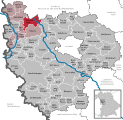
Windelsbach
- municipality of Germany
Windelsbach is a small town located in Franconia, Germany, known for its beautiful natural surroundings and outdoor activities, including hiking. There are several key aspects to consider when hiking in and around Windelsbach:...
- Country:

- Postal Code: 91635
- Local Dialing Code: 09867
- Licence Plate Code: AN
- Coordinates: 49° 23' 0" N, 10° 18' 0" E


- GPS tracks (wikiloc): [Link]
- AboveSeaLevel: 453 м m
- Area: 38.51 sq km
- Population: 959
- Web site: [Link]


Ohrenbach
- municipality of Germany
Ohrenbach is a small village located in Bavaria, Germany, known for its picturesque landscapes and proximity to various outdoor activities. While it may not be as widely recognized as some larger hiking destinations in the region, there are still plenty of opportunities for hiking enthusiasts to explore beautiful nature trails and enjoy the serene surroundings....
- Country:

- Postal Code: 91620
- Local Dialing Code: 09865
- Licence Plate Code: AN
- Coordinates: 49° 28' 0" N, 10° 13' 0" E


- GPS tracks (wikiloc): [Link]
- AboveSeaLevel: 409 м m
- Area: 22.74 sq km
- Population: 728
- Web site: [Link]
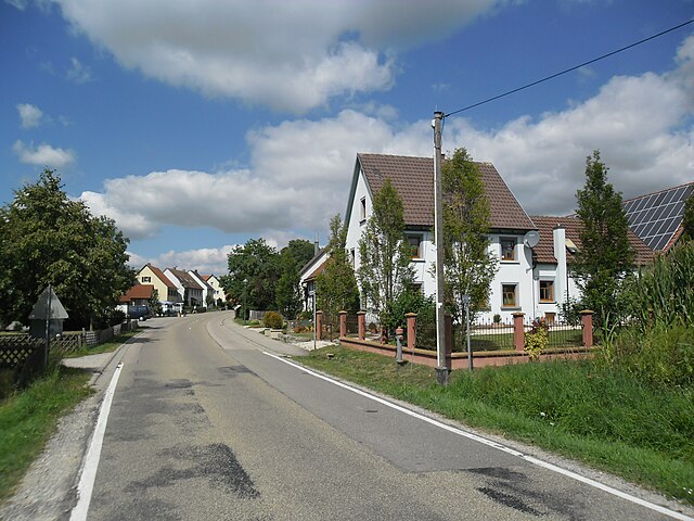

Schnelldorf
- municipality of Germany
Schnelldorf is a charming village located in the region of Bavaria, Germany. It’s surrounded by beautiful landscapes, making it an excellent location for hiking enthusiasts. Here are some insights into hiking in Schnelldorf:...
- Country:

- Postal Code: 91625
- Local Dialing Code: 07950
- Licence Plate Code: AN
- Coordinates: 49° 12' 0" N, 10° 10' 0" E


- GPS tracks (wikiloc): [Link]
- AboveSeaLevel: 470 м m
- Area: 51.48 sq km
- Population: 3030
- Web site: [Link]


Colmberg
- municipality of Germany
Colmberg, a charming village located in Bavaria, Germany, is a great destination for hiking enthusiasts. Nestled in the picturesque Franconian countryside, it offers several trails that cater to different skill levels and preferences. Here’s an overview of what you can expect when hiking in Colmberg:...
- Country:

- Postal Code: 91598
- Local Dialing Code: 09803
- Licence Plate Code: AN
- Coordinates: 49° 22' 0" N, 10° 25' 0" E


- GPS tracks (wikiloc): [Link]
- AboveSeaLevel: 448 м m
- Area: 38.35 sq km
- Population: 1663
- Web site: [Link]
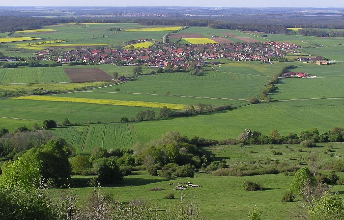

Ehingen
- municipality in Middle Franconia, Bavaria, Germany
Ehingen, located in the picturesque region of Middle Franconia in Germany, offers a wonderful environment for hiking enthusiasts. The area is characterized by rolling hills, lush forests, and scenic vineyards, making it an excellent destination for hiking and outdoor activities. Here are some highlights and tips for hiking in and around Ehingen:...
- Country:

- Postal Code: 91725
- Local Dialing Code: 09835
- Licence Plate Code: AN
- Coordinates: 49° 4' 59" N, 10° 31' 59" E


- GPS tracks (wikiloc): [Link]
- AboveSeaLevel: 456 м m
- Area: 47.63 sq km
- Population: 1940
- Web site: [Link]


Steinsfeld
- municipality of Germany
Steinsfeld, a charming village located in Bavaria, Germany, offers a variety of hiking opportunities for both beginners and experienced hikers. The surrounding landscape features rolling hills, lush forests, and picturesque meadows, making it an ideal location for outdoor enthusiasts....
- Country:

- Postal Code: 91628
- Local Dialing Code: 09861
- Licence Plate Code: AN
- Coordinates: 49° 25' 0" N, 10° 13' 0" E


- GPS tracks (wikiloc): [Link]
- AboveSeaLevel: 404 м m
- Area: 31.8 sq km
- Population: 1179
- Web site: [Link]

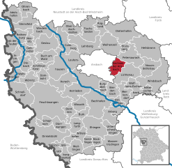
Sachsen bei Ansbach
- municipality of Germany
Sachsen bei Ansbach, located in the Bavaria region of Germany, offers a variety of beautiful hiking trails that showcase its stunning landscapes and natural beauty. Here are some highlights you might consider when planning a hiking trip in the area:...
- Country:

- Postal Code: 91623
- Local Dialing Code: 09827
- Licence Plate Code: AN
- Coordinates: 49° 17' 0" N, 10° 39' 0" E


- GPS tracks (wikiloc): [Link]
- AboveSeaLevel: 406 м m
- Area: 20.95 sq km
- Population: 2283
- Web site: [Link]


Neusitz
- municipality of Germany
Neusitz is a quaint town located in Bavaria, Germany, known for its picturesque landscapes and proximity to several hiking opportunities. Nestled near the historic Tauber Valley, the area offers a variety of trails that cater to different skill levels and preferences....
- Country:

- Postal Code: 91616
- Local Dialing Code: 09861
- Licence Plate Code: AN
- Coordinates: 49° 22' 0" N, 10° 13' 0" E


- GPS tracks (wikiloc): [Link]
- AboveSeaLevel: 400 м m
- Area: 13.79 sq km
- Population: 1437
- Web site: [Link]
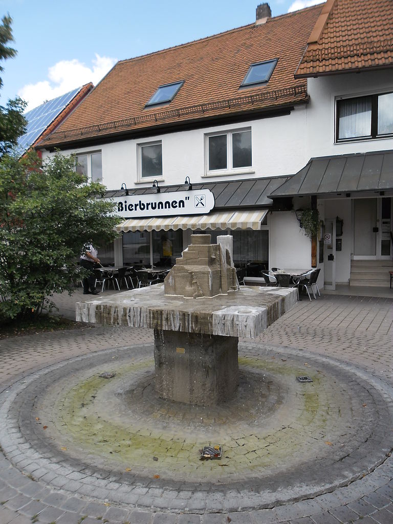

Schopfloch
- municipality of Germany
Schopfloch is a charming village located in Bavaria, Germany, known for its picturesque landscapes and scenic hiking trails. The area around Schopfloch offers a mix of natural beauty, tranquility, and outdoor activities that make it a great destination for hikers of all levels....
- Country:

- Postal Code: 91626
- Local Dialing Code: 09857
- Licence Plate Code: AN
- Coordinates: 49° 7' 0" N, 10° 18' 0" E


- GPS tracks (wikiloc): [Link]
- AboveSeaLevel: 484 м m
- Area: 15.34 sq km
- Population: 2640
- Web site: [Link]


Arberg
- municipality of Germany
Arberg is a small town located in the Franconia region of Bavaria, Germany. While it may not be as widely known for its hiking trails as larger national parks, it still offers opportunities for outdoor enthusiasts to explore the scenic beauty of the surrounding areas....
- Country:

- Postal Code: 91722
- Local Dialing Code: 09822
- Licence Plate Code: AN
- Coordinates: 49° 8' 0" N, 10° 37' 0" E


- GPS tracks (wikiloc): [Link]
- AboveSeaLevel: 468 м m
- Area: 31.31 sq km
- Population: 2007
- Web site: [Link]


Oberdachstetten
- municipality of Germany
Oberdachstetten is a small village located in Bavaria, Germany, known for its picturesque landscapes and charming rural atmosphere. While it may not be as famous as some larger hiking destinations, there are several appealing hiking options in and around the area....
- Country:

- Postal Code: 91617
- Local Dialing Code: 09845
- Licence Plate Code: AN
- Coordinates: 49° 24' 55" N, 10° 25' 23" E


- GPS tracks (wikiloc): [Link]
- AboveSeaLevel: 441 м m
- Area: 23.66 sq km
- Population: 1249
- Web site: [Link]


Wieseth
- municipality of Germany
Wieseth is a small town located in Bavaria, Germany, known for its scenic landscapes and outdoor activities, including hiking. The surrounding area offers a variety of trails that cater to different skill levels, making it a great destination for both beginner and experienced hikers....
- Country:

- Postal Code: 91632
- Local Dialing Code: 09822
- Licence Plate Code: AN
- Coordinates: 49° 10' 0" N, 10° 28' 0" E


- GPS tracks (wikiloc): [Link]
- AboveSeaLevel: 440 м m
- Area: 20.65 sq km
- Population: 1285
- Web site: [Link]


Petersaurach
- municipality of Germany
Petersaurach, located in Bavaria, Germany, is a charming area for hiking enthusiasts. The region is characterized by its beautiful landscapes, rolling hills, lush forests, and scenic trails that cater to various skill levels....
- Country:

- Postal Code: 91580
- Local Dialing Code: 0 98 72
- Licence Plate Code: AN
- Coordinates: 49° 17' 0" N, 10° 45' 0" E


- GPS tracks (wikiloc): [Link]
- AboveSeaLevel: 442 м m
- Area: 41.81 sq km
- Population: 3927
- Web site: [Link]
Wilburgstetten
- municipality of Germany
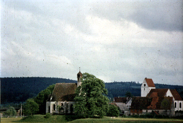
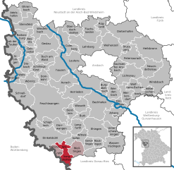
Wilburgstetten is a charming village located in Bavaria, Germany, and it offers some wonderful opportunities for hiking enthusiasts. The surrounding area is characterized by picturesque landscapes, including gentle hills, lush forests, and meandering trails that provide a perfect setting for outdoor activities....
- Country:

- Postal Code: 91634
- Local Dialing Code: 09853
- Licence Plate Code: AN
- Coordinates: 49° 2' 0" N, 10° 23' 0" E


- GPS tracks (wikiloc): [Link]
- AboveSeaLevel: 441 м m
- Area: 25.28 sq km
- Population: 1998
- Web site: [Link]

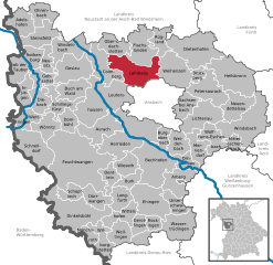
Lehrberg
- municipality of Germany
Lehrberg, a small town located in Bavaria, Germany, offers a lovely setting for hiking enthusiasts. While it might not be as mountainous as some other regions in Bavaria, it still has its own charm and scenic countryside perfect for hiking....
- Country:

- Postal Code: 91611
- Local Dialing Code: 09820
- Licence Plate Code: AN
- Coordinates: 49° 19' 0" N, 10° 31' 0" E


- GPS tracks (wikiloc): [Link]
- AboveSeaLevel: 407 м m
- Area: 50.88 sq km
- Population: 3116
- Web site: [Link]


Merkendorf
- town in Germany
Merkendorf is a charming town located in Bavaria, Germany, known for its beautiful countryside and scenic trails. Here are some highlights and tips for hiking in and around Merkendorf:...
- Country:

- Postal Code: 91732
- Local Dialing Code: 09826
- Licence Plate Code: AN
- Coordinates: 49° 12' 0" N, 10° 41' 0" E


- GPS tracks (wikiloc): [Link]
- AboveSeaLevel: 438 м m
- Area: 26.08 sq km
- Population: 2174
- Web site: [Link]


Weihenzell
- municipality of Germany
Weihenzell is a picturesque village located in the region of Bavaria, Germany. This area is ideal for hiking enthusiasts due to its beautiful landscapes, rich nature, and accessible trails. Here are some key points to consider when hiking in and around Weihenzell:...
- Country:

- Postal Code: 91629
- Local Dialing Code: 09802
- Licence Plate Code: AN
- Coordinates: 49° 21' 0" N, 10° 37' 0" E


- GPS tracks (wikiloc): [Link]
- AboveSeaLevel: 387 м m
- Area: 45.18 sq km
- Population: 2095
- Web site: [Link]


Gebsattel
- municipality of Germany
Gebsattel is a small area located in Bavaria, Germany, and offers a variety of outdoor activities, including hiking. Though it may not be as well-known as some larger hiking destinations, its picturesque landscapes and scenic trails make it a hidden gem for outdoor enthusiasts....
- Country:

- Postal Code: 91607
- Local Dialing Code: 09861
- Licence Plate Code: AN
- Coordinates: 49° 21' 0" N, 10° 11' 0" E


- GPS tracks (wikiloc): [Link]
- AboveSeaLevel: 378 м m
- Area: 19.12 sq km
- Population: 1425
- Web site: [Link]


Geslau
- municipality of Germany
Geslau is a charming village located in Bavaria, Germany, surrounded by beautiful landscapes that make it an excellent spot for hiking enthusiasts. Here are some highlights to consider when hiking in and around Geslau:...
- Country:

- Postal Code: 91608
- Local Dialing Code: 09867
- Licence Plate Code: AN
- Coordinates: 49° 22' 0" N, 10° 18' 53" E


- GPS tracks (wikiloc): [Link]
- AboveSeaLevel: 435 м m
- Area: 41.97 sq km
- Population: 1282
- Web site: [Link]


Langfurth
- municipality of Germany
Langfurth is a quaint area that offers various hiking opportunities for outdoor enthusiasts. Nestled in scenic landscapes, it provides trails suitable for hikers of all skill levels. While exact trail information can vary, here are some general tips and highlights for hiking in Langfurth:...
- Country:

- Postal Code: 91731
- Local Dialing Code: 09856
- Licence Plate Code: AN
- Coordinates: 49° 6' 0" N, 10° 26' 0" E


- GPS tracks (wikiloc): [Link]
- AboveSeaLevel: 443 м m
- Area: 21.17 sq km
- Population: 1956
- Web site: [Link]


Gerolfingen
- municipality of Germany
Gerolfingen is a charming area in Switzerland, tucked away in the region of Thurgau. While it may not be as widely recognized as some of the larger hiking destinations in Switzerland, it offers opportunities for delightful outdoor experiences amidst beautiful pastoral landscapes, rolling hills, and views of Lake Constance....
- Country:

- Postal Code: 91726
- Local Dialing Code: 09854
- Licence Plate Code: AN
- Coordinates: 49° 2' 0" N, 10° 31' 0" E


- GPS tracks (wikiloc): [Link]
- AboveSeaLevel: 430 м m
- Area: 12.59 sq km
- Population: 1065
- Web site: [Link]


Weiltingen
- municipality of Germany
Weiltingen, located in Bavaria, Germany, is a charming village surrounded by beautiful landscapes that offer a variety of hiking opportunities. The region is characterized by its rolling hills, forests, and picturesque countryside, making it an excellent destination for outdoor enthusiasts. Here are some key points to consider for hiking in Weiltingen:...
- Country:

- Postal Code: 91744
- Local Dialing Code: 09853
- Licence Plate Code: AN
- Coordinates: 49° 1' 0" N, 10° 28' 0" E


- GPS tracks (wikiloc): [Link]
- AboveSeaLevel: 440 м m
- Area: 24.02 sq km
- Population: 1289
- Web site: [Link]


Wettringen
- municipality in Bayaria, Germany
Wettringen is a charming village located in Bavaria, Germany, and while it may not be as famous as some of the larger towns and cities in the region, it offers beautiful landscapes and opportunities for hiking enthusiasts....
- Country:

- Postal Code: 91631
- Local Dialing Code: 09869
- Licence Plate Code: AN
- Coordinates: 49° 15' 0" N, 10° 9' 0" E


- GPS tracks (wikiloc): [Link]
- AboveSeaLevel: 420 м m
- Area: 21.46 sq km
- Population: 886
- Web site: [Link]


Weidenbach
- municipality of Germany
Weidenbach, located in Bavaria, Germany, is surrounded by scenic landscapes, ideal for hiking enthusiasts. The region offers a variety of trails that cater to different skill levels, making it suitable for both beginners and experienced hikers....
- Country:

- Postal Code: 91746
- Local Dialing Code: 09826
- Licence Plate Code: AN
- Coordinates: 49° 12' 0" N, 10° 37' 0" E


- GPS tracks (wikiloc): [Link]
- AboveSeaLevel: 437 м m
- Area: 21.71 sq km
- Population: 1994
- Web site: [Link]


Ornbau
- town in Germany
Ornbau, a small town in Bavaria, Germany, may not be widely known as a hiking destination, but it can be a charming area for outdoor enthusiasts. The surrounding landscapes offer various trails and natural beauty typical of the Franconia region....
- Country:

- Postal Code: 91737
- Local Dialing Code: 09826
- Licence Plate Code: AN
- Coordinates: 49° 10' 40" N, 10° 39' 20" E


- GPS tracks (wikiloc): [Link]
- AboveSeaLevel: 419 м m
- Area: 15.16 sq km
- Population: 1457
- Web site: [Link]


Röckingen
- municipality of Germany
Röckingen, a small village in the region of Bavaria, Germany, offers a variety of hiking opportunities in a picturesque landscape. While it may not be as widely recognized as some major hiking destinations, its tranquil environment and scenic views make it a lovely spot for outdoor enthusiasts. Here are some key points to consider when hiking in Röckingen:...
- Country:

- Postal Code: 91740
- Local Dialing Code: 09832
- Licence Plate Code: AN
- Coordinates: 49° 2' 0" N, 10° 34' 0" E


- GPS tracks (wikiloc): [Link]
- AboveSeaLevel: 449 м m
- Area: 10.91 sq km
- Population: 705
- Web site: [Link]


Herrieden
- town in Germany
Herrieden, located in the Ansbach district of Bavaria, Germany, is a quaint town that offers several opportunities for hiking enthusiasts. The surrounding landscape is characterized by beautiful rolling hills, forested areas, and scenic views that are typical of the Franconian region....
- Country:

- Postal Code: 91567
- Local Dialing Code: 09825
- Licence Plate Code: AN
- Coordinates: 49° 13' 0" N, 10° 31' 0" E


- GPS tracks (wikiloc): [Link]
- AboveSeaLevel: 423 м m
- Area: 81.71 sq km
- Population: 6250
- Web site: [Link]


Lichtenau
- human settlement in Germany
Lichtenau, located in the state of Bavaria, Germany, is surrounded by beautiful landscapes that offer a variety of hiking opportunities. The region is characterized by its rolling hills, forests, and picturesque views, making it an excellent destination for outdoor enthusiasts....
- Country:

- Postal Code: 91586
- Local Dialing Code: 09827
- Licence Plate Code: AN
- Coordinates: 49° 16' 0" N, 10° 41' 0" E


- GPS tracks (wikiloc): [Link]
- AboveSeaLevel: 390 м m
- Area: 41.39 sq km
- Population: 3486
- Web site: [Link]
Shares border with regions:
Donau-Ries
- district in Bavaria, Germany
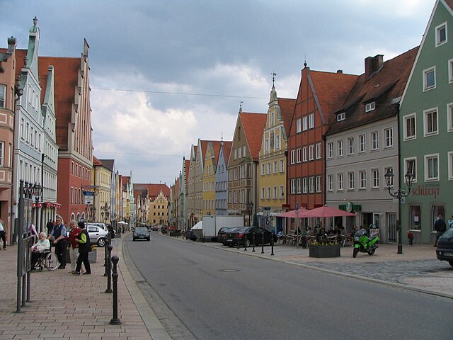
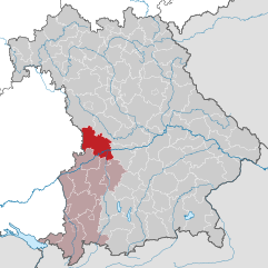
Donau-Ries is a beautiful region in Bavaria, Germany, known for its stunning landscapes, rich history, and cultural significance. Spanning both the Danube River and the Ries crater, this area offers diverse hiking opportunities for both beginners and more experienced trekkers....
- Country:

- Capital: Donauwörth
- Licence Plate Code: NÖ; DON
- Coordinates: 48° 49' 48" N, 10° 40' 12" E


- GPS tracks (wikiloc): [Link]
- AboveSeaLevel: 508 м m
- Area: 1275.00 sq km
- Population: 117483
- Web site: [Link]

Roth
- district in Bavaria, Germany
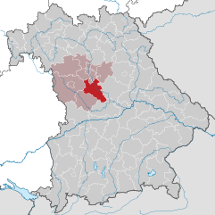
Roth district, located in Bavaria, Germany, offers a variety of beautiful landscapes and hiking opportunities that appeal to both novice and experienced hikers. The area is characterized by rolling hills, forests, and picturesque views. Here are some highlights and tips for hiking in Roth:...
- Country:

- Capital: Roth
- Licence Plate Code: RH; HIP
- Coordinates: 49° 15' 0" N, 11° 4' 48" E


- GPS tracks (wikiloc): [Link]
- AboveSeaLevel: 355 м m
- Area: 895.00 sq km
- Population: 103944
- Web site: [Link]


Weißenburg-Gunzenhausen
- district of Bavaria, Germany
 Hiking in Weißenburg-Gunzenhausen
Weißenburg-Gunzenhausen, located in Bavaria, Germany, is a great destination for hiking enthusiasts. This region is known for its beautiful landscapes, including hills, lakes, and forests, making it perfect for various outdoor activities....
- Country:

- Capital: Weißenburg in Bayern
- Licence Plate Code: WUG; GUN
- Coordinates: 49° 4' 48" N, 10° 49' 48" E


- GPS tracks (wikiloc): [Link]
- AboveSeaLevel: 452 м m
- Area: 970.83 sq km
- Population: 92331
- Web site: [Link]


Fürth
- district in Bavaria, Germany
Fürth, located in Bavaria, Germany, offers a variety of hiking opportunities that cater to different skill levels and preferences. The area is characterized by beautiful hills, forests, and rivers, making it a great spot for outdoor enthusiasts....
- Country:

- Capital: Zirndorf
- Licence Plate Code: FÜ
- Coordinates: 49° 25' 0" N, 10° 50' 0" E


- GPS tracks (wikiloc): [Link]
- AboveSeaLevel: 397 м m
- Area: 308.00 sq km
- Population: 116193
- Web site: [Link]
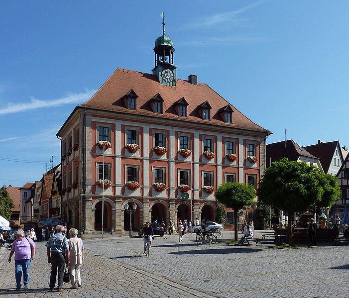

Neustadt (Aisch)-Bad Windsheim
- district in Bavaria, Germany
 Hiking in Neustadt (Aisch)-Bad Windsheim
Neustadt (Aisch)-Bad Windsheim, located in the Franconian region of Bavaria, Germany, offers a variety of scenic hiking opportunities for outdoor enthusiasts. The area is characterized by its picturesque landscapes, charming villages, and the rich cultural heritage of Franconia. Here are some highlights of hiking in this region:...
- Country:

- Capital: Neustadt an der Aisch
- Licence Plate Code: UFF; SEF; NEA
- Coordinates: 49° 34' 48" N, 10° 30' 0" E


- GPS tracks (wikiloc): [Link]
- AboveSeaLevel: 384 м m
- Area: 1267.54 sq km
- Population: 85686
- Web site: [Link]


Ansbach
- town in Bavaria, Germany
Hiking in Ansbach, a charming town located in Bavaria, Germany, offers a variety of scenic trails and routes that showcase the region's natural beauty and rich history. The surrounding landscapes are characterized by rolling hills, dense forests, and picturesque countryside, making it an excellent destination for outdoor enthusiasts....
- Country:

- Postal Code: 91522
- Local Dialing Code: 09825; 09823; 09820; 09805; 09802; 0981
- Licence Plate Code: AN
- Coordinates: 49° 18' 0" N, 10° 35' 0" E


- GPS tracks (wikiloc): [Link]
- AboveSeaLevel: 409 м m
- Area: 99.92 sq km
- Population: 39839
- Web site: [Link]
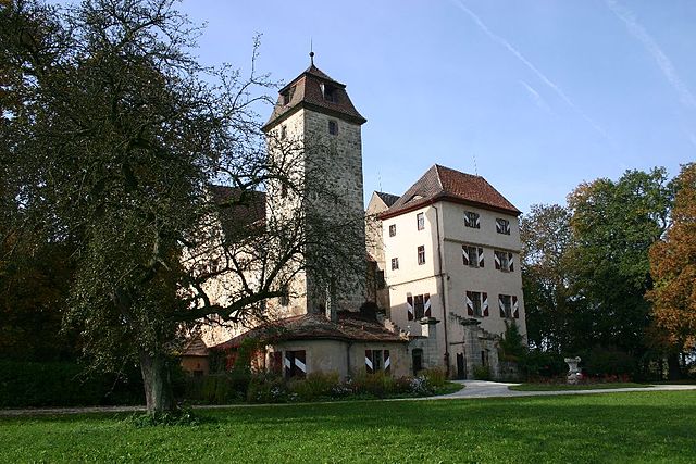

Muhr am See
- municipality of Germany
Muhr am See, located in Bavaria, Germany, is a picturesque destination that offers a variety of outdoor activities, including hiking. The area is characterized by its beautiful landscapes, tranquil lakes, and lush forests, making it an ideal place for nature enthusiasts....
- Country:

- Postal Code: 91735
- Local Dialing Code: 09831
- Licence Plate Code: WUG
- Coordinates: 49° 9' 16" N, 10° 43' 6" E


- GPS tracks (wikiloc): [Link]
- AboveSeaLevel: 422 м m
- Area: 10.95 sq km
- Population: 2223
- Web site: [Link]


Gunzenhausen
- town in Bavaria, Germany
Gunzenhausen is a charming town located in Bavaria, Germany, and serves as a gateway to some beautiful hiking opportunities, particularly around the Franconian Lake District (Fränkisches Seenland). Here’s what you can expect when hiking in and around Gunzenhausen:...
- Country:

- Postal Code: 91710
- Local Dialing Code: 09836; 09831
- Coordinates: 49° 6' 53" N, 10° 45' 15" E


- GPS tracks (wikiloc): [Link]
- AboveSeaLevel: 416 м m
- Area: 82.72 sq km
- Population: 16562
- Web site: [Link]


Haundorf
- municipality of Germany
Haundorf, a quaint village located in the Bavarian region of Germany, offers a variety of hiking opportunities for outdoor enthusiasts. Here are some details to consider if you're planning a hike in the area:...
- Country:

- Postal Code: 91729
- Local Dialing Code: 09837
- Licence Plate Code: WUG
- Coordinates: 49° 11' 0" N, 10° 46' 0" E


- GPS tracks (wikiloc): [Link]
- AboveSeaLevel: 445 м m
- Area: 51.34 sq km
- Population: 1909
- Web site: [Link]
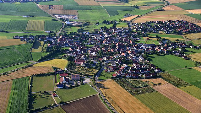

Gnotzheim
- human settlement in Germany
Gnotzheim is a small village in Bavaria, Germany, surrounded by picturesque landscapes that make it a wonderful spot for hiking enthusiasts. The region features a variety of trails that cater to different skill levels, from gentle walks suitable for families to more challenging hikes for experienced trekkers....
- Country:

- Postal Code: 91728
- Local Dialing Code: 09833
- Licence Plate Code: WUG
- Coordinates: 49° 4' 0" N, 10° 43' 0" E


- GPS tracks (wikiloc): [Link]
- AboveSeaLevel: 473 м m
- Area: 12.48 sq km
- Population: 834
- Web site: [Link]


Main-Tauber
- district of Baden-Württemberg, Germany
Main-Tauber-Kreis, located in the Baden-Württemberg state of Germany, is a beautiful region known for its stunning landscapes, historic towns, and rich cultural heritage, making it an excellent destination for hiking enthusiasts. Here are some key aspects of hiking in this picturesque area:...
- Country:

- Capital: Tauberbischofsheim
- Licence Plate Code: TBB
- Coordinates: 49° 34' 12" N, 9° 42' 36" E


- GPS tracks (wikiloc): [Link]
- AboveSeaLevel: 190 м m
- Area: 1304.41 sq km
- Population: 132181
- Web site: [Link]


Landkreis Schwäbisch Hall
- district of Baden-Württemberg, Germany
 Hiking in Landkreis Schwäbisch Hall
Schwäbisch Hall district, located in Baden-Württemberg, Germany, is known for its picturesque landscapes, charming villages, and rich history, making it a great destination for hiking enthusiasts. Here are some highlights and tips for hiking in the area:...
- Country:

- Capital: Schwäbisch Hall
- Licence Plate Code: SHA
- Coordinates: 49° 9' 0" N, 9° 54' 36" E


- GPS tracks (wikiloc): [Link]
- AboveSeaLevel: 426 м m
- Area: 1484.00 sq km
- Population: 191614
- Web site: [Link]

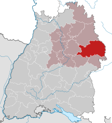
Ostalb
- district of Baden-Württemberg, Germany
Ostalbkreis, located in the state of Baden-Württemberg in Germany, is a fantastic destination for hiking enthusiasts. The region is characterized by its diverse landscapes, which include rolling hills, dense forests, and picturesque valleys, providing a variety of trails suitable for all levels of hikers....
- Country:

- Capital: Aalen
- Licence Plate Code: AA
- Coordinates: 48° 52' 0" N, 10° 6' 0" E


- GPS tracks (wikiloc): [Link]
- AboveSeaLevel: 436 м m
- Area: 1511.57 sq km
- Population: 311587
- Web site: [Link]

