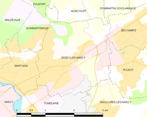
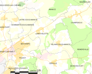
Seichamps (Seichamps)

- commune in Meurthe-et-Moselle, France
- Country:

- Postal Code: 54280
- Coordinates: 48° 42' 57" N, 6° 15' 58" E


- GPS tracks (wikiloc): [Link]
- Area: 4.3 sq km
- Population: 4809
- Web site: http://www.mairie-seichamps.fr
- Wikipedia en: wiki(en)
- Wikipedia: wiki(fr)
- Wikidata storage: Wikidata: Q818892
- Wikipedia Commons Category: [Link]
- Freebase ID: [/m/03qdg_s]
- Freebase ID: [/m/03qdg_s]
- GeoNames ID: Alt: [2975292]
- GeoNames ID: Alt: [2975292]
- SIREN number: [215404989]
- SIREN number: [215404989]
- BnF ID: [15264565c]
- BnF ID: [15264565c]
- INSEE municipality code: 54498
- INSEE municipality code: 54498
Shares border with regions:

Essey-lès-Nancy
- commune in Meurthe-et-Moselle, France
- Country:
- Postal Code: 54270
- Coordinates: 48° 42' 21" N, 6° 13' 20" E
- GPS tracks (wikiloc): [Link]
- Area: 5.75 sq km
- Population: 8709
- Web site: [Link]
Laneuvelotte
- commune in Meurthe-et-Moselle, France
- Country:
- Postal Code: 54280
- Coordinates: 48° 43' 44" N, 6° 17' 35" E
- GPS tracks (wikiloc): [Link]
- Area: 9.13 sq km
- Population: 438


Laître-sous-Amance
- commune in Meurthe-et-Moselle, France
- Country:
- Postal Code: 54770
- Coordinates: 48° 44' 48" N, 6° 16' 32" E
- GPS tracks (wikiloc): [Link]
- Area: 5.11 sq km
- Population: 410


Dommartin-sous-Amance
- commune in Meurthe-et-Moselle, France
- Country:
- Postal Code: 54770
- Coordinates: 48° 44' 27" N, 6° 15' 19" E
- GPS tracks (wikiloc): [Link]
- AboveSeaLevel: 213 м m
- Area: 4.03 sq km
- Population: 264


Pulnoy
- commune in Meurthe-et-Moselle, France
- Country:
- Postal Code: 54425
- Coordinates: 48° 42' 4" N, 6° 15' 30" E
- GPS tracks (wikiloc): [Link]
- Area: 3.74 sq km
- Population: 4474
- Web site: [Link]