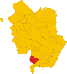
Senise (Senise)
.svg)
- Italian comune
 Hiking in Senise
Senise, a charming town located in the Basilicata region of Italy, offers an array of hiking opportunities in a stunning natural environment. The surrounding area is characterized by rolling hills, lush forests, and breathtaking views. Here are some highlights and suggestions for hiking in Senise:
Hiking Trails
-
Cascate di San Fele: Although not directly in Senise, nearby San Fele is home to beautiful waterfalls and rugged trails leading to stunning views. It's worth the trip for those who enjoy both nature and photography.
-
Parco Nazionale del Pollino: A short distance from Senise, this national park boasts vast landscapes and a variety of trails suitable for different skill levels. Hiking here offers the chance to explore unique flora and fauna, as well as impressive geological formations.
-
Local Trails: There are numerous smaller trails around Senise that meander through the countryside, olive groves, and vineyards. These trails are perfect for leisurely walks and experiencing local wildlife.
Best Times to Hike
- Spring (April to June): Ideal temperatures and blooming wildflowers make this an excellent time for hiking.
- Autumn (September to November): The fall foliage creates a stunning backdrop, and the weather is usually mild.
Preparation Tips
- Footwear: Wear sturdy hiking boots for stability on rocky terrain.
- Water and Snacks: Always carry enough water and energy-boosting snacks.
- Map and GPS: Familiarize yourself with trail maps and consider a GPS device or app.
- Layered Clothing: Weather can change quickly, so dress in layers.
Safety Considerations
- Avoid hiking alone when possible, especially if you are unfamiliar with the area.
- Inform someone of your hiking plans and expected return time.
- Check the weather forecast before heading out.
Local Attractions
After a day of hiking, enjoy local cuisine in Senise, known for its traditional Lucanian dishes. Be sure to visit local markets and perhaps sample the area’s famous Senise peppers.
Hiking in Senise offers an authentic Italian outdoor experience, blending natural beauty with cultural richness. Enjoy your adventure!
- Country:

- Postal Code: 85038
- Local Dialing Code: 0973
- Licence Plate Code: PZ
- Coordinates: 40° 8' 0" N, 16° 17' 0" E


- GPS tracks (wikiloc): [Link]
- AboveSeaLevel: 335 м m
- Area: 97.31 sq km
- Population: 6995
- Web site: http://www.comune.senise.pz.it/
- Wikipedia en: wiki(en)
- Wikipedia: wiki(it)
- Wikidata storage: Wikidata: Q52676
- Wikipedia Commons Category: [Link]
- Freebase ID: [/m/0fh3yr]
- GeoNames ID: Alt: [6539015]
- VIAF ID: Alt: [241858053]
- OSM relation ID: [40292]
- WOEID: [724029]
- UN/LOCODE: [ITPZ8]
- ISTAT ID: 076085
- Italian cadastre code: I610
Shares border with regions:

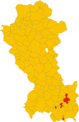
Colobraro
- Italian comune
Hiking in Colobraro
Colobraro is a small hilltop village located in the Basilicata region of southern Italy, known for its stunning landscapes, historical charm, and various hiking opportunities. While it may not be as widely recognized as some other hiking destinations in Italy, it offers a unique experience for those looking to explore serene trails and enjoy nature....
- Country:
- Postal Code: 75021
- Local Dialing Code: 0835
- Licence Plate Code: MT
- Coordinates: 40° 11' 0" N, 16° 26' 0" E
- GPS tracks (wikiloc): [Link]
- AboveSeaLevel: 630 м m
- Area: 66.61 sq km
- Population: 1203
- Web site: [Link]
San Giorgio Lucano
- Italian comune
Hiking in San Giorgio Lucano
San Giorgio Lucano, a charming town in the Basilicata region of Italy, is not only known for its historical architecture and picturesque landscapes but also offers some excellent hiking opportunities. Nestled in the Pollino National Park area, the region is characterized by its rugged terrain, rolling hills, and stunning natural beauty, making it an appealing destination for outdoor enthusiasts....
- Country:
- Postal Code: 75027
- Local Dialing Code: 0835
- Licence Plate Code: MT
- Coordinates: 40° 7' 0" N, 16° 23' 0" E
- GPS tracks (wikiloc): [Link]
- AboveSeaLevel: 416 м m
- Area: 39.26 sq km
- Population: 1157
- Web site: [Link]

Chiaromonte
- Italian comune
Hiking in Chiaromonte
Chiaromonte is a charming hilltop town located in the Basilicata region of southern Italy, and it offers some fantastic opportunities for hiking. Here are some key points about hiking in and around Chiaromonte:...
- Country:
- Postal Code: 85032
- Local Dialing Code: 0973
- Licence Plate Code: PZ
- Coordinates: 40° 7' 0" N, 16° 13' 0" E
- GPS tracks (wikiloc): [Link]
- AboveSeaLevel: 794 м m
- Area: 70.02 sq km
- Population: 1922
- Web site: [Link]
Noepoli
- Italian comune
Hiking in Noepoli
Noepoli is a small town located in the southern part of Italy, specifically in the Basilicata region. While it may not be as widely known for hiking as some other areas in Italy, it does offer opportunities for outdoor enthusiasts looking to explore the natural beauty of the region....
- Country:
- Postal Code: 85035
- Local Dialing Code: 0973
- Licence Plate Code: PZ
- Coordinates: 40° 5' 0" N, 16° 20' 0" E
- GPS tracks (wikiloc): [Link]
- AboveSeaLevel: 676 м m
- Area: 46.71 sq km
- Population: 841
- Web site: [Link]
Roccanova
- Italian comune
Hiking in Roccanova
Roccanova is a charming destination located in the Basilicata region of southern Italy. Nestled in the Apennine Mountains, it offers a range of hiking opportunities for outdoor enthusiasts. Here’s a guide to help you explore the hiking options in and around Roccanova:...
- Country:
- Postal Code: 85036
- Local Dialing Code: 0973
- Licence Plate Code: PZ
- Coordinates: 40° 13' 0" N, 16° 12' 0" E
- GPS tracks (wikiloc): [Link]
- AboveSeaLevel: 648 м m
- Area: 61.74 sq km
- Population: 1477
- Web site: [Link]
Sant'Arcangelo
- Italian comune
Hiking in Sant'Arcangelo
Sant'Arcangelo, located in the Basilicata region of Italy, is known for its beautiful landscapes, rich history, and charming architecture. Hiking in this area can be a rewarding experience, offering stunning views and opportunities to explore the natural and cultural heritage of the region....
- Country:
- Postal Code: 85037
- Local Dialing Code: 0973
- Licence Plate Code: PZ
- Coordinates: 40° 14' 55" N, 16° 16' 14" E
- GPS tracks (wikiloc): [Link]
- AboveSeaLevel: 388 м m
- Area: 89.1 sq km
- Population: 6448
- Web site: [Link]