Serville (Serville)

- commune in Eure-et-Loir, France
- Country:

- Postal Code: 28410
- Coordinates: 48° 46' 8" N, 1° 29' 7" E


- GPS tracks (wikiloc): [Link]
- Area: 5.62 sq km
- Population: 360
- Wikipedia en: wiki(en)
- Wikipedia: wiki(fr)
- Wikidata storage: Wikidata: Q961365
- Wikipedia Commons Category: [Link]
- Freebase ID: [/m/03nrmx8]
- GeoNames ID: Alt: [6430902]
- SIREN number: [212803753]
- BnF ID: [15254305r]
- INSEE municipality code: 28375
Shares border with regions:


Marchezais
- commune in Eure-et-Loir, France
- Country:
- Postal Code: 28410
- Coordinates: 48° 46' 20" N, 1° 30' 30" E
- GPS tracks (wikiloc): [Link]
- Area: 2.19 sq km
- Population: 309
- Web site: [Link]


Cherisy
- commune in Eure-et-Loir, France
- Country:
- Postal Code: 28500
- Coordinates: 48° 44' 48" N, 1° 25' 19" E
- GPS tracks (wikiloc): [Link]
- Area: 12.38 sq km
- Population: 1874
- Web site: [Link]

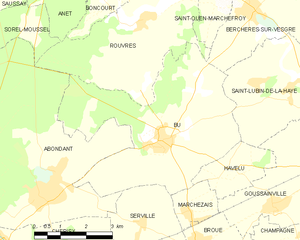
Bû
- commune in Eure-et-Loir, France
- Country:
- Postal Code: 28410
- Coordinates: 48° 47' 47" N, 1° 29' 43" E
- GPS tracks (wikiloc): [Link]
- Area: 22.6 sq km
- Population: 1926
- Web site: [Link]


Germainville
- commune in Eure-et-Loir, France
- Country:
- Postal Code: 28500
- Coordinates: 48° 44' 30" N, 1° 28' 55" E
- GPS tracks (wikiloc): [Link]
- Area: 8.67 sq km
- Population: 279
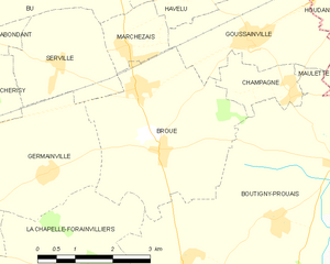
Broué
- commune in Eure-et-Loir, France
- Country:
- Postal Code: 28410
- Coordinates: 48° 44' 54" N, 1° 31' 19" E
- GPS tracks (wikiloc): [Link]
- Area: 12.03 sq km
- Population: 890
- Web site: [Link]