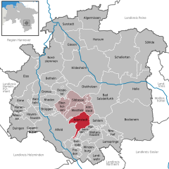
Sibbesse (Samtgemeinde Sibbesse)
- Samtgemeinde in Lower Saxony
 Hiking in Sibbesse
Sibbesse, located in the Samtgemeinde of Sibbesse in Lower Saxony, Germany, offers a variety of hiking opportunities that showcase the beautiful landscapes of the region. The area is characterized by rolling hills, lush forests, and charming rural scenery, making it a pleasant destination for hikers of all skill levels.
Hiking Trails and Areas:
-
Local Trails:
- Sibbesse has several local hiking trails that wind through picturesque countryside and wooded areas. Trails may vary in difficulty, offering options for both casual walkers and more serious hikers.
- The trails are usually well-marked and can lead you through beautiful nature, including meadows, streams, and forests.
-
Natural Attractions:
- The region around Sibbesse is rich in biodiversity, with flora and fauna that can be enjoyed along the trails. Keep an eye out for local wildlife and enjoy the peace of nature.
-
Scenic Views:
- Elevated areas around Sibbesse provide opportunities for scenic viewpoints where you can admire the rolling hills and agricultural land typical of Lower Saxony.
Recommendations:
- Check Trail Maps: Before embarking on your hike, it’s advisable to obtain a local hiking map or guide that details the trails, distances, and points of interest.
- Seasonal Hiking: Each season offers a different experience. Spring brings blooming flowers, summer is great for lush greenery, fall showcases colorful foliage, and winter can offer serene snow-covered landscapes.
- Prepare for Weather: As with any hiking excursion, dress appropriately for the weather, wear sturdy shoes, and carry essentials such as water, snacks, and a first-aid kit.
Local Culture and Amenities:
- Cafés and Restaurants: After a day of hiking, consider visiting local cafés or restaurants to experience regional cuisine and hospitality.
- Cultural Sites: Don’t miss the chance to explore local historical sites or community events if you have the time.
Overall, hiking in Sibbesse provides a peaceful retreat into nature while allowing you to enjoy the scenic beauty and charm of the Lower Saxony countryside. Whether you’re a seasoned hiker or just looking for a leisurely walk, Sibbesse offers a delightful hiking experience.
- Country:

- Coordinates: 52° 3' 0" N, 9° 54' 0" E


- GPS tracks (wikiloc): [Link]
- Web site: http://www.samtgemeinde-sibbesse.de/
- Wikipedia en: wiki(en)
- Wikipedia: wiki(de)
- Wikidata storage: Wikidata: Q532353
- Freebase ID: [/m/02v_w5l]
- Freebase ID: [/m/02v_w5l]
- VIAF ID: Alt: [248280165]
- VIAF ID: Alt: [248280165]
- GND ID: Alt: [4595945-6]
- GND ID: Alt: [4595945-6]
- German regional key: 032545404
- German regional key: 032545404
Includes regions:


Almstedt
- municipality of Germany
Hiking in Almstedt
Almstedt is a small village in Lower Saxony, Germany, and while it may not be as well-known as some larger hiking destinations, it is surrounded by beautiful natural landscapes that make it a great spot for outdoor enthusiasts....
- Country:
- Postal Code: 31079
- Local Dialing Code: 05060
- Licence Plate Code: HI
- Coordinates: 52° 2' 0" N, 9° 57' 53" E
- GPS tracks (wikiloc): [Link]
- AboveSeaLevel: 190 м m
- Area: 9.92 sq km
Sibbesse
- human settlement in Germany
Hiking in Sibbesse
Sibbesse is a small town in Lower Saxony, Germany, and is surrounded by beautiful landscapes that are ideal for hiking enthusiasts. The region features a mix of rolling hills, forests, and fields, offering a variety of trails suitable for all levels of hikers....
- Country:
- Postal Code: 31079
- Local Dialing Code: 05065
- AboveSeaLevel: 192 м m
- Area: 8.71 sq km

Adenstedt
- municipality of Germany
Hiking in Adenstedt
Adenstedt, a small village in Lower Saxony, Germany, may not be as well-known for hiking as some other regions, but it offers lovely landscapes and opportunities for outdoor activities. When planning a hiking trip in and around Adenstedt, here are some points to consider:...
- Country:
- Postal Code: 31079
- Local Dialing Code: 05060
- Licence Plate Code: HI
- Coordinates: 52° 0' 0" N, 9° 56' 0" E
- GPS tracks (wikiloc): [Link]
- AboveSeaLevel: 201 м m
- Area: 18.67 sq km
- Web site: [Link]


Eberholzen
- municipality of Germany
Hiking in Eberholzen
Eberholzen is a small village located in Lower Saxony, Germany, and it is surrounded by beautiful natural landscapes that offer a range of hiking opportunities. Here are some highlights about hiking in and around Eberholzen:...
- Country:
- Postal Code: 31079
- Local Dialing Code: 05065
- Licence Plate Code: HI
- Coordinates: 52° 3' 0" N, 9° 51' 0" E
- GPS tracks (wikiloc): [Link]
- AboveSeaLevel: 210 м m
- Area: 9.92 sq km
- Web site: [Link]


Westfeld
- municipality of Germany
Hiking in Westfeld
Westfeld, located in the beautiful region of North Rhine-Westphalia, Germany, is an attractive destination for hiking enthusiasts. Nestled in the mountainous landscape of the Rothaargebirge, Westfeld offers a variety of trails that cater to different skill levels, making it suitable for both beginners and experienced hikers....
- Country:
- Postal Code: 31079
- Local Dialing Code: 05065
- Licence Plate Code: HI
- Coordinates: 52° 2' 59" N, 9° 50' 59" E
- GPS tracks (wikiloc): [Link]
- AboveSeaLevel: 164 м m
- Area: 13.36 sq km
- Web site: [Link]