Simiane-la-Rotonde (Simiane-la-Rotonde)
- commune in Alpes-de-Haute-Provence, France
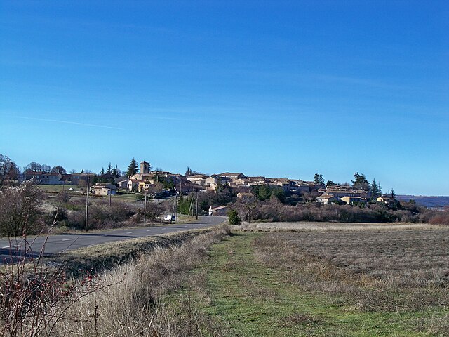
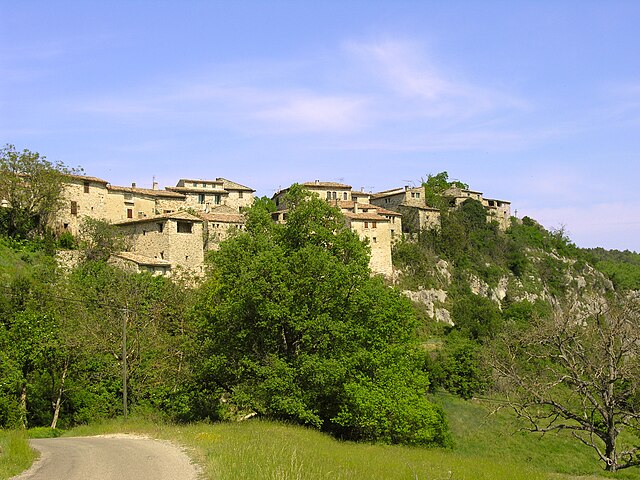
Simiane-la-Rotonde is a charming village located in the Provence-Alpes-Côte d'Azur region of southeastern France, known for its picturesque landscapes and rich history. It's an excellent destination for hiking enthusiasts looking to explore the beautiful natural surroundings of the Luberon region.
Hiking Trails
-
Luberon National Park: The village is situated near the Luberon National Park, which offers a network of well-marked trails catering to varying skill levels. You can find easy walks through vineyards and olive groves, as well as more challenging hikes up to ridges for panoramic views.
-
Sentier des Ocres: A short drive away, you'll find the Ochre Trail in Roussillon. This trail winds through striking ochre cliffs and offers unique geological formations, making it a perfect complement to your hiking experience in Simiane-la-Rotonde.
-
Cedar Forests: Trails lead through lush cedar forests where you can enjoy serene walks amidst nature, often accompanied by the sounds of local wildlife.
Key Features
- Scenic Views: Many trails provide breathtaking views of the surrounding countryside, including vineyards, lavender fields, and the distant mountains of the Vaucluse.
- Flora and Fauna: The region is home to diverse species of plants and animals, perfect for nature lovers and photographers looking to capture the beauty of provencal biodiversity.
- Cultural Highlights: While hiking, you can also discover historical sites, such as the village's medieval architecture and panoramic viewpoints.
Tips for Hiking in Simiane-la-Rotonde
- Season: The best time to hike is during spring (April to June) and fall (September to October) when temperatures are milder and the landscapes are vibrant.
- Equipment: Wear sturdy hiking shoes and bring plenty of water, a hat, and sunscreen, especially during summer months.
- Navigation: Carry a map or use a hiking app for offline navigation, as some trails may not be well marked.
- Respect Nature: Stick to marked paths and carry out any trash you bring in to help preserve the natural beauty of the area.
Overall, hiking in and around Simiane-la-Rotonde provides a wonderful blend of natural beauty, physical activity, and cultural exploration, making it a rewarding experience for outdoor enthusiasts.
- Country:

- Postal Code: 04150
- Coordinates: 43° 58' 50" N, 5° 33' 46" E


- GPS tracks (wikiloc): [Link]
- Area: 67.86 sq km
- Population: 592
- Web site: http://www.simiane-la-rotonde.fr
- Wikipedia en: wiki(en)
- Wikipedia: wiki(fr)
- Wikidata storage: Wikidata: Q938496
- Wikipedia Commons Category: [Link]
- Freebase ID: [/m/03m7xpf]
- Freebase ID: [/m/03m7xpf]
- GeoNames ID: Alt: [2974518]
- GeoNames ID: Alt: [2974518]
- SIREN number: [210402087]
- SIREN number: [210402087]
- VIAF ID: Alt: [235262018]
- VIAF ID: Alt: [235262018]
- PACTOLS thesaurus ID: [pcrtlAlMNYSiLn]
- PACTOLS thesaurus ID: [pcrtlAlMNYSiLn]
- WOEID: [622184]
- WOEID: [622184]
- INSEE municipality code: 04208
- INSEE municipality code: 04208
Shares border with regions:

Revest-du-Bion
- commune in Alpes-de-Haute-Provence, France
Revest-du-Bion, located in the Provence-Alpes-Côte d'Azur region of France, offers a beautiful setting for hiking enthusiasts. Surrounded by natural beauty, this charming village is nestled in the foothills of the Lure Mountains, providing a variety of trails suitable for all skill levels....
- Country:

- Postal Code: 04150
- Coordinates: 44° 4' 58" N, 5° 32' 54" E


- GPS tracks (wikiloc): [Link]
- Area: 43.45 sq km
- Population: 573

Montsalier
- commune in Alpes-de-Haute-Provence, France
Montsalier is a wonderful destination for hiking enthusiasts, located in the beautiful region of Provence-Alpes-Côte d'Azur in southeastern France. The area offers a variety of trails that cater to different skill levels, from leisurely walks to more challenging hikes. Here are some key points to consider:...
- Country:

- Postal Code: 04150
- Coordinates: 44° 0' 44" N, 5° 36' 33" E


- GPS tracks (wikiloc): [Link]
- AboveSeaLevel: 630 м m
- Area: 23.81 sq km
- Population: 127

Lagarde-d'Apt
- commune in Vaucluse, France
Lagarde-d'Apt is a picturesque village located in the Vaucluse department in the Provence-Alpes-Côte d'Azur region of France. It is situated in a beautiful part of the Luberon, which is known for its stunning landscapes, rolling hills, and rich biodiversity. The area is ideal for hiking enthusiasts, offering a variety of trails that cater to different skill levels....
- Country:

- Postal Code: 84400
- Coordinates: 43° 59' 1" N, 5° 28' 23" E


- GPS tracks (wikiloc): [Link]
- Area: 21.79 sq km
- Population: 39

Banon
- commune in Alpes-de-Haute-Provence, France
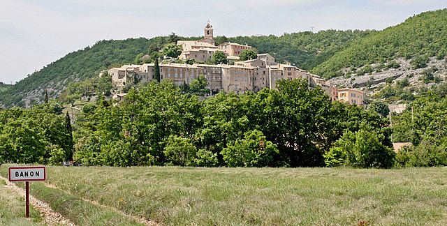
Banon, situated in the Alpes-de-Haute-Provence region of France, is a charming village known for its picturesque landscapes, rich history, and excellent hiking opportunities. Here's a guide to hiking in and around Banon:...
- Country:

- Postal Code: 04150
- Coordinates: 44° 2' 17" N, 5° 37' 41" E


- GPS tracks (wikiloc): [Link]
- Area: 39.81 sq km
- Population: 966
- Web site: [Link]

Oppedette
- commune in Alpes-de-Haute-Provence, France
Oppedette is a beautiful area located in the Provence region of France, known for its stunning natural landscapes and rich geological features. The region offers great hiking opportunities, making it an excellent destination for outdoor enthusiasts. Here are some highlights of hiking in Oppedette:...
- Country:

- Postal Code: 04110
- Coordinates: 43° 56' 3" N, 5° 35' 25" E


- GPS tracks (wikiloc): [Link]
- Area: 8.49 sq km
- Population: 53


Saint-Christol
- commune in Vaucluse, France
Saint-Christol, located in the Vaucluse department of France, is a charming destination for hiking enthusiasts. The region boasts picturesque landscapes, featuring vineyards, rolling hills, and scenic views of the surrounding countryside....
- Country:

- Postal Code: 84390
- Coordinates: 44° 1' 43" N, 5° 29' 32" E


- GPS tracks (wikiloc): [Link]
- Area: 46.08 sq km
- Population: 1348
- Web site: [Link]


Viens
- commune in Vaucluse, France
Viens, located in the Vaucluse department of the Provence-Alpes-Côte d'Azur region in southern France, is a charming village surrounded by stunning natural landscapes, making it an excellent destination for hiking enthusiasts....
- Country:

- Postal Code: 84750
- Coordinates: 43° 53' 42" N, 5° 34' 0" E


- GPS tracks (wikiloc): [Link]
- Area: 34.59 sq km
- Population: 625
- Web site: [Link]


Gignac
- commune in Vaucluse, France
Gignac, located in the Vaucluse department in the Provence-Alpes-Côte d'Azur region of France, offers a picturesque backdrop for hiking enthusiasts. Here are some highlights and tips for hiking in this area:...
- Country:

- Postal Code: 84400
- Coordinates: 43° 55' 9" N, 5° 31' 36" E


- GPS tracks (wikiloc): [Link]
- Area: 8.15 sq km
- Population: 67

Vachères
- commune in Alpes-de-Haute-Provence, France
Vachères is a charming village located in the Provence-Alpes-Côte d'Azur region of southeastern France. Nestled in the heart of the Luberon area, it offers stunning natural landscapes, picturesque views, and a variety of hiking trails suited for all skill levels. Here are some highlights of hiking in Vachères:...
- Country:

- Postal Code: 04110
- Coordinates: 43° 55' 53" N, 5° 38' 18" E


- GPS tracks (wikiloc): [Link]
- Area: 23.42 sq km
- Population: 264
