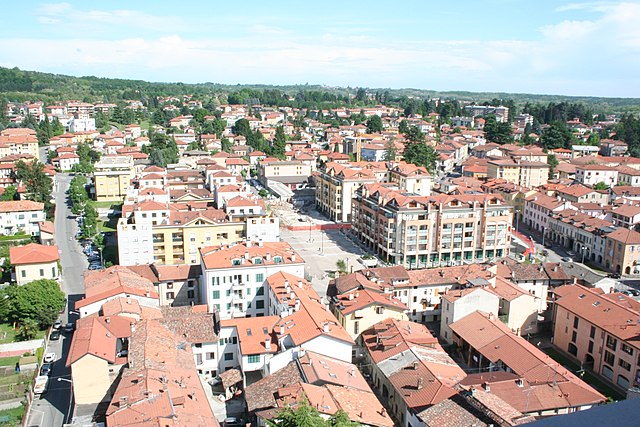
Solbiate con Cagno (Solbiate con Cagno)
- human settlement in Italy
 Hiking in Solbiate con Cagno
Solbiate con Cagno is a small town located in the Lombardy region of Italy, near the Brianza area and not far from Lake Como. The region offers a variety of hiking opportunities and scenic trails suitable for different skill levels. Here are some key points to consider if you're planning to hike in and around Solbiate con Cagno:
Trails and Routes
-
Local Trails: The area around Solbiate con Cagno has several trails that wind through forests, hills, and picturesque landscapes. You can find routes that range from easy walks to more challenging hikes.
-
Parco della Valle del Lambro: This nearby park offers beautiful landscapes, and various trails along the river Lambro, perfect for hiking enthusiasts looking for natural scenery and wildlife.
-
Monte Cornizzolo: Situated a bit further afield, this mountain is a popular hiking destination with well-marked trails. The summit provides stunning views of Lake Como and the surrounding Alps, making the effort worthwhile.
-
Sentiero del Viandante: A historical trail that traverses the hills above Lake Como, this path is a longer trek ideal for more experienced hikers looking for a challenge.
Preparation
-
Equipment: Wear comfortable hiking boots and bring plenty of water, snacks, a map, and a first-aid kit. A trekking pole might also help if you're hiking on uneven terrain.
-
Weather Conditions: Check the local weather forecast before heading out, as conditions can change. It's advisable to hike during the spring and fall for mild temperatures and fewer crowds.
-
Local Regulations: Be aware of local regulations regarding trail access, especially in protected areas, and follow Leave No Trace principles to help preserve the landscapes.
Community and Culture
-
Local Amenities: After a day of hiking, you can enjoy local Italian cuisine in the town or surrounding areas. There are often small restaurants and cafes where you can sample regional dishes.
-
Cultural Sites: Take some time to explore the local culture and history, including any historical landmarks or churches in Solbiate con Cagno.
Hiking in Solbiate con Cagno and its surroundings can be a rewarding experience, offering a blend of natural beauty, physical activity, and cultural exploration. Remember to take your time, enjoy the scenery, and respect the local environment.
- Country:

- Postal Code: 22070
- Local Dialing Code: 031
- Licence Plate Code: CO
- Coordinates: 45° 47' 0" N, 8° 56' 0" E


- GPS tracks (wikiloc): [Link]
- Area: 7.62 sq km
- Population: 4662
- Wikidata storage: Wikidata: Q60194073
- Wikipedia Commons Category: [Link]
- ISTAT ID: 013255
- Italian cadastre code: M412
Includes regions:


Cagno
- Italian comune
Hiking in Cagno
Cagno is a charming village located in the region of Lombardy, northern Italy, near the city of Como and the Lake Como area. While it might not be as widely recognized as a hiking destination compared to the surrounding mountains, Cagno and its surroundings offer some beautiful opportunities for outdoor enthusiasts....
- Country:
- Postal Code: 22070
- Local Dialing Code: 031
- Licence Plate Code: CO
- Coordinates: 45° 48' 40" N, 8° 55' 2" E
- GPS tracks (wikiloc): [Link]
- AboveSeaLevel: 405 м m
- Area: 3.53 sq km
- Population: 2057
- Web site: [Link]
Solbiate
- Italian comune
Hiking in Solbiate
Solbiate, located in the Lombardy region of Italy, offers a scenic setting for hiking enthusiasts. Nestled near the foothills of the Alps and surrounded by lush greenery, this area provides several hiking opportunities for various skill levels. Here are some highlights you can expect while hiking in and around Solbiate:...
- Country:
- Postal Code: 22070
- Local Dialing Code: 031
- Licence Plate Code: CO
- Coordinates: 45° 47' 0" N, 8° 56' 0" E
- GPS tracks (wikiloc): [Link]
- AboveSeaLevel: 445 м m
- Area: 4.09 sq km
- Population: 2605
- Web site: [Link]
Shares border with regions:
Albiolo
- Italian comune
Hiking in Albiolo
Albiolo is a small town located in the province of Como, in the Lombardy region of Italy, surrounded by beautiful scenery and part of the foothills of the Alps. This makes it an excellent base for various hiking opportunities, ranging from easy walks to more challenging trails....
- Country:
- Postal Code: 22070
- Local Dialing Code: 031
- Licence Plate Code: CO
- Coordinates: 45° 48' 0" N, 8° 56' 0" E
- GPS tracks (wikiloc): [Link]
- AboveSeaLevel: 423 м m
- Area: 2.84 sq km
- Population: 2739
- Web site: [Link]
Beregazzo con Figliaro
- Italian comune
Hiking in Beregazzo con Figliaro
Beregazzo con Figliaro is a charming municipality in the province of Como in northern Italy, situated near the shores of Lake Como. While it may not be as well-known for hiking as some of the nearby areas, it does offer access to beautiful landscapes and trails suitable for various levels of hikers....
- Country:
- Postal Code: 22070
- Local Dialing Code: 031
- Licence Plate Code: CO
- Coordinates: 45° 46' 55" N, 8° 56' 36" E
- GPS tracks (wikiloc): [Link]
- AboveSeaLevel: 423 м m
- Area: 3.8 sq km
- Population: 2772
- Web site: [Link]


Binago
- Italian comune
Hiking in Binago
Binago, located in the Philippines, is a lesser-known hiking destination that offers a mix of scenic natural beauty and cultural experiences. While it may not have the same level of recognition as some of the major national parks or hiking areas in the country, it still possesses some unique trails and landscapes worth exploring....
- Country:
- Postal Code: 22070
- Local Dialing Code: 031
- Licence Plate Code: CO
- Coordinates: 45° 47' 0" N, 8° 55' 0" E
- GPS tracks (wikiloc): [Link]
- AboveSeaLevel: 431 м m
- Area: 7.12 sq km
- Population: 4799
- Web site: [Link]


Cantello
- comune in Varese, Lombardy, Italy
Hiking in Cantello
Cantello is a small town located on the border of Italy and Switzerland, near the southern part of the Alps. It offers a beautiful natural setting for hiking enthusiasts, with various trails that cater to different skill levels. Here are some highlights and tips for hiking in Cantello:...
- Country:
- Postal Code: 21050
- Local Dialing Code: 0332
- Licence Plate Code: VA
- Coordinates: 45° 49' 0" N, 8° 53' 0" E
- GPS tracks (wikiloc): [Link]
- AboveSeaLevel: 404 м m
- Area: 9.13 sq km
- Population: 4747
- Web site: [Link]

Malnate
- Italian comune
Hiking in Malnate
Malnate is a charming town in the Lombardy region of Italy, close to the Swiss border. While the town itself may not be known for extensive hiking trails, its location near the Prealps and the surrounding natural scenery offers some beautiful hiking opportunities in the nearby areas....
- Country:
- Postal Code: 21046
- Local Dialing Code: 0332
- Licence Plate Code: VA
- Coordinates: 45° 48' 0" N, 8° 53' 0" E
- GPS tracks (wikiloc): [Link]
- AboveSeaLevel: 355 м m
- Area: 9 sq km
- Population: 16784
- Web site: [Link]


Valmorea
- Italian comune
Hiking in Valmorea
Valmorea is a beautiful area located in the Lombardy region of Italy, near the border with Switzerland. It's known for its stunning natural landscapes, diverse hiking trails, and rich cultural heritage. Here's a guide to hiking in Valmorea:...
- Country:
- Postal Code: 22070
- Local Dialing Code: 031
- Licence Plate Code: CO
- Coordinates: 45° 49' 0" N, 8° 56' 0" E
- GPS tracks (wikiloc): [Link]
- AboveSeaLevel: 400 м m
- Area: 3.13 sq km
- Population: 2666
- Web site: [Link]
Olgiate Comasco
- Italian comune
Hiking in Olgiate Comasco
Olgiate Comasco is a charming town located in the Lombardy region of Italy, close to the border with Switzerland. It offers access to various hiking opportunities, particularly in the surrounding natural landscapes that include hills, lakes, and forested areas. Here are some highlights and tips for hiking in and around Olgiate Comasco:...
- Country:
- Postal Code: 22077
- Local Dialing Code: 031
- Licence Plate Code: CO
- Coordinates: 45° 47' 0" N, 8° 58' 0" E
- GPS tracks (wikiloc): [Link]
- AboveSeaLevel: 400 м m
- Area: 10.96 sq km
- Population: 11633
- Web site: [Link]
Rodero
- Italian comune
Hiking in Rodero
Rodero is a charming area, although it might not be widely known for its hiking trails compared to other regions. However, if you're looking for scenic hiking opportunities, here are a few things to keep in mind when hiking in and around such areas:...
- Country:
- Postal Code: 22070
- Local Dialing Code: 031
- Licence Plate Code: CO
- Coordinates: 45° 49' 30" N, 8° 54' 59" E
- GPS tracks (wikiloc): [Link]
- AboveSeaLevel: 400 м m
- Area: 2.52 sq km
- Population: 1381
- Web site: [Link]