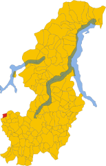
Rodero (Rodero)
- Italian comune
Rodero is a charming area, although it might not be widely known for its hiking trails compared to other regions. However, if you're looking for scenic hiking opportunities, here are a few things to keep in mind when hiking in and around such areas:
1. :
Depending on the region's geography, you may find a mix of forested trails, ridgelines, and perhaps even coastal paths if near a shoreline. Look for local maps or trail guides that can highlight the best routes.
2. :
Areas like Rodero may offer opportunities to encounter local wildlife. Keep your camera ready, but remember to respect the animals' space.
3. :
Check the weather before embarking on your hike. Different seasons may bring variable conditions, so pack accordingly with layers, rain gear, and sun protection.
4. :
Always let someone know your hiking plans, especially if you’re venturing into less-trafficked areas. Familiarize yourself with the trail conditions and carry sufficient water and snacks.
5. :
Stay informed about any local guidelines or regulations regarding hiking in the area, including trail access, fire restrictions, and camping rules if you plan an overnight trip.
6. :
If you're not familiar with the area, consider joining a guided hike. Local instructors can provide insight into the region’s natural history, flora, and fauna.
7. :
Connect with local hiking groups or social media communities. This can provide valuable insights about trails and conditions as well as offer companionship on hikes.
Conclusion:
Hiking in Rodero can be a delightful experience with its natural beauty. Planning ahead ensures that you have a safe and enjoyable adventure. If you have specific trails or areas in mind, I can provide more tailored advice!
- Country:

- Postal Code: 22070
- Local Dialing Code: 031
- Licence Plate Code: CO
- Coordinates: 45° 49' 30" N, 8° 54' 59" E


- GPS tracks (wikiloc): [Link]
- AboveSeaLevel: 400 м m
- Area: 2.52 sq km
- Population: 1381
- Web site: http://www.comunerodero.it
- Wikipedia en: wiki(en)
- Wikipedia: wiki(it)
- Wikidata storage: Wikidata: Q47413
- Wikipedia Commons Category: [Link]
- Freebase ID: [/m/0gj1l2]
- GeoNames ID: Alt: [6543725]
- VIAF ID: Alt: [158609568]
- OSM relation ID: [46238]
- ISTAT ID: 013197
- Italian cadastre code: H478
Shares border with regions:


Bizzarone
- Italian comune
Bizzarone is a small town in the Lombardy region of northern Italy, located near the border with Switzerland. While it may not be as widely known for hiking as some larger areas, the surrounding landscapes offer beautiful opportunities for those looking to explore nature....
- Country:

- Postal Code: 22020
- Local Dialing Code: 031
- Licence Plate Code: CO
- Coordinates: 45° 50' 0" N, 8° 57' 0" E


- GPS tracks (wikiloc): [Link]
- AboveSeaLevel: 436 м m
- Area: 2.67 sq km
- Population: 1600
- Web site: [Link]


Cantello
- comune in Varese, Lombardy, Italy
Cantello is a small town located on the border of Italy and Switzerland, near the southern part of the Alps. It offers a beautiful natural setting for hiking enthusiasts, with various trails that cater to different skill levels. Here are some highlights and tips for hiking in Cantello:...
- Country:

- Postal Code: 21050
- Local Dialing Code: 0332
- Licence Plate Code: VA
- Coordinates: 45° 49' 0" N, 8° 53' 0" E


- GPS tracks (wikiloc): [Link]
- AboveSeaLevel: 404 м m
- Area: 9.13 sq km
- Population: 4747
- Web site: [Link]


Valmorea
- Italian comune
Valmorea is a beautiful area located in the Lombardy region of Italy, near the border with Switzerland. It's known for its stunning natural landscapes, diverse hiking trails, and rich cultural heritage. Here's a guide to hiking in Valmorea:...
- Country:

- Postal Code: 22070
- Local Dialing Code: 031
- Licence Plate Code: CO
- Coordinates: 45° 49' 0" N, 8° 56' 0" E


- GPS tracks (wikiloc): [Link]
- AboveSeaLevel: 400 м m
- Area: 3.13 sq km
- Population: 2666
- Web site: [Link]

Solbiate con Cagno
- human settlement in Italy
Solbiate con Cagno is a small town located in the Lombardy region of Italy, near the Brianza area and not far from Lake Como. The region offers a variety of hiking opportunities and scenic trails suitable for different skill levels. Here are some key points to consider if you're planning to hike in and around Solbiate con Cagno:...
- Country:

- Postal Code: 22070
- Local Dialing Code: 031
- Licence Plate Code: CO
- Coordinates: 45° 47' 0" N, 8° 56' 0" E


- GPS tracks (wikiloc): [Link]
- Area: 7.62 sq km
- Population: 4662


Stabio
- municipality in the canton of Ticino, Switzerland
Stabio is a small municipality located in the canton of Ticino, Switzerland. The area is characterized by beautiful landscapes and a mild climate, making it a nice spot for hiking and outdoor activities. Here are some highlights about hiking in Stabio:...
- Country:

- Postal Code: 6854
- Local Dialing Code: 004191; 091
- Licence Plate Code: TI
- Coordinates: 45° 51' 0" N, 8° 56' 0" E


- GPS tracks (wikiloc): [Link]
- AboveSeaLevel: 357 м m
- Area: 6.23 sq km
- Population: 4616
- Web site: [Link]

