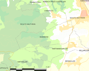
Soultz-Haut-Rhin (Soultz-Haut-Rhin)

- commune in Haut-Rhin, France
- Country:

- Postal Code: 68360
- Coordinates: 47° 53' 9" N, 7° 13' 45" E


- GPS tracks (wikiloc): [Link]
- Area: 29.56 sq km
- Population: 7150
- Web site: http://www.tourisme-soultz.fr
- Wikipedia en: wiki(en)
- Wikipedia: wiki(fr)
- Wikidata storage: Wikidata: Q501798
- Wikipedia Commons Gallery: [Link]
- Wikipedia Commons Category: [Link]
- Freebase ID: [/m/02rm6rf]
- Freebase ID: [/m/02rm6rf]
- GeoNames ID: Alt: [2973993]
- GeoNames ID: Alt: [2973993]
- SIREN number: [216803155]
- SIREN number: [216803155]
- BnF ID: [15272017v]
- BnF ID: [15272017v]
- VIAF ID: Alt: [168306891]
- VIAF ID: Alt: [168306891]
- WOEID: [622593]
- WOEID: [622593]
- SUDOC authorities ID: [035056932]
- SUDOC authorities ID: [035056932]
- INSEE municipality code: 68315
- INSEE municipality code: 68315
Shares border with regions:


Lautenbachzell
- commune in Haut-Rhin, France
- Country:
- Postal Code: 68610
- Coordinates: 47° 56' 25" N, 7° 8' 57" E
- GPS tracks (wikiloc): [Link]
- Area: 23.14 sq km
- Population: 968

Raedersheim
- commune in Haut-Rhin, France
- Country:
- Postal Code: 68190
- Coordinates: 47° 53' 18" N, 7° 16' 53" E
- GPS tracks (wikiloc): [Link]
- Area: 5.69 sq km
- Population: 1121

Rimbachzell
- commune in Haut-Rhin, France
- Country:
- Postal Code: 68500
- Coordinates: 47° 54' 2" N, 7° 10' 34" E
- GPS tracks (wikiloc): [Link]
- Area: 1.79 sq km
- Population: 195


Rimbach-près-Guebwiller
- commune in Haut-Rhin, France
- Country:
- Postal Code: 68500
- Coordinates: 47° 54' 16" N, 7° 9' 20" E
- GPS tracks (wikiloc): [Link]
- Area: 4.84 sq km
- Population: 203
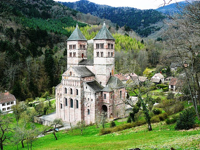

Murbach
- commune in Haut-Rhin, France
- Country:
- Postal Code: 68530
- Coordinates: 47° 55' 26" N, 7° 9' 27" E
- GPS tracks (wikiloc): [Link]
- Area: 6.66 sq km
- Population: 151


Guebwiller
- commune in Haut-Rhin, France
- Country:
- Postal Code: 68500
- Coordinates: 47° 54' 27" N, 7° 12' 37" E
- GPS tracks (wikiloc): [Link]
- AboveSeaLevel: 300 м m
- Area: 9.68 sq km
- Population: 11319
- Web site: [Link]


Goldbach-Altenbach
- commune in Haut-Rhin, France
- Country:
- Postal Code: 68760
- Coordinates: 47° 52' 23" N, 7° 6' 15" E
- GPS tracks (wikiloc): [Link]
- AboveSeaLevel: 680 м m
- Area: 9.14 sq km
- Population: 285
- Web site: [Link]

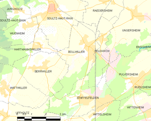
Bollwiller
- commune in Haut-Rhin, France
- Country:
- Postal Code: 68540
- Coordinates: 47° 51' 26" N, 7° 15' 43" E
- GPS tracks (wikiloc): [Link]
- Area: 8.63 sq km
- Population: 3848


Hartmannswiller
- commune in Haut-Rhin, France
- Country:
- Postal Code: 68500
- Coordinates: 47° 51' 43" N, 7° 12' 57" E
- GPS tracks (wikiloc): [Link]
- Area: 4.78 sq km
- Population: 641


Berrwiller
- commune in Haut-Rhin, France
- Country:
- Postal Code: 68500
- Coordinates: 47° 50' 59" N, 7° 13' 9" E
- GPS tracks (wikiloc): [Link]
- Area: 7.66 sq km
- Population: 1183
- Web site: [Link]


Willer-sur-Thur
- commune in Haut-Rhin, France
- Country:
- Postal Code: 68760
- Coordinates: 47° 50' 37" N, 7° 4' 23" E
- GPS tracks (wikiloc): [Link]
- Area: 18 sq km
- Population: 1853


Geishouse
- commune in Haut-Rhin, France
- Country:
- Postal Code: 68690
- Coordinates: 47° 53' 1" N, 7° 3' 36" E
- GPS tracks (wikiloc): [Link]
- Area: 7.28 sq km
- Population: 454
- Web site: [Link]


Wattwiller
- commune in Haut-Rhin, France
- Country:
- Postal Code: 68700
- Coordinates: 47° 50' 11" N, 7° 10' 48" E
- GPS tracks (wikiloc): [Link]
- Area: 13.61 sq km
- Population: 1656
- Web site: [Link]

Wuenheim
- commune in Haut-Rhin, France
- Country:
- Postal Code: 68500
- Coordinates: 47° 52' 23" N, 7° 12' 32" E
- GPS tracks (wikiloc): [Link]
- Area: 6.17 sq km
- Population: 793


Jungholtz
- commune in Haut-Rhin, France
- Country:
- Postal Code: 68500
- Coordinates: 47° 53' 7" N, 7° 11' 43" E
- GPS tracks (wikiloc): [Link]
- Area: 4 sq km
- Population: 909

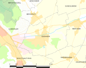
Issenheim
- commune in Haut-Rhin, France
- Country:
- Postal Code: 68500
- Coordinates: 47° 54' 9" N, 7° 15' 14" E
- GPS tracks (wikiloc): [Link]
- AboveSeaLevel: 268 м m
- Area: 8.18 sq km
- Population: 3429
- Web site: [Link]