Soustons (Soustons)

- commune in Landes, France
- Country:

- Postal Code: 40140
- Coordinates: 43° 45' 12" N, 1° 19' 40" E


- GPS tracks (wikiloc): [Link]
- Area: 100.38 sq km
- Population: 7664
- Web site: http://www.mairie-soustons.fr
- Wikipedia en: wiki(en)
- Wikipedia: wiki(fr)
- Wikidata storage: Wikidata: Q606970
- Wikipedia Commons Category: [Link]
- Freebase ID: [/m/03m4m52]
- GeoNames ID: Alt: [2973918]
- SIREN number: [214003105]
- BnF ID: [152592526]
- VIAF ID: Alt: [137376813]
- Library of Congress authority ID: Alt: [n97043358]
- INSEE municipality code: 40310
Shares border with regions:


Saint-Geours-de-Maremne
- commune in Landes, France
- Country:
- Postal Code: 40230
- Coordinates: 43° 41' 14" N, 1° 13' 45" E
- GPS tracks (wikiloc): [Link]
- Area: 42.9 sq km
- Population: 2582
- Web site: [Link]


Messanges
- commune in Landes, France
- Country:
- Postal Code: 40660
- Coordinates: 43° 48' 56" N, 1° 22' 43" E
- GPS tracks (wikiloc): [Link]
- Area: 34 sq km
- Population: 961

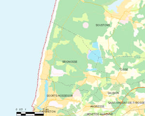
Seignosse
- commune in Landes, France
- Country:
- Postal Code: 40510
- Coordinates: 43° 41' 21" N, 1° 22' 22" E
- GPS tracks (wikiloc): [Link]
- Area: 35.09 sq km
- Population: 3843
- Web site: [Link]


Léon
- commune in Landes, France
- Country:
- Postal Code: 40550
- Coordinates: 43° 52' 37" N, 1° 18' 11" E
- GPS tracks (wikiloc): [Link]
- Area: 64.45 sq km
- Population: 1963
- Web site: [Link]


Vieux-Boucau-les-Bains
- commune in Landes, France
- Country:
- Postal Code: 40480
- Coordinates: 43° 47' 10" N, 1° 24' 16" E
- GPS tracks (wikiloc): [Link]
- Area: 4.25 sq km
- Population: 1580


Magescq
- commune in Landes, France
- Country:
- Postal Code: 40140
- Coordinates: 43° 46' 46" N, 1° 13' 2" E
- GPS tracks (wikiloc): [Link]
- Area: 77.12 sq km
- Population: 2035
- Web site: [Link]

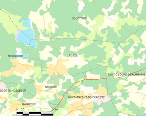
Tosse
- commune in Landes, France
- Country:
- Postal Code: 40230
- Coordinates: 43° 41' 21" N, 1° 19' 59" E
- GPS tracks (wikiloc): [Link]
- Area: 17.94 sq km
- Population: 2545


Azur
- commune in Landes, France
- Country:
- Postal Code: 40140
- Coordinates: 43° 47' 56" N, 1° 18' 8" E
- GPS tracks (wikiloc): [Link]
- Area: 16.94 sq km
- Population: 796