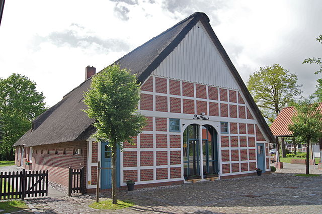
Stade (Stade)

- city in Lower Saxony, Germany
 Hiking in Stade
Stade is a picturesque town in Lower Saxony, Germany, with a rich maritime history and beautiful surroundings. While Stade itself may not be a well-known hiking destination, it is located near several natural areas and parks that offer hiking opportunities. Here are some aspects to consider for hiking in and around Stade:
Hiking Trails
-
Old Country (Altes Land):
- This area, just south of Stade, is known for its orchards and scenic views. You can enjoy leisurely walks along rural paths and riverside trails, especially during the apple blossom season in spring.
-
Buxtehude:
- A short distance from Stade, Buxtehude offers several hiking options, including the famous "Buxtehuder Riede," a nature reserve with beautiful wetlands and a mix of forest and meadow landscapes.
-
Niederelbe:
- Walking along the River Elbe can provide a satisfying experience with beautiful views of the river, charming villages, and opportunities for birdwatching.
-
Nature Reserves:
- Look for local nature reserves such as the "Biosphärenreservat Niedersächsische Elbtalaue," which features rich biodiversity and well-marked trails through forests, meadows, and along the Elbe River.
Tips for Hiking in Stade
-
Seasonal Considerations:
- Spring and autumn are ideal times to hike in this region, with mild weather and vibrant colors. Summer is also lovely, although it can be warmer, while winters are generally cold and may require special gear.
-
Local Maps and Guides:
- Consider picking up local hiking maps or guides from tourist information centers in Stade to find the best trails and explore the natural beauty of the area.
-
Safety and Preparation:
- Carry plenty of water, snacks, and a basic first-aid kit. Proper footwear is essential, as some trails can be uneven or muddy, especially after rain.
-
Respect Nature:
- Follow Leave No Trace principles to keep the trails and natural areas clean and accessible for future hikers.
Other Activities
Aside from hiking, Stade offers a charming old town with medieval architecture, museums, and local shops. You can combine outdoor activities with cultural exploration by visiting attractions like the St. Willehadi Church or the Stade History Museum.
Whether you're a seasoned hiker or a casual walker, Stade and its surroundings provide lovely options for enjoying nature and getting some fresh air.
- Country:

- Postal Code: 21684; 21683; 21682; 21680
- Local Dialing Code: 04141
- Licence Plate Code: STD
- Coordinates: 53° 36' 3" N, 9° 28' 35" E


- GPS tracks (wikiloc): [Link]
- AboveSeaLevel: 9 м m
- Area: 110.04 sq km
- Population: 46378
- Web site: http://www.stade.de
- Wikipedia en: wiki(en)
- Wikipedia: wiki(de)
- Wikidata storage: Wikidata: Q6949
- Wikipedia Commons Gallery: [Link]
- Wikipedia Commons Category: [Link]
- Wikipedia Commons Maps Category: [Link]
- Freebase ID: [/m/01sjcp]
- Freebase ID: [/m/01sjcp]
- Freebase ID: [/m/01sjcp]
- GeoNames ID: Alt: [2829901]
- GeoNames ID: Alt: [2829901]
- GeoNames ID: Alt: [2829901]
- BnF ID: [11969759v]
- BnF ID: [11969759v]
- BnF ID: [11969759v]
- VIAF ID: Alt: [126702671]
- VIAF ID: Alt: [126702671]
- VIAF ID: Alt: [126702671]
- OSM relation ID: [444799]
- OSM relation ID: [444799]
- OSM relation ID: [444799]
- GND ID: Alt: [4056709-6]
- GND ID: Alt: [4056709-6]
- GND ID: Alt: [4056709-6]
- archINFORM location ID: [11222]
- archINFORM location ID: [11222]
- archINFORM location ID: [11222]
- Library of Congress authority ID: Alt: [n83012831]
- Library of Congress authority ID: Alt: [n83012831]
- Library of Congress authority ID: Alt: [n83012831]
- MusicBrainz area ID: [cd6a5efa-2c28-42ef-a445-40b7116af221]
- MusicBrainz area ID: [cd6a5efa-2c28-42ef-a445-40b7116af221]
- MusicBrainz area ID: [cd6a5efa-2c28-42ef-a445-40b7116af221]
- Encyclopædia Britannica Online ID: [place/Stade-Germany]
- Encyclopædia Britannica Online ID: [place/Stade-Germany]
- Encyclopædia Britannica Online ID: [place/Stade-Germany]
- EMLO location ID: [c7ea0aa3-4322-463d-9270-b3b99cbe4159]
- EMLO location ID: [c7ea0aa3-4322-463d-9270-b3b99cbe4159]
- EMLO location ID: [c7ea0aa3-4322-463d-9270-b3b99cbe4159]
- Facebook Places ID: [111569958858832]
- Facebook Places ID: [111569958858832]
- Facebook Places ID: [111569958858832]
- German municipality key: 03359038
- German municipality key: 03359038
- German municipality key: 03359038
Includes regions:
Haddorf
- human settlement in Germany
Hiking in Haddorf
Haddorf, a small locality in the district of Harburg in Lower Saxony, Germany, may not be as widely recognized as some larger hiking destinations, but it offers charming landscapes and opportunities for outdoor activities. While specific hiking trails may not be as well-known, the surrounding area is rich in natural beauty, with picturesque countryside, forests, and small streams that provide a peaceful setting for walking and hiking....
- Country:
- Postal Code: 21683
- Local Dialing Code: 04141
- Coordinates: 53° 36' 0" N, 9° 24' 0" E
- GPS tracks (wikiloc): [Link]
- AboveSeaLevel: 19 м m
Hahle
- human settlement in Germany
Hiking in Hahle
It appears there might be a misunderstanding or a typo regarding "Hahle." If you meant "Hale," it could refer to various places, but it's not immediately clear which location you are referring to, as multiple regions or trails may exist with similar names....
- Country:
- Coordinates: 53° 36' 0" N, 9° 26' 0" E
- GPS tracks (wikiloc): [Link]

Wiepenkathen
- human settlement in Germany
Hiking in Wiepenkathen
Wiepenkathen is a small village located near the city of Buxtehude in Lower Saxony, Germany. While it may not be known as a prominent hiking destination, it offers access to scenic trails and natural areas, especially if you’re willing to venture into the surrounding region....
- Country:
- Postal Code: 21684
- Local Dialing Code: 04141
- Coordinates: 53° 34' 54" N, 9° 25' 12" E
- GPS tracks (wikiloc): [Link]
Hagen
- human settlement in Germany
Hiking in Hagen
Hagen (Stade) is a picturesque area in Lower Saxony, Germany, known for its beautiful landscapes and outdoor opportunities. Here are some highlights and considerations for hiking in this region:...
- Country:
- Postal Code: 21684
- Local Dialing Code: 04141
- Coordinates: 53° 33' 11" N, 9° 27' 27" E
- GPS tracks (wikiloc): [Link]
- AboveSeaLevel: 18 м m

Bützfleth
- town
Hiking in Bützfleth
Bützfleth is a small district located in Lower Saxony, Germany, near the Elbe River. While it may not be as well-known for hiking as larger national parks or wilderness areas, it offers some scenic trails and areas where you can enjoy nature....
- Country:
- Postal Code: 21683
- Local Dialing Code: 04146
- Coordinates: 53° 39' 15" N, 9° 28' 48" E
- GPS tracks (wikiloc): [Link]
- AboveSeaLevel: 1 м m
Barge
- human settlement
Hiking in Barge
Barge, located in the Stade district of Lower Saxony, Germany, is a charming area with various opportunities for hiking and enjoying nature. The region is primarily flat and picturesque, making it suitable for hikers of all levels....
- Country:
- Postal Code: 21680
- Local Dialing Code: 04141
- Coordinates: 53° 34' 40" N, 9° 27' 46" E
- GPS tracks (wikiloc): [Link]
Shares border with regions:

Hammah
- municipality of Germany
Hiking in Hammah
Hammah, located in the Al Wusta Governorate of Oman, offers some unique hiking experiences. While not as widely known as other hiking destinations in Oman, Hammah is characterized by its rugged terrain, stunning landscapes, and rich biodiversity....
- Country:
- Postal Code: 21714
- Local Dialing Code: 04144
- Licence Plate Code: STD
- Coordinates: 53° 38' 0" N, 9° 23' 0" E
- GPS tracks (wikiloc): [Link]
- AboveSeaLevel: 8 м m
- Area: 29.29 sq km
- Population: 3102
- Web site: [Link]


Agathenburg
- municipality of Germany
Hiking in Agathenburg
Agathenburg is a small municipality located in Lower Saxony, Germany, and while it may not be as widely recognized as major hiking destinations, it offers opportunities for outdoor enthusiasts who enjoy tranquil and scenic landscapes....
- Country:
- Postal Code: 21684
- Local Dialing Code: 04141
- Licence Plate Code: STD
- Coordinates: 53° 33' 50" N, 9° 31' 47" E
- GPS tracks (wikiloc): [Link]
- AboveSeaLevel: 16 м m
- Area: 11.32 sq km
- Population: 1177
- Web site: [Link]

Fredenbeck
- Samtgemeinde in Lower Saxony
Hiking in Fredenbeck
Fredenbeck, located in the Samtgemeinde in Lower Saxony, Germany, is a great place for hiking enthusiasts. The region is characterized by its scenic landscapes, charming villages, and a variety of trails suitable for different skill levels. Here are some highlights for hiking in and around Fredenbeck:...
- Country:
- Coordinates: 53° 31' 0" N, 9° 23' 0" E
- GPS tracks (wikiloc): [Link]
- Population: 12774
- Web site: [Link]

Deinste
- municipality of Germany
Hiking in Deinste
Deinste is a quaint village located in Lower Saxony, Germany, known for its rural charm and surrounding natural landscapes. While the area might not be heavily commercialized for tourism, it offers opportunities for hiking and enjoying the great outdoors....
- Country:
- Postal Code: 21717
- Local Dialing Code: 04149
- Licence Plate Code: STD
- Coordinates: 53° 32' 0" N, 9° 26' 0" E
- GPS tracks (wikiloc): [Link]
- AboveSeaLevel: 21 м m
- Area: 27.25 sq km
- Population: 2015
- Web site: [Link]


Dollern
- municipality of Germany
Hiking in Dollern
Dollern is a quaint village located in Lower Saxony, Germany, which is surrounded by beautiful natural landscapes, making it suitable for hiking enthusiasts. While it may not be a well-known hiking destination, here are some aspects you might consider when hiking in and around Dollern:...
- Country:
- Postal Code: 21739
- Local Dialing Code: 04163
- Licence Plate Code: STD
- Coordinates: 53° 32' 0" N, 9° 33' 0" E
- GPS tracks (wikiloc): [Link]
- AboveSeaLevel: 31 м m
- Area: 11.96 sq km
- Population: 2052
- Web site: [Link]


Hollern-Twielenfleth
- municipality of Germany
Hiking in Hollern-Twielenfleth
Hollern-Twielenfleth is a small district located in Lower Saxony, Germany, along the banks of the Elbe River. While it may not be a widely recognized hiking destination like larger natural parks, it offers some enjoyable opportunities for outdoor activities, particularly for those who appreciate scenic views and peaceful surroundings....
- Country:
- Postal Code: 21723
- Local Dialing Code: 04141
- Licence Plate Code: STD
- Coordinates: 53° 36' 0" N, 9° 32' 0" E
- GPS tracks (wikiloc): [Link]
- AboveSeaLevel: 2 м m
- Area: 20.46 sq km
- Population: 3436
- Web site: [Link]


Drochtersen
- municipality of Germany
Hiking in Drochtersen
Drochtersen is a charming municipality located in Lower Saxony, Germany, which offers a variety of opportunities for hiking and outdoor activities. The region is characterized by its picturesque landscapes, featuring meadows, forests, and rivers, making it an appealing destination for nature lovers and hiking enthusiasts....
- Country:
- Postal Code: 21706
- Local Dialing Code: 04775; 04148; 04143
- Licence Plate Code: STD
- Coordinates: 53° 42' 0" N, 9° 23' 0" E
- GPS tracks (wikiloc): [Link]
- AboveSeaLevel: 2 м m
- Area: 126.74 sq km
- Population: 11164
- Web site: [Link]
Düdenbüttel
- municipality of Germany
Hiking in Düdenbüttel
Düdenbüttel, a small village in Lower Saxony, Germany, offers a tranquil environment for hiking enthusiasts, though it may not be as well-known for hiking compared to larger national parks or mountain areas. Here are some key points about hiking in and around Düdenbüttel:...
- Country:
- Postal Code: 21709
- Local Dialing Code: 04144
- Licence Plate Code: STD
- Coordinates: 53° 35' 28" N, 9° 21' 0" E
- GPS tracks (wikiloc): [Link]
- AboveSeaLevel: 14 м m
- Area: 10.18 sq km
- Population: 981
- Web site: [Link]