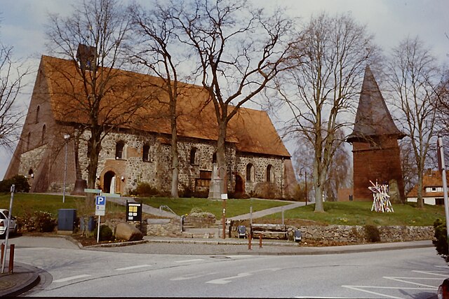
Stelle (Stelle)
- municipality in Germany
Stelle, a small municipality in Lower Saxony, Germany, offers a peaceful setting for hiking enthusiasts, particularly for those who enjoy exploring rural landscapes. While the area itself may not be as well-known for hiking as larger national parks or mountainous regions, it provides a variety of trails and natural scenery worth exploring.
Trails and Nature
-
Surrounding Areas: Stelle is located near the Lüneburg Heath (Lüneburger Heide), a large nature reserve with extensive hiking opportunities. The heath is famous for its heather fields, which bloom beautifully in late summer, and its picturesque landscapes.
-
Local Trails: There are several local walking paths that wind through fields, forests, and rural areas. These trails are often well-marked and provide a great way to enjoy the peaceful countryside, observe local flora and fauna, and experience the charm of the Niedersachsen region.
-
Bicycle Paths: In addition to hiking, many trails in the area are also suitable for cycling, allowing you to explore a wider range of scenery.
Hiking Tips
-
Map and Navigation: It’s a good idea to have a physical map or a GPS device since mobile reception can be spotty in rural areas.
-
Suitable Gear: Wear comfortable hiking boots to navigate different types of terrain, and dress in layers, as weather can change quickly.
-
Water and Snacks: Carry enough water and some snacks, especially if you're planning a longer hike.
-
Respect Nature: Follow local guidelines regarding wildlife and plant life to help preserve the natural beauty of the area.
Accessibility
Stelle is well-connected to nearby towns, making it convenient to reach popular hiking destinations in the Lüneburg Heath region. It is easily accessible via public transport or car, and there are various starting points for hikes nearby.
Whether you're a seasoned hiker or someone looking for a relaxing walk in nature, Stelle and its surrounding areas provide a wonderful experience for all who appreciate the outdoors.
- Country:

- Postal Code: 21435
- Local Dialing Code: 04174
- Licence Plate Code: WL
- Coordinates: 53° 22' 0" N, 10° 7' 0" E


- GPS tracks (wikiloc): [Link]
- AboveSeaLevel: 8 м m
- Area: 38.50 sq km
- Population: 11102
- Web site: http://www.gemeinde-stelle.de
- Wikipedia en: wiki(en)
- Wikipedia: wiki(de)
- Wikidata storage: Wikidata: Q701148
- Wikipedia Commons Category: [Link]
- Freebase ID: [/m/0c72c3]
- Freebase ID: [/m/0c72c3]
- GeoNames ID: Alt: [6552650]
- GeoNames ID: Alt: [6552650]
- OSM relation ID: [252884]
- OSM relation ID: [252884]
- GND ID: Alt: [4057240-7]
- GND ID: Alt: [4057240-7]
- Historical Gazetteer (GOV) ID: [STELLEJO53BJ]
- Historical Gazetteer (GOV) ID: [STELLEJO53BJ]
- German municipality key: 03353032
- German municipality key: 03353032
Includes regions:
Fliegenberg
- human settlement in Germany
Fliegenberg is a lovely hiking destination in Germany, particularly known for its scenic beauty and well-marked trails. The area typically features a mix of terrain, including forests, hills, and possibly rivers or lakes, which makes it an enjoyable spot for hikers of all levels....
Achterdeich
- human settlement in Germany
Achterdeich is a lesser-known hiking area that provides a unique experience for outdoor enthusiasts. It's located in a region characterized by flat landscapes, wetlands, and sometimes dike systems, which are typical of Dutch countryside or similar areas. Here are a few key points about hiking in Achterdeich:...
- Country:

- Postal Code: 21435
- Local Dialing Code: 04174
- Coordinates: 53° 22' 53" N, 10° 7' 25" E


- GPS tracks (wikiloc): [Link]
Rosenweide
- human settlement in Germany
Rosenweide is a picturesque area that offers various hiking opportunities. While specific trails and conditions might vary, here are some general points you might consider if planning a hiking trip there:...
Ashausen
- human settlement
Ashausen is a small village located in Lower Saxony, Germany, and while it may not be a well-known hiking destination, it can serve as a starting point for exploring the surrounding natural landscapes. Here are some highlights and tips for hiking in and around Ashausen:...
- Country:

- Postal Code: 21435
- Coordinates: 53° 21' 48" N, 10° 8' 12" E


- GPS tracks (wikiloc): [Link]
Shares border with regions:


Seevetal
- municipality in the district of Harburg, in Lower Saxony, Germany
Seevetal, located in Lower Saxony, Germany, is not only a charming area with beautiful landscapes but also offers some wonderful hiking opportunities. The region is characterized by its lush forests, picturesque rivers, and scenic countryside. Here are some highlights and tips for hiking in Seevetal:...
- Country:

- Postal Code: 21217–21220
- Local Dialing Code: 040; 04185; 04105
- Licence Plate Code: WL
- Coordinates: 53° 23' 0" N, 10° 2' 0" E


- GPS tracks (wikiloc): [Link]
- AboveSeaLevel: 14 м m
- Area: 105.10 sq km
- Population: 41234
- Web site: [Link]

