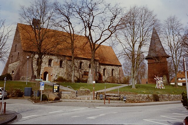
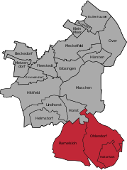
Seevetal (Seevetal)

- municipality in the district of Harburg, in Lower Saxony, Germany
 Hiking in Seevetal
Seevetal, located in Lower Saxony, Germany, is not only a charming area with beautiful landscapes but also offers some wonderful hiking opportunities. The region is characterized by its lush forests, picturesque rivers, and scenic countryside. Here are some highlights and tips for hiking in Seevetal:
Hiking Trails
-
Seevetal Nature Trails: There are various well-marked nature trails that take you through the beautiful landscapes. The "Waldroute" (Forest Trail) offers a serene experience among the trees and is perfect for a leisurely hike.
-
Lüneburg Heath: While not directly in Seevetal, the nearby Lüneburg Heath (Lüneburger Heide) is worth a visit for hiking enthusiasts. It boasts vast heathlands, unique flora, and fauna, and offers numerous marked trails.
-
Riverside Paths: The Chelmer River and others surrounding Seevetal provide lovely walking paths where you can enjoy the tranquility of water and wildlife.
Hiking Tips
-
Trail Markings: Most trails are well-marked, but it’s always good to have a map or a hiking app handy in case you want to explore side paths.
-
Weather Preparedness: Check the weather forecast before heading out. While the summer months are beautiful, spring and fall can bring sudden changes in weather.
-
Footwear: Wear comfortable hiking shoes, especially if you plan to hike through forested or uneven terrain.
-
Local Regulations: Pay attention to local rules regarding dogs, camping, and trail usage to ensure a safe and enjoyable experience.
-
Refreshments: Bring water and snacks, especially if you plan on hiking longer trails, as amenities might be sparse.
Accessibility
Seevetal is accessible by public transportation from Hamburg, making it a convenient spot for a day hike. The local tourism office can also provide information on guided tours and specific hiking events.
Overall, hiking in Seevetal offers a charming mix of nature and tranquility, making it a fantastic outdoor activity for both locals and visitors. Enjoy your hike!
- Country:

- Postal Code: 21217–21220
- Local Dialing Code: 040; 04185; 04105
- Licence Plate Code: WL
- Coordinates: 53° 23' 0" N, 10° 2' 0" E


- GPS tracks (wikiloc): [Link]
- AboveSeaLevel: 14 м m
- Area: 105.10 sq km
- Population: 41234
- Web site: https://www.seevetal.de/
- Wikipedia en: wiki(en)
- Wikipedia: wiki(de)
- Wikidata storage: Wikidata: Q7084
- Wikipedia Commons Category: [Link]
- Freebase ID: [/m/0c727_]
- Freebase ID: [/m/0c727_]
- GeoNames ID: Alt: [2833564]
- GeoNames ID: Alt: [2833564]
- VIAF ID: Alt: [248969688]
- VIAF ID: Alt: [248969688]
- OSM relation ID: [252889]
- OSM relation ID: [252889]
- GND ID: Alt: [4054200-2]
- GND ID: Alt: [4054200-2]
- archINFORM location ID: [11968]
- archINFORM location ID: [11968]
- MusicBrainz area ID: [923e98aa-d7ee-4542-ace4-0346c4721465]
- MusicBrainz area ID: [923e98aa-d7ee-4542-ace4-0346c4721465]
- Quora topic ID: [Seevetal]
- Quora topic ID: [Seevetal]
- TGN ID: [1041197]
- TGN ID: [1041197]
- German municipality key: 03353031
- German municipality key: 03353031
Includes regions:


Fleestedt, Glüsingen, Beckedorf, Metzendorf
- human settlement in Germany
Hiking in Fleestedt, Glüsingen, Beckedorf, Metzendorf
Fleestedt, Glüsingen, Beckedorf, and Metzendorf are small municipalities located in Lower Saxony, Germany. While these areas may not be as widely known for hiking as more prominent hiking destinations, they offer opportunities for enjoying nature and exploring the countryside....
- Country:

Hittfeld, Emmelndorf, Helmstorf, Lindhorst
- human settlement in Germany
Hiking in Hittfeld, Emmelndorf, Helmstorf, Lindhorst
Hiking in the areas of Hittfeld, Emmelndorf, Helmstorf, and Lindhorst in Germany offers a combination of picturesque landscapes, scenic trails, and a glimpse into the local flora and fauna. Here’s a brief overview of what you can expect in each area:...
- Country:

Maschen, Horst, Hörsten
- human settlement in Germany
Hiking in Maschen, Horst, Hörsten
Maschen, Horst, and Hörsten are all located in the Lower Saxony region of Germany, near Hamburg. While these areas may not be as well-known for hiking compared to more mountainous regions, they do offer some charming trails and nature experiences suitable for hikers of various levels....
- Country:


Meckelfeld, Klein-Moor
- human settlement in Germany
Hiking in Meckelfeld, Klein-Moor
Meckelfeld, located in the vicinity of Hamburg, Germany, offers a serene environment for hiking enthusiasts. The area around Klein-Moor is especially known for its picturesque landscapes, which include lush forests, meadows, and wetlands. Here are some highlights and suggestions for hiking in this area:...
- Country:
Over, Bullenhausen, Groß-Moor
- human settlement in Germany
Hiking in Over, Bullenhausen, Groß-Moor
Over, Bullenhausen, and Groß-Moor are charming areas located in Lower Saxony, Germany, that offer scenic landscapes for hiking enthusiasts. The region is characterized by its natural beauty, including forests, fields, and waterways, making it a pleasant destination for outdoor activities....
- Country:

Ramelsloh, Ohlendorf, Holtorfsloh
- human settlement in Germany
Hiking in Ramelsloh, Ohlendorf, Holtorfsloh
Hiking in the areas of Ramelsloh, Ohlendorf, and Holtorfsloh, which are located in Lower Saxony, Germany, offers a mix of scenic landscapes, charming rural settings, and opportunities to explore local flora and fauna. Here’s an overview of what you can expect when hiking in these regions:...
- Country:
Shares border with regions:


Hamburg
- city in Germany, city state and federal state
Hiking in Hamburg
Hiking in and around Hamburg offers a unique blend of urban landscapes and natural scenery. While Hamburg is primarily known for its rich maritime history and vibrant city life, nearby areas provide some excellent opportunities for hiking enthusiasts....
- Country:
- Postal Code: 22041–22769; 20095–21149
- Local Dialing Code: 04721; 040
- Licence Plate Code: HH
- Coordinates: 53° 33' 0" N, 10° 0' 0" E
- GPS tracks (wikiloc): [Link]
- AboveSeaLevel: 6 м m
- Area: 755.30 sq km
- Population: 1834244
- Web site: [Link]


Rosengarten
- rural municipality in the district of Harburg, Lower Saxony, Germany
Hiking in Rosengarten
Rosengarten, located in Lower Saxony, Germany, offers hikers a beautiful landscape characterized by its rolling hills, dense forests, and scenic views. The area is part of the Lüneburg Heath, known for its unique heathland ecosystems and diverse flora and fauna....
- Country:
- Postal Code: 21224
- Local Dialing Code: 04108; 04105; 040
- Licence Plate Code: WL
- Coordinates: 53° 23' 0" N, 9° 54' 0" E
- GPS tracks (wikiloc): [Link]
- AboveSeaLevel: 85 м m
- Area: 63.67 sq km
- Population: 14031
- Web site: [Link]
Bendestorf
- municipality of Germany
Hiking in Bendestorf
Bendestorf, a small village in Lower Saxony, Germany, offers some wonderful opportunities for hiking enthusiasts, surrounded by picturesque landscapes and natural beauty. Here are some highlights for hiking in and around Bendestorf:...
- Country:
- Postal Code: 21227
- Local Dialing Code: 04183
- Licence Plate Code: WL
- Coordinates: 53° 20' 8" N, 9° 59' 3" E
- GPS tracks (wikiloc): [Link]
- AboveSeaLevel: 21 м m
- Area: 3.88 sq km
- Population: 2427
- Web site: [Link]
Harmstorf
- municipality of Germany
Hiking in Harmstorf
Harmstorf is a small village located in Lower Saxony, Germany, and while it may not be widely known for hiking trails, it offers access to the beautiful landscapes typical of the surrounding areas. Here are some aspects to consider if you're planning to hike in and around Harmstorf:...
- Country:
- Postal Code: 21228
- Local Dialing Code: 04105
- Licence Plate Code: WL
- Coordinates: 53° 21' 0" N, 9° 58' 59" E
- GPS tracks (wikiloc): [Link]
- AboveSeaLevel: 15 м m
- Area: 5.97 sq km
- Population: 829
- Web site: [Link]
Marxen
- municipality of Germany
Hiking in Marxen
Marxen, located in Lower Saxony, Germany, is a charming village surrounded by scenic landscapes, making it a great destination for hiking enthusiasts. The area is characterized by its rolling hills, dense forests, and picturesque fields, offering a variety of trails catering to different skill levels....
- Country:
- Postal Code: 21439
- Local Dialing Code: 04185
- Licence Plate Code: WL
- Coordinates: 53° 19' 0" N, 10° 1' 0" E
- GPS tracks (wikiloc): [Link]
- AboveSeaLevel: 43 м m
- Area: 13.42 sq km
- Population: 1507
- Web site: [Link]
Brackel
- municipality in Lower Saxony
Hiking in Brackel
Brackel is a district in the city of Dortmund, located in North Rhine-Westphalia, Germany. While Brackel itself is primarily an urban area, it provides access to some scenic hiking opportunities in the surrounding regions, particularly in the nearby countryside and parks....
- Country:
- Postal Code: 21438
- Local Dialing Code: 04185
- Licence Plate Code: WL
- Coordinates: 53° 18' 0" N, 10° 2' 0" E
- GPS tracks (wikiloc): [Link]
- AboveSeaLevel: 53 м m
- Area: 13.91 sq km
- Population: 1878
- Web site: [Link]


Stelle
- municipality in Germany
Hiking in Stelle
Stelle, a small municipality in Lower Saxony, Germany, offers a peaceful setting for hiking enthusiasts, particularly for those who enjoy exploring rural landscapes. While the area itself may not be as well-known for hiking as larger national parks or mountainous regions, it provides a variety of trails and natural scenery worth exploring....
- Country:
- Postal Code: 21435
- Local Dialing Code: 04174
- Licence Plate Code: WL
- Coordinates: 53° 22' 0" N, 10° 7' 0" E
- GPS tracks (wikiloc): [Link]
- AboveSeaLevel: 8 м m
- Area: 38.50 sq km
- Population: 11102
- Web site: [Link]