Sternenberg (Sternenberg)

- commune in Haut-Rhin, France
 Hiking in Sternenberg
Sternenberg is a small village located in the Haut-Rhin department of France, situated in the Alsace region. The surrounding area is characterized by its beautiful landscapes, including rolling hills, vineyards, and forests, making it a great destination for hiking enthusiasts.
Hiking Opportunities
-
Scenic Trails: The region offers a variety of trails that cater to different skill levels. You can find gentle walks suitable for families as well as more challenging hikes for experienced trekkers. The trails often provide stunning views of the countryside and the Vosges Mountains.
-
Vineyard Routes: Given Alsace's prominence in wine production, many trails wind through vineyards, allowing hikers to experience the beautiful terroir of the region. Wine-themed hikes often include stops at local wineries for tastings.
-
Nature Reserves: Nearby nature reserves and parks offer opportunities to observe local wildlife and enjoy the diverse flora. Look for trails that lead through protected areas where you might encounter unique plant and animal species.
-
Marked Paths: The Alsace region is well-known for its well-marked hiking paths. Keep an eye out for the signs indicating the GR (Grande Randonnée) routes, which are long-distance hiking trails that traverse the region.
-
Guided Tours: If you're unfamiliar with the area or prefer to hike with a guide, many local organizations offer guided hikes that can provide insights into the region's history, culture, and ecology.
Tips for Hiking in Sternenberg
- Weather: Check weather conditions before you start your hike, as the weather can change rapidly in mountainous areas.
- Gear: Wear appropriate footwear and carry a backpack with essentials like water, snacks, a first aid kit, and a map or GPS device.
- Local Guidelines: Be mindful of local guidelines and regulations, especially in nature reserves, to preserve the natural environment.
- Cultural Experiences: Don’t miss out on tasting local Alsatian cuisine and wines at restaurants or inns available in and around Sternenberg.
Overall, hiking in Sternenberg offers a rich experience, combining natural beauty, outdoor activity, and cultural immersion in the charming Alsace region. Enjoy your hike!
- Country:

- Postal Code: 68780
- Coordinates: 47° 41' 45" N, 7° 5' 38" E


- GPS tracks (wikiloc): [Link]
- Area: 3.44 sq km
- Population: 153
- Wikipedia en: wiki(en)
- Wikipedia: wiki(fr)
- Wikidata storage: Wikidata: Q635478
- Wikipedia Commons Category: [Link]
- Freebase ID: [/m/03nstyz]
- GeoNames ID: Alt: [6441635]
- SIREN number: [216803262]
- BnF ID: [15272028h]
- INSEE municipality code: 68326
Shares border with regions:


Bellemagny
- commune in Haut-Rhin, France
Hiking in Bellemagny
Bellemagny, located in the picturesque region of the French Alps, offers a variety of hiking experiences suitable for all levels, from leisurely walks to challenging mountain treks. The area is characterized by stunning landscapes, including rugged mountains, lush forests, and serene lakes....
- Country:
- Postal Code: 68210
- Coordinates: 47° 41' 23" N, 7° 4' 2" E
- GPS tracks (wikiloc): [Link]
- Area: 2.1 sq km
- Population: 188

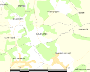
Guevenatten
- commune in Haut-Rhin, France
Hiking in Guevenatten
Guevenatten is a lesser-known but beautiful hiking destination that offers a range of trails suitable for various skill levels. While specific trail names and conditions can vary, here are some general features you might expect:...
- Country:
- Postal Code: 68210
- Coordinates: 47° 40' 55" N, 7° 4' 46" E
- GPS tracks (wikiloc): [Link]
- Area: 2.15 sq km
- Population: 138


Hecken
- commune in Haut-Rhin, France
Hiking in Hecken
Hecken, located in the Haut-Rhin department of the Alsace region in northeastern France, offers a picturesque backdrop for hiking enthusiasts. The region is characterized by its stunning natural landscapes, vineyards, and charming villages, making it a delightful destination for outdoor activities. Here’s what you can expect when hiking in and around Hecken:...
- Country:
- Postal Code: 68210
- Coordinates: 47° 41' 31" N, 7° 7' 29" E
- GPS tracks (wikiloc): [Link]
- Area: 2.45 sq km
- Population: 460


Bretten
- commune in Haut-Rhin, France
Hiking in Bretten
Bretten, located in the Haut-Rhin department of Alsace in France, offers a delightful experience for hiking enthusiasts. The region is characterized by its beautiful landscapes, vineyards, and picturesque villages, making it an excellent destination for both casual walkers and seasoned hikers....
- Country:
- Postal Code: 68780
- Coordinates: 47° 41' 58" N, 7° 4' 19" E
- GPS tracks (wikiloc): [Link]
- Area: 4.16 sq km
- Population: 175


Diefmatten
- commune in Haut-Rhin, France
Hiking in Diefmatten
Diefmatten, located in the Vosges Mountains of France, is a beautiful area for hiking enthusiasts. The region is known for its stunning landscapes, diverse flora and fauna, and various hiking trails that cater to different skill levels....
- Country:
- Postal Code: 68780
- Coordinates: 47° 42' 28" N, 7° 6' 56" E
- GPS tracks (wikiloc): [Link]
- Area: 3.17 sq km
- Population: 275


Soppe-le-Bas
- commune in Haut-Rhin, France
Hiking in Soppe-le-Bas
Soppe-le-Bas is a small commune located in the Haute-Saône department in the Bourgogne-Franche-Comté region of eastern France. While it may not be one of the most famous hiking destinations in France, it offers opportunities for outdoor enthusiasts to explore the beautiful rural landscapes of the region....
- Country:
- Postal Code: 68780
- Coordinates: 47° 43' 2" N, 7° 5' 22" E
- GPS tracks (wikiloc): [Link]
- Area: 5.68 sq km
- Population: 770