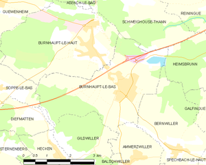
Soppe-le-Bas (Soppe-le-Bas)

- commune in Haut-Rhin, France
 Hiking in Soppe-le-Bas
Soppe-le-Bas is a small commune located in the Haute-Saône department in the Bourgogne-Franche-Comté region of eastern France. While it may not be one of the most famous hiking destinations in France, it offers opportunities for outdoor enthusiasts to explore the beautiful rural landscapes of the region.
Hiking Opportunities
-
Scenic Trails: The area around Soppe-le-Bas features rolling hills, forests, and open fields, making it suitable for hiking. You can find several local trails that may not be extensively mapped but offer a chance to connect with nature.
-
Nearby Nature Reserves: Consider exploring nearby natural areas, like the Parc Naturel Régional des Ballons des Vosges. This park is not too far from Soppe-le-Bas and provides a wider range of hiking trails with varying levels of difficulty, along with stunning views.
-
Flora and Fauna: The region is home to diverse plants and wildlife. Hikers may encounter various species of birds and small mammals, especially if you're hiking in the early morning or late afternoon.
Tips for Hiking in Soppe-le-Bas
- Maps and Navigation: If you’re planning your hikes, it’s essential to have local maps or a reliable GPS. Some of the trails may not be well marked.
- Weather Considerations: Check the weather conditions before heading out, as the terrain can change rapidly with rain or storms.
- Local Advice: Don’t hesitate to ask locals for advice on the best hiking spots. They may know hidden gems or trails that aren’t widely advertised.
Conclusion
While Soppe-le-Bas might not be a well-known hiking destination, its charming countryside and proximity to larger natural parks make it a worthwhile stop for hikers looking for a peaceful experience in nature. Always ensure you’re prepared with the right gear, enough water, and a plan before heading out on your hiking adventure!
- Country:

- Postal Code: 68780
- Coordinates: 47° 43' 2" N, 7° 5' 22" E


- GPS tracks (wikiloc): [Link]
- Area: 5.68 sq km
- Population: 770
- Wikipedia en: wiki(en)
- Wikipedia: wiki(fr)
- Wikidata storage: Wikidata: Q477197
- Wikipedia Commons Category: [Link]
- Freebase ID: [/m/03nphph]
- Freebase ID: [/m/03nphph]
- GeoNames ID: Alt: [6441622]
- GeoNames ID: Alt: [6441622]
- SIREN number: [216803130]
- SIREN number: [216803130]
- BnF ID: [152720155]
- BnF ID: [152720155]
- INSEE municipality code: 68313
- INSEE municipality code: 68313
Shares border with regions:


Gildwiller
- commune in Haut-Rhin, France
Hiking in Gildwiller
Gildwiller is a small village in the Alsace region of France. While it may not be as well-known for hiking as some larger areas, it offers a picturesque landscape and a peaceful environment that can delight outdoor enthusiasts....
- Country:
- Postal Code: 68210
- Coordinates: 47° 41' 22" N, 7° 8' 3" E
- GPS tracks (wikiloc): [Link]
- AboveSeaLevel: 295 м m
- Area: 5.02 sq km
- Population: 283

Burnhaupt-le-Bas
- commune in Haut-Rhin, France
Hiking in Burnhaupt-le-Bas
Burnhaupt-le-Bas is a charming village located in the Alsace region of northeastern France, known for its rich natural scenery and beautiful hiking opportunities. While it may not be as widely recognized as some of the larger hiking destinations in the region, it offers several attractive trails and is a great starting point for outdoor activities....
- Country:
- Postal Code: 68520
- Coordinates: 47° 43' 4" N, 7° 9' 42" E
- GPS tracks (wikiloc): [Link]
- Area: 11.77 sq km
- Population: 1849
- Web site: [Link]


Burnhaupt-le-Haut
- commune in Haut-Rhin, France
Hiking in Burnhaupt-le-Haut
Burnhaupt-le-Haut is a small commune located in the Alsace region of northeastern France. It offers picturesque landscapes and opportunities for hiking enthusiasts to explore the surrounding natural beauty....
- Country:
- Postal Code: 68520
- Coordinates: 47° 43' 49" N, 7° 8' 43" E
- GPS tracks (wikiloc): [Link]
- Area: 12.49 sq km
- Population: 1807


Bretten
- commune in Haut-Rhin, France
Hiking in Bretten
Bretten, located in the Haut-Rhin department of Alsace in France, offers a delightful experience for hiking enthusiasts. The region is characterized by its beautiful landscapes, vineyards, and picturesque villages, making it an excellent destination for both casual walkers and seasoned hikers....
- Country:
- Postal Code: 68780
- Coordinates: 47° 41' 58" N, 7° 4' 19" E
- GPS tracks (wikiloc): [Link]
- Area: 4.16 sq km
- Population: 175


Guewenheim
- commune in Haut-Rhin, France
- Country:
- Postal Code: 68116
- Coordinates: 47° 45' 11" N, 7° 5' 32" E
- GPS tracks (wikiloc): [Link]
- Area: 8.55 sq km
- Population: 1321


Diefmatten
- commune in Haut-Rhin, France
Hiking in Diefmatten
Diefmatten, located in the Vosges Mountains of France, is a beautiful area for hiking enthusiasts. The region is known for its stunning landscapes, diverse flora and fauna, and various hiking trails that cater to different skill levels....
- Country:
- Postal Code: 68780
- Coordinates: 47° 42' 28" N, 7° 6' 56" E
- GPS tracks (wikiloc): [Link]
- Area: 3.17 sq km
- Population: 275


Soppe-le-Haut
- former commune in Haut-Rhin, France
- Country:
- Postal Code: 68780
- Coordinates: 47° 43' 55" N, 7° 3' 39" E
- GPS tracks (wikiloc): [Link]
- Area: 7.37 sq km
- Population: 569


Sternenberg
- commune in Haut-Rhin, France
Hiking in Sternenberg
Sternenberg is a small village located in the Haut-Rhin department of France, situated in the Alsace region. The surrounding area is characterized by its beautiful landscapes, including rolling hills, vineyards, and forests, making it a great destination for hiking enthusiasts....
- Country:
- Postal Code: 68780
- Coordinates: 47° 41' 45" N, 7° 5' 38" E
- GPS tracks (wikiloc): [Link]
- Area: 3.44 sq km
- Population: 153