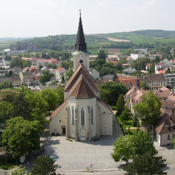
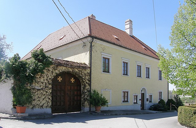
Stronsdorf (Stronsdorf)
- municipality in Austria
 Hiking in Stronsdorf
Stronsdorf is a small village located in Lower Austria, making it a charming destination for hiking enthusiasts. The region is characterized by its picturesque landscapes, vineyards, and rolling hills, providing a variety of scenic trails for hikers of all levels.
Hiking Trails:
-
Local Trails: In and around Stronsdorf, you can find well-marked local trails that can vary in difficulty. These trails often meander through vineyards and farmland, offering beautiful views and a peaceful atmosphere.
-
Wine Trails: The area is known for its wine production, and many hiking routes incorporate visits to vineyards. This not only allows for lovely walks but also the opportunity to sample some of the local wine.
-
Nature Reserves: Nearby nature reserves can offer longer trails that take you through diverse ecosystems, forests, and along rivers. These trails are often well-maintained and include information panels about the local flora and fauna.
Tips for Hiking in Stronsdorf:
- Best Season: Spring and autumn are the ideal times for hiking, as the temperatures are mild and the scenery is particularly beautiful with seasonal colors.
- Footwear: Wear comfortable hiking shoes, as some paths may be uneven or rugged.
- Maps: While many trails are marked, it's a good idea to carry a map or a GPS device to navigate correctly.
- Hydration: Bring enough water and snacks, especially if you plan on hiking longer trails.
- Respect Nature: Stay on designated paths to protect local wildlife and plant life.
Nearby Attractions:
- Wine Tasting: After a day of hiking, consider visiting local wineries for tastings.
- Cultural Sites: Explore the cultural heritage in the surrounding area, including historical buildings and sites related to the region's winemaking tradition.
Hiking in Stronsdorf can be a relaxing experience, combining physical activity with the enjoyment of nature and local culture. Whether you're looking for a leisurely stroll or a more challenging hike, you'll find a variety of options in this charming region.
- Country:

- Postal Code: 2153
- Local Dialing Code: 02526
- Licence Plate Code: MI
- Coordinates: 48° 39' 10" N, 16° 17' 48" E


- GPS tracks (wikiloc): [Link]
- AboveSeaLevel: 211 м m
- Area: 48.17 sq km
- Population: 1584
- Web site: http://www.stronsdorf.at/
- Wikipedia en: wiki(en)
- Wikipedia: wiki(de)
- Wikidata storage: Wikidata: Q655726
- Wikipedia Commons Category: [Link]
- Freebase ID: [/m/02qyjh2]
- GeoNames ID: Alt: [2764109]
- VIAF ID: Alt: [249391610]
- GND ID: Alt: [4526887-3]
- Austrian municipality key: [31650]
Shares border with regions:
Gnadendorf
- municipality in Austria
Hiking in Gnadendorf
Gnadendorf is a picturesque area in Austria known for its beautiful landscapes and outdoor recreational opportunities, including hiking. Located in the Lower Austria region, Gnadendorf offers a variety of trails suitable for different skill levels, making it ideal for both novice and experienced hikers....
- Country:
- Postal Code: 2152
- Local Dialing Code: 02525
- Licence Plate Code: MI
- Coordinates: 48° 36' 57" N, 16° 23' 50" E
- GPS tracks (wikiloc): [Link]
- AboveSeaLevel: 272 м m
- Area: 48.26 sq km
- Population: 1127
- Web site: [Link]

Nappersdorf-Kammersdorf
- municipality in Austria
Hiking in Nappersdorf-Kammersdorf
Nappersdorf-Kammersdorf, located in Austria, is known for its picturesque landscapes and tranquil rural settings, making it a charming destination for hiking enthusiasts. Here are some key aspects to consider when hiking in this area:...
- Country:
- Postal Code: 2033
- Local Dialing Code: 02953
- Licence Plate Code: HL
- Coordinates: 48° 38' 0" N, 16° 14' 0" E
- GPS tracks (wikiloc): [Link]
- AboveSeaLevel: 234 м m
- Area: 38.86 sq km
- Population: 1233
- Web site: [Link]
Hollabrunn
- municipality in Austria
Hiking in Hollabrunn
Hollabrunn is a town located in Lower Austria, surrounded by beautiful landscapes, which makes it a great place for hiking enthusiasts. The region offers a variety of trails suitable for different skill levels, ranging from leisurely walks to more challenging hikes....
- Country:
- Postal Code: 2020
- Local Dialing Code: 02952
- Licence Plate Code: HL
- Coordinates: 48° 34' 0" N, 16° 5' 0" E
- GPS tracks (wikiloc): [Link]
- AboveSeaLevel: 236 м m
- Area: 152.38 sq km
- Population: 11681
- Web site: [Link]

Ernstbrunn
- municipality in Austria
Hiking in Ernstbrunn
Ernstbrunn is a charming municipality located in the Lower Austria region of Austria, known for its picturesque landscapes and outdoor activities, including hiking. Here are some highlights and tips for hiking in and around Ernstbrunn:...
- Country:
- Postal Code: 2115
- Local Dialing Code: 02576
- Licence Plate Code: KO
- Coordinates: 48° 31' 34" N, 16° 21' 41" E
- GPS tracks (wikiloc): [Link]
- AboveSeaLevel: 293 м m
- Area: 80.71 sq km
- Population: 3213
- Web site: [Link]

Laa an der Thaya
- municipality in Austria
Hiking in Laa an der Thaya
Laa an der Thaya is a charming town located in Lower Austria, situated near the border with the Czech Republic. The area is known for its beautiful natural landscapes, making it an ideal location for hiking enthusiasts. Here are some key points to consider when planning a hiking trip in and around Laa an der Thaya:...
- Country:
- Postal Code: 2064, 2136
- Local Dialing Code: 02522
- Licence Plate Code: MI
- Coordinates: 48° 43' 0" N, 16° 23' 0" E
- GPS tracks (wikiloc): [Link]
- AboveSeaLevel: 183 м m
- Area: 72.91 sq km
- Population: 6280
- Web site: [Link]
Großharras
- municipality in Austria
Hiking in Großharras
Großharras, located in Lower Austria, offers a range of hiking opportunities for outdoor enthusiasts. The region is characterized by its picturesque landscapes, rolling hills, and serene rural scenery, making it an ideal place for both casual walkers and experienced hikers....
- Country:
- Postal Code: 2034
- Local Dialing Code: 02526
- Licence Plate Code: MI
- Coordinates: 48° 39' 50" N, 16° 14' 51" E
- GPS tracks (wikiloc): [Link]
- AboveSeaLevel: 206 м m
- Area: 42.66 sq km
- Population: 1116
- Web site: [Link]

Gaubitsch
- municipality in Austria
Hiking in Gaubitsch
Gaubitsch is a small village located in Austria, known for its picturesque landscapes and natural beauty, making it a charming place for hiking enthusiasts. The surrounding region offers a variety of hiking trails suitable for different skill levels, from leisurely walks to more challenging hikes. Here are some insights about hiking in and around Gaubitsch:...
- Country:
- Postal Code: 2154
- Local Dialing Code: 02522
- Licence Plate Code: MI
- Coordinates: 48° 39' 0" N, 16° 23' 0" E
- GPS tracks (wikiloc): [Link]
- AboveSeaLevel: 229 м m
- Area: 22.48 sq km
- Population: 894
- Web site: [Link]

Unterstinkenbrunn
- municipality in Austria
Hiking in Unterstinkenbrunn
Unterstinkenbrunn is a charming village located in Lower Austria, surrounded by picturesque landscapes that make it a great destination for hiking enthusiasts. The region offers various trails that range in difficulty, allowing both beginners and experienced hikers to enjoy the natural beauty of the area....
- Country:
- Postal Code: 2154
- Local Dialing Code: 02526
- Licence Plate Code: MI
- Coordinates: 48° 40' 2" N, 16° 20' 47" E
- GPS tracks (wikiloc): [Link]
- AboveSeaLevel: 207 м m
- Area: 9.42 sq km
- Population: 560
- Web site: [Link]