Hollabrunn (Hollabrunn)
- municipality in Austria
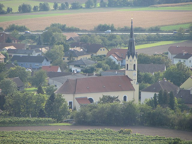
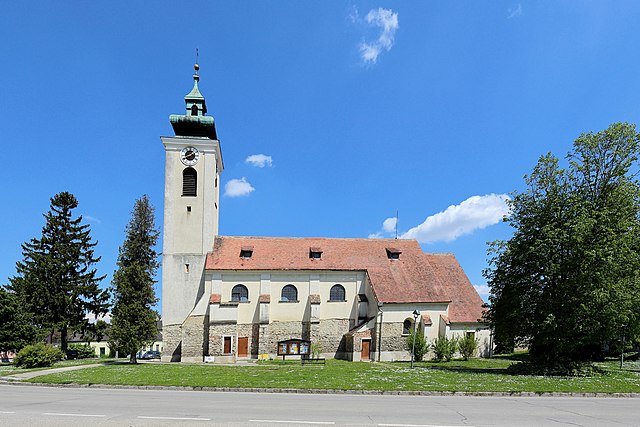
Hollabrunn is a town located in Lower Austria, surrounded by beautiful landscapes, which makes it a great place for hiking enthusiasts. The region offers a variety of trails suitable for different skill levels, ranging from leisurely walks to more challenging hikes.
Key Points about Hiking in Hollabrunn:
-
Scenic Trails: The area features picturesque trails that wind through vineyards, forests, and rolling hills. The natural beauty of the landscape changes with the seasons, providing unique experiences year-round.
-
Local Nature Parks: Nearby nature parks, such as the Naturpark Leiser Berge, offer well-marked hiking paths and are ideal for nature lovers. These parks are home to diverse flora and fauna, making hikes both enjoyable and educational.
-
Cultural Attractions: Hiking trails often lead to quaint villages and historical sites, allowing hikers to combine physical activity with cultural exploration. You can encounter local architecture and visit small, charming wineries along the way.
-
Accessibility: Many trails are easily accessible from Hollabrunn, making it convenient for both locals and visitors. Signage is usually clear, which helps hikers navigate without getting lost.
-
Family-Friendly Options: There are several family-friendly hiking routes, making it suitable for hikers of all ages. Shorter trails with gentle slopes can be perfect for a fun outing with kids.
-
Hiking Events: Throughout the year, there may be organized hiking events and festivals that commemorate the local culture and promote outdoor activities, giving hikers an opportunity to meet others and explore new trails.
Tips for Hiking in Hollabrunn:
- Proper Gear: Wear sturdy hiking shoes and dress in layers, as the weather can change quickly.
- Stay Hydrated: Carry water, especially on warmer days, and consider packing snacks.
- Trail Maps: While many trails are well-marked, having a map or a hiking app can be helpful for planning your route.
- Respect Nature: Follow Leave No Trace principles to help keep the environment clean and preserve the natural beauty for future hikers.
Whether you are a beginner or an experienced hiker, Hollabrunn offers a wonderful destination to enjoy the outdoors. Happy hiking!
- Country:

- Postal Code: 2020
- Local Dialing Code: 02952
- Licence Plate Code: HL
- Coordinates: 48° 34' 0" N, 16° 5' 0" E


- GPS tracks (wikiloc): [Link]
- AboveSeaLevel: 236 м m
- Area: 152.38 sq km
- Population: 11681
- Web site: http://www.hollabrunn.gv.at
- Wikipedia en: wiki(en)
- Wikipedia: wiki(de)
- Wikidata storage: Wikidata: Q624352
- Wikipedia Commons Gallery: [Link]
- Wikipedia Commons Category: [Link]
- Freebase ID: [/m/025wfzl]
- GeoNames ID: Alt: [2775636]
- VIAF ID: Alt: [158299520]
- GND ID: Alt: [4025618-2]
- archINFORM location ID: [10258]
- Library of Congress authority ID: Alt: [n82098538]
- MusicBrainz area ID: [290ae70b-b4a5-43b5-a62b-db2ef638181d]
- Austrian municipality key: [31022]
Shares border with regions:
Gnadendorf
- municipality in Austria
Gnadendorf is a picturesque area in Austria known for its beautiful landscapes and outdoor recreational opportunities, including hiking. Located in the Lower Austria region, Gnadendorf offers a variety of trails suitable for different skill levels, making it ideal for both novice and experienced hikers....
- Country:

- Postal Code: 2152
- Local Dialing Code: 02525
- Licence Plate Code: MI
- Coordinates: 48° 36' 57" N, 16° 23' 50" E


- GPS tracks (wikiloc): [Link]
- AboveSeaLevel: 272 м m
- Area: 48.26 sq km
- Population: 1127
- Web site: [Link]

Ziersdorf
- municipality in Austria
Ziersdorf, located in Lower Austria, is known for its beautiful countryside and scenic landscapes, making it a great destination for hiking enthusiasts. Here are some key points to consider when planning a hiking trip in Ziersdorf:...
- Country:

- Postal Code: 3710
- Local Dialing Code: 02956
- Licence Plate Code: HL
- Coordinates: 48° 32' 0" N, 15° 56' 0" E


- GPS tracks (wikiloc): [Link]
- AboveSeaLevel: 230 м m
- Area: 48.72 sq km
- Population: 3446
- Web site: [Link]

Nappersdorf-Kammersdorf
- municipality in Austria
 Hiking in Nappersdorf-Kammersdorf
Nappersdorf-Kammersdorf, located in Austria, is known for its picturesque landscapes and tranquil rural settings, making it a charming destination for hiking enthusiasts. Here are some key aspects to consider when hiking in this area:...
- Country:

- Postal Code: 2033
- Local Dialing Code: 02953
- Licence Plate Code: HL
- Coordinates: 48° 38' 0" N, 16° 14' 0" E


- GPS tracks (wikiloc): [Link]
- AboveSeaLevel: 234 м m
- Area: 38.86 sq km
- Population: 1233
- Web site: [Link]

Ernstbrunn
- municipality in Austria
Ernstbrunn is a charming municipality located in the Lower Austria region of Austria, known for its picturesque landscapes and outdoor activities, including hiking. Here are some highlights and tips for hiking in and around Ernstbrunn:...
- Country:

- Postal Code: 2115
- Local Dialing Code: 02576
- Licence Plate Code: KO
- Coordinates: 48° 31' 34" N, 16° 21' 41" E


- GPS tracks (wikiloc): [Link]
- AboveSeaLevel: 293 м m
- Area: 80.71 sq km
- Population: 3213
- Web site: [Link]

Stronsdorf
- municipality in Austria
Stronsdorf is a small village located in Lower Austria, making it a charming destination for hiking enthusiasts. The region is characterized by its picturesque landscapes, vineyards, and rolling hills, providing a variety of scenic trails for hikers of all levels....
- Country:

- Postal Code: 2153
- Local Dialing Code: 02526
- Licence Plate Code: MI
- Coordinates: 48° 39' 10" N, 16° 17' 48" E


- GPS tracks (wikiloc): [Link]
- AboveSeaLevel: 211 м m
- Area: 48.17 sq km
- Population: 1584
- Web site: [Link]

Göllersdorf
- municipality in Austria
Göllersdorf, located in Lower Austria, is a charming area offering a variety of hiking opportunities, suitable for both beginners and more experienced hikers. The region boasts beautiful landscapes, rolling hills, vineyards, and serene countryside, making it an ideal destination for nature enthusiasts....
- Country:

- Postal Code: 2013
- Local Dialing Code: 02954
- Licence Plate Code: HL
- Coordinates: 48° 29' 29" N, 16° 7' 14" E


- GPS tracks (wikiloc): [Link]
- AboveSeaLevel: 202 м m
- Area: 59.56 sq km
- Population: 2999
- Web site: [Link]

Sitzendorf an der Schmida
- municipality in Austria
 Hiking in Sitzendorf an der Schmida
Sitzendorf an der Schmida is a picturesque village located in the Lower Austria region of Austria. The surrounding countryside offers a delightful range of hiking opportunities, making it a great destination for outdoor enthusiasts....
- Country:

- Postal Code: 3714
- Local Dialing Code: 02959
- Licence Plate Code: HL
- Coordinates: 48° 35' 59" N, 15° 56' 24" E


- GPS tracks (wikiloc): [Link]
- AboveSeaLevel: 244 м m
- Area: 61.85 sq km
- Population: 2162
- Web site: [Link]


Großweikersdorf
- municipality in Austria
Großweikersdorf, located in the Lower Austria region, offers some beautiful hiking opportunities. The area features scenic landscapes, charming vineyards, and rolling hills, making it a great destination for outdoor enthusiasts....
- Country:

- Postal Code: 3701
- Local Dialing Code: 02955
- Licence Plate Code: TU
- Coordinates: 48° 28' 21" N, 15° 58' 48" E


- GPS tracks (wikiloc): [Link]
- AboveSeaLevel: 211 м m
- Area: 43.32 sq km
- Population: 3180
- Web site: [Link]

Rußbach
- municipality in Austria
Rußbach is a beautiful village located in the Salzburger Land region of Austria, known for its stunning natural scenery and excellent hiking opportunities. Nestled in the Dachstein Mountains, Rußbach offers a variety of hiking trails suitable for all experience levels, from leisurely walks to challenging mountain hikes....
- Country:

- Postal Code: 3702
- Local Dialing Code: 02955
- Licence Plate Code: KO
- Coordinates: 48° 27' 5" N, 16° 2' 22" E


- GPS tracks (wikiloc): [Link]
- AboveSeaLevel: 247 м m
- Area: 30.65 sq km
- Population: 1424
- Web site: [Link]

Heldenberg
- municipality in Austria
Heldenberg, located in Lower Austria, is a fantastic hiking destination that offers a mix of beautiful landscapes, historical sites, and outdoor activities. Here are some key details you should know about hiking in Heldenberg:...
- Country:

- Local Dialing Code: 02956
- Licence Plate Code: HL
- Coordinates: 48° 30' 0" N, 15° 57' 0" E


- GPS tracks (wikiloc): [Link]
- AboveSeaLevel: 238 м m
- Area: 27.37 sq km
- Population: 1270
- Web site: [Link]

Großmugl
- municipality in Austria
Großmugl is a small town located in the Lower Austria region of Austria. While it may not be as widely known for hiking compared to larger national parks or mountainous areas, it offers access to scenic trails and beautiful landscapes typical of the Austrian countryside....
- Country:

- Postal Code: 2002, 2032
- Local Dialing Code: 02268
- Licence Plate Code: KO
- Coordinates: 48° 29' 57" N, 16° 13' 50" E


- GPS tracks (wikiloc): [Link]
- AboveSeaLevel: 217 м m
- Area: 64.49 sq km
- Population: 1595
- Web site: [Link]

Wullersdorf
- municipality in Austria
Wullersdorf, located in Austria, is a charming destination for hiking enthusiasts. The region is characterized by its picturesque landscapes, rolling hills, and a mix of rural and forested areas, making it an excellent spot for outdoor activities....
- Country:

- Postal Code: 2041
- Local Dialing Code: 02951
- Licence Plate Code: HL
- Coordinates: 48° 38' 0" N, 16° 6' 0" E


- GPS tracks (wikiloc): [Link]
- AboveSeaLevel: 248 м m
- Area: 63.89 sq km
- Population: 2385
- Web site: [Link]

Grabern
- municipality in Austria
Grabern, nestled in the picturesque landscapes of Lower Austria, offers a variety of hiking options for enthusiasts looking to explore its natural beauty. While it may not be as well-known as some of the larger hiking regions, the area around Grabern provides charming trails that showcase the rolling hills, vineyards, and scenic views characteristic of this part of Austria....
- Country:

- Postal Code: 2020
- Local Dialing Code: 02952
- Licence Plate Code: HL
- Coordinates: 48° 36' 51" N, 16° 1' 11" E


- GPS tracks (wikiloc): [Link]
- AboveSeaLevel: 251 м m
- Area: 30.94 sq km
- Population: 1642
- Web site: [Link]