Taponnat-Fleurignac (Taponnat-Fleurignac)

- commune in Charente, France
- Country:

- Postal Code: 16110
- Coordinates: 45° 46' 45" N, 0° 24' 32" E


- GPS tracks (wikiloc): [Link]
- Area: 21.49 sq km
- Population: 1541
- Web site: http://www.taponnat-fleurignac.fr
- Wikipedia en: wiki(en)
- Wikipedia: wiki(fr)
- Wikidata storage: Wikidata: Q1440571
- Wikipedia Commons Category: [Link]
- Freebase ID: [/m/03mcdzj]
- GeoNames ID: Alt: [2973399]
- SIREN number: [211603790]
- BnF ID: [15248816j]
- INSEE municipality code: 16379
Shares border with regions:

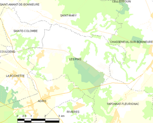
Les Pins
- commune in Charente, France
- Country:
- Postal Code: 16260
- Coordinates: 45° 49' 10" N, 0° 23' 25" E
- GPS tracks (wikiloc): [Link]
- Area: 21.06 sq km
- Population: 456


Yvrac-et-Malleyrand
- commune in Charente, France
- Country:
- Postal Code: 16110
- Coordinates: 45° 45' 0" N, 0° 26' 52" E
- GPS tracks (wikiloc): [Link]
- AboveSeaLevel: 210 м m
- Area: 18.9 sq km
- Population: 532


Saint-Adjutory
- commune in Charente, France
- Country:
- Postal Code: 16310
- Coordinates: 45° 45' 54" N, 0° 28' 29" E
- GPS tracks (wikiloc): [Link]
- Area: 14.04 sq km
- Population: 470


Marillac-le-Franc
- commune in Charente, France
- Country:
- Postal Code: 16110
- Coordinates: 45° 44' 7" N, 0° 25' 47" E
- GPS tracks (wikiloc): [Link]
- AboveSeaLevel: 100 м m
- Area: 14.49 sq km
- Population: 825

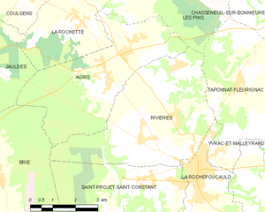
Rivières
- commune in Charente, France
- Country:
- Postal Code: 16110
- Coordinates: 45° 45' 10" N, 0° 21' 43" E
- GPS tracks (wikiloc): [Link]
- Area: 21.54 sq km
- Population: 1985


La Rochefoucauld
- commune in Charente, France
- Country:
- Postal Code: 16110
- Coordinates: 45° 44' 26" N, 0° 23' 10" E
- GPS tracks (wikiloc): [Link]
- Area: 7.21 sq km
- Population: 2954
- Web site: [Link]


Chasseneuil-sur-Bonnieure
- commune in Charente, France
- Country:
- Postal Code: 16260
- Coordinates: 45° 49' 26" N, 0° 27' 0" E
- GPS tracks (wikiloc): [Link]
- Area: 33.34 sq km
- Population: 3036
- Web site: [Link]