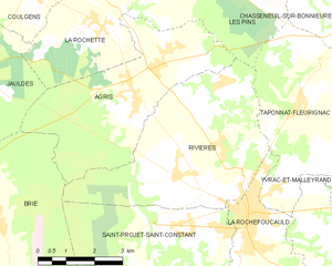
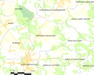
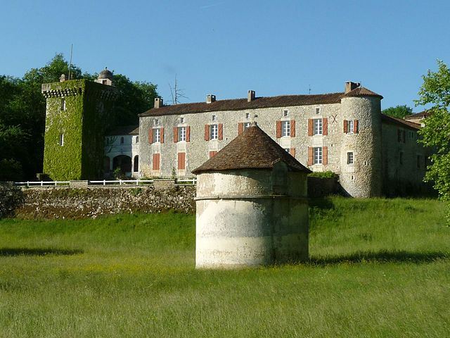
La Rochefoucauld (La Rochefoucauld)

- commune in Charente, France
- Country:

- Postal Code: 16110
- Coordinates: 45° 44' 26" N, 0° 23' 10" E


- GPS tracks (wikiloc): [Link]
- Area: 7.21 sq km
- Population: 2954
- Web site: http://www.larochefoucauld.fr
- Wikipedia en: wiki(en)
- Wikipedia: wiki(fr)
- Wikidata storage: Wikidata: Q693992
- Wikipedia Commons Category: [Link]
- Freebase ID: [/m/03mccxv]
- GeoNames ID: Alt: [6455620]
- SIREN number: [211602818]
- BnF ID: [15248720h]
- VIAF ID: Alt: [233805955]
- WOEID: [599769]
- INSEE municipality code: 16281
Shares border with regions:


Marillac-le-Franc
- commune in Charente, France
- Country:
- Postal Code: 16110
- Coordinates: 45° 44' 7" N, 0° 25' 47" E
- GPS tracks (wikiloc): [Link]
- AboveSeaLevel: 100 м m
- Area: 14.49 sq km
- Population: 825

Rivières
- commune in Charente, France
- Country:
- Postal Code: 16110
- Coordinates: 45° 45' 10" N, 0° 21' 43" E
- GPS tracks (wikiloc): [Link]
- Area: 21.54 sq km
- Population: 1985

Taponnat-Fleurignac
- commune in Charente, France
- Country:
- Postal Code: 16110
- Coordinates: 45° 46' 45" N, 0° 24' 32" E
- GPS tracks (wikiloc): [Link]
- Area: 21.49 sq km
- Population: 1541
- Web site: [Link]

Rancogne
- commune in Charente, France
- Country:
- Postal Code: 16110
- Coordinates: 45° 41' 48" N, 0° 24' 13" E
- GPS tracks (wikiloc): [Link]
- Area: 12.52 sq km
- Population: 379


Saint-Projet-Saint-Constant
- commune in Charente, France
- Country:
- Postal Code: 16110
- Coordinates: 45° 44' 19" N, 0° 21' 38" E
- GPS tracks (wikiloc): [Link]
- Area: 16.94 sq km
- Population: 1072
- Web site: [Link]