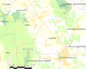
canton of La Rochefoucauld (canton de La Rochefoucauld)
- canton of France
- Country:

- Capital: La Rochefoucauld
- Coordinates: 45° 44' 29" N, 0° 23' 14" E


- GPS tracks (wikiloc): [Link]
- Wikidata storage: Wikidata: Q1725653
- Library of Congress authority ID: Alt: [n97053138]
- INSEE canton code: [1622]
Includes regions:


Yvrac-et-Malleyrand
- commune in Charente, France
- Country:
- Postal Code: 16110
- Coordinates: 45° 45' 0" N, 0° 26' 52" E
- GPS tracks (wikiloc): [Link]
- AboveSeaLevel: 210 м m
- Area: 18.9 sq km
- Population: 532


Jauldes
- commune in Charente, France
- Country:
- Postal Code: 16560
- Coordinates: 45° 47' 8" N, 0° 15' 28" E
- GPS tracks (wikiloc): [Link]
- Area: 25.59 sq km
- Population: 779
- Web site: [Link]


Marillac-le-Franc
- commune in Charente, France
- Country:
- Postal Code: 16110
- Coordinates: 45° 44' 7" N, 0° 25' 47" E
- GPS tracks (wikiloc): [Link]
- AboveSeaLevel: 100 м m
- Area: 14.49 sq km
- Population: 825

Rivières
- commune in Charente, France
- Country:
- Postal Code: 16110
- Coordinates: 45° 45' 10" N, 0° 21' 43" E
- GPS tracks (wikiloc): [Link]
- Area: 21.54 sq km
- Population: 1985


Coulgens
- commune in Charente, France
- Country:
- Postal Code: 16560
- Coordinates: 45° 48' 41" N, 0° 17' 13" E
- GPS tracks (wikiloc): [Link]
- Area: 11.7 sq km
- Population: 540
- Web site: [Link]

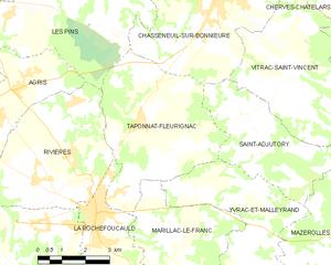
Taponnat-Fleurignac
- commune in Charente, France
- Country:
- Postal Code: 16110
- Coordinates: 45° 46' 45" N, 0° 24' 32" E
- GPS tracks (wikiloc): [Link]
- Area: 21.49 sq km
- Population: 1541
- Web site: [Link]


La Rochette
- commune in Charente, France
- Country:
- Postal Code: 16110
- Coordinates: 45° 48' 5" N, 0° 18' 50" E
- GPS tracks (wikiloc): [Link]
- Area: 10.99 sq km
- Population: 530
- Web site: [Link]

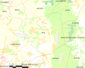
Brie
- commune in Charente, France
- Country:
- Postal Code: 16590
- Coordinates: 45° 44' 16" N, 0° 14' 27" E
- GPS tracks (wikiloc): [Link]
- AboveSeaLevel: 135 м m
- Area: 34.05 sq km
- Population: 4260


Chazelles
- commune in Charente, France
- Country:
- Postal Code: 16380
- Coordinates: 45° 38' 51" N, 0° 22' 1" E
- GPS tracks (wikiloc): [Link]
- Area: 25.8 sq km
- Population: 1543
- Web site: [Link]

Rancogne
- commune in Charente, France
- Country:
- Postal Code: 16110
- Coordinates: 45° 41' 48" N, 0° 24' 13" E
- GPS tracks (wikiloc): [Link]
- Area: 12.52 sq km
- Population: 379


Vilhonneur
- commune in Charente, France
- Country:
- Postal Code: 16220
- Coordinates: 45° 40' 52" N, 0° 25' 12" E
- GPS tracks (wikiloc): [Link]
- Area: 9.36 sq km
- Population: 392


La Rochefoucauld
- commune in Charente, France
- Country:
- Postal Code: 16110
- Coordinates: 45° 44' 26" N, 0° 23' 10" E
- GPS tracks (wikiloc): [Link]
- Area: 7.21 sq km
- Population: 2954
- Web site: [Link]


Bunzac
- commune in Charente, France
- Country:
- Postal Code: 16110
- Coordinates: 45° 42' 4" N, 0° 21' 5" E
- GPS tracks (wikiloc): [Link]
- Area: 13.32 sq km
- Population: 467


Agris
- commune in Charente, France
- Country:
- Postal Code: 16110
- Coordinates: 45° 46' 30" N, 0° 20' 6" E
- GPS tracks (wikiloc): [Link]
- Area: 18.74 sq km
- Population: 850
- Web site: [Link]


Pranzac
- commune in Charente, France
- Country:
- Postal Code: 16110
- Coordinates: 45° 40' 13" N, 0° 21' 2" E
- GPS tracks (wikiloc): [Link]
- Area: 15.06 sq km
- Population: 910


Saint-Projet-Saint-Constant
- commune in Charente, France
- Country:
- Postal Code: 16110
- Coordinates: 45° 44' 19" N, 0° 21' 38" E
- GPS tracks (wikiloc): [Link]
- Area: 16.94 sq km
- Population: 1072
- Web site: [Link]